Category:Maps of Hamburg-Nord
Jump to navigation
Jump to search
Subcategories
This category has the following 12 subcategories, out of 12 total.
A
B
- Maps of Hamburg-Barmbek-Nord (17 F)
- Maps of Hamburg-Barmbek-Süd (28 F)
E
- Maps of Hamburg-Eppendorf (15 F)
F
G
H
- Maps of Hamburg-Hohenfelde (17 F)
L
O
- Maps of Hamburg-Ohlsdorf (6 F)
U
- Maps of Hamburg-Uhlenhorst (29 F)
W
- Maps of Hamburg-Winterhude (26 F)
Media in category "Maps of Hamburg-Nord"
The following 22 files are in this category, out of 22 total.
-
Bezirkskarte Hamburg-Nord.png 2,605 × 2,550; 1,020 KB
-
Dulsberg in HH.svg 1,713 × 1,689; 780 KB
-
Hamburg Bezirk Hamburg-Nord.svg 1,713 × 1,689; 780 KB
-
Pincerno - Bezirk Hamburg-Nord 11-2008.png 1,267 × 1,333; 49 KB
-
Pincerno - Bezirk Hamburg-Nord 2008.gif 1,267 × 1,333; 32 KB
-
Pincerno - Hamburger Bezirke 2008 - Hamburg-Nord.gif 1,267 × 1,333; 21 KB
-
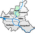
Hamburg-Stadtteilkarte-Nord.jpg 600 × 569; 136 KB
-
Hamburg 1898 Meyers 5. Aufl..jpg 3,176 × 2,480; 7.3 MB
-
Meyers b8 s0038a.jpg 3,184 × 2,490; 7.07 MB
-
Hamburg 1905 Meyers 6. Aufl..jpg 3,193 × 2,479; 7.88 MB
-
Pincerno - Dulsberg 11-2008.PNG 1,267 × 1,333; 48 KB
-
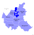
Hamburg location map simplified districts-Nord.svg 558 × 548; 111 KB
-
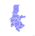
Hamburg Nord Subdivisions.svg 165 × 187; 1.28 MB
-
Karte Franksche Siedlung.png 1,709 × 1,546; 438 KB
-
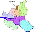
HH-Langenhorn-quarter.jpg 843 × 746; 387 KB
-
Pincerno - Stadtteile Bezirk Hamburg-Nord 11-2008.png 1,267 × 1,333; 23 KB
-
Pincerno - Stadtteile im Bezirk Hamburg-Nord 2008 IV.gif 1,267 × 1,333; 15 KB
-
Hamburg Wahlkreis 8.png 1,186 × 1,144; 28 KB
-
Hamburg Wahlkreis 9.png 1,186 × 1,144; 28 KB


