Category:Maps of 6th-century Europe
Jump to navigation
Jump to search
| Preceded by: Maps of 5th-century Europe |
6th century maps of Europe 501 AD-600 AD |
Succeeded by: Maps of 7th-century Europe |
Subcategories
This category has the following 7 subcategories, out of 7 total.
B
- Maps of 6th-century Bulgaria (2 F)
F
I
M
- Maps of 6th-century Italy (14 F)
V
- Maps of the Vandalic War (12 F)
Media in category "Maps of 6th-century Europe"
The following 137 files are in this category, out of 137 total.
-
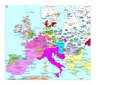
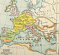
 Europe 526-600.jpg 907 × 1,427; 410 KB
-
 Europe 533-600.jpg 860 × 667; 352 KB
-
 118 of '(Italy and her Invaders, Vol. 1-4.)' (11217175325).jpg 2,793 × 2,213; 1.47 MB
-
 2022 04 16 - MAP West Germanic – cc. 580 CE - END.png 2,752 × 2,551; 3.64 MB
-
 2022 10 16 - Westgermanisch – um 580 - END.png 2,752 × 2,646; 3.71 MB
-
 2022 11 13 - Map West Germanic – cc. 580 CE - final.png 2,752 × 2,646; 3.69 MB
-
 34 of '(Italy and her Invaders, Vol. 1-4.)' (11214674914).jpg 3,428 × 2,518; 1.62 MB
-
 A history of Rome (1917) (14761658634).jpg 2,072 × 3,086; 969 KB
-
 A history of Rome (1917) (14761659264).jpg 2,058 × 2,924; 884 KB
-
 Europe en 500.pdf 1,752 × 1,239; 455 KB
-
 Atlas of European history (1909) (14597297739).jpg 2,170 × 1,600; 832 KB
-
 Putz93.jpg 1,252 × 1,168; 755 KB
-
 528 CE, Europe.svg 512 × 438; 1.5 MB
-
 537 Septimania mk.svg 458 × 327; 29 KB
-
 537Septimania.JPG 456 × 326; 23 KB
-
 537Septimania3 es.svg 1,998 × 1,422; 80 KB
-
 537Septimania3 pt.svg 1,998 × 1,422; 25 KB
-
 537Septimania3.JPG 456 × 326; 24 KB
-
 537Septimania4.JPG 456 × 326; 23 KB
-
 537SeptimaniaGIF.png 456 × 326; 12 KB
-
 Europe en 550.pdf 1,752 × 1,239; 458 KB
-
 555 justinian conquests-fr.svg 1,648 × 1,049; 1.93 MB
-
 Europa BV042518575.jpg 1,954 × 1,337; 304 KB
-
 Historical atlas of modern Europe 1903 (135895354).jpg 9,126 × 6,828; 52.5 MB
-
 565 CE, Europe.svg 512 × 438; 1.5 MB
-
 Putz92.jpg 1,237 × 1,153; 716 KB
-
 600 CE, Europe.svg 512 × 438; 1.55 MB
-
 Allemanie in de middeleeuwen.jpg 663 × 676; 165 KB
-
 Anglo saxon jute 575ad.png 960 × 720; 178 KB
-
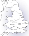 Anglo-Saxon England 2.svg 900 × 1,100; 574 KB
-
 Britain peoples circa 600 de.svg 578 × 772; 1.78 MB
-
 Britain peoples circa 600 ru.svg 994 × 1,233; 1.32 MB
-
 Britain peoples circa 600 zh-hans.svg 994 × 1,233; 1.33 MB
-
 Britain peoples circa 600-es.svg 994 × 1,233; 3.44 MB
-
 Britain peoples circa 600-fr.svg 994 × 1,233; 1.45 MB
-
 Britain peoples circa 600-hu.svg 994 × 1,233; 1.65 MB
-
 Britain peoples circa 600-ko.svg 994 × 1,233; 1.33 MB
-
 Britain peoples circa 600-pt.svg 994 × 1,233; 1.33 MB
-
 Britain peoples circa 600.svg 994 × 1,233; 1.88 MB
-
 Britain.circa.540.jpg 2,046 × 2,814; 675 KB
-
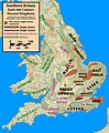 Britain.early.6th.century.nascent.kingdoms.jpg 2,292 × 2,777; 896 KB
-
 Britonia6hcentury-ar.jpg 1,670 × 2,928; 375 KB
-
 Britonia6hcentury.png 1,670 × 2,928; 542 KB
-
 Britonia6hcentury2.svg 1,464 × 2,405; 181 KB
-
 Byzantinisches Reich BV042750793.jpg 4,484 × 3,357; 2.55 MB
-
 Central.Britain.c550.jpg 1,674 × 1,794; 425 KB
-
 Die slawische Besiedlung zwischen dem 5. und 7. Jh. n. Chr.jpg 902 × 648; 389 KB
-
 Droysens-20b.jpg 2,082 × 1,828; 3.15 MB
-
 Droysens-20c.jpg 2,104 × 1,820; 3.36 MB
-
 Droysens-20d.jpg 2,103 × 1,819; 3.45 MB
-
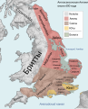
 Early Medieval Scotland areas.png 794 × 1,123; 1.51 MB
-
 Early Slavic settlement Prague-type CZ.png 1,477 × 873; 153 KB
-
 East Roman.jpg 835 × 664; 165 KB
-
 Erster und Zweiter Gotenkrieg-SW.png 2,264 × 2,478; 441 KB
-
 Erster und Zweiter Gotenkrieg.png 1,133 × 1,240; 1.33 MB
-
 Europa in 526 hu.png 1,000 × 800; 308 KB
-
 Europa in 526-es.svg 1,844 × 1,472; 523 KB
-
 Europa in 526-pt.svg 512 × 409; 49 KB
-
 Europa in 526.png 799 × 639; 98 KB
-
 Europe 526-600 japref.jpg 900 × 1,400; 325 KB
-
 Europe at the close of the 6th century, showing the Gothic monarchies (14780052291).jpg 2,176 × 1,392; 544 KB
-
 Europe at the death of Justinian I in 565.jpg 2,747 × 1,966; 4.19 MB
-
 Europe at the death of Theoderic the Great in 526.jpg 2,754 × 1,961; 3.71 MB
-
 Europe en 551.pdf 1,752 × 1,239; 457 KB
-
 Europe in 526.jpg 1,541 × 961; 1.43 MB
-
 Europee en 501.pdf 1,752 × 1,239; 454 KB
-
 Európa 600.svg 512 × 542; 4.6 MB
-
 Frankenreich unter den Merowingern.jpg 3,287 × 2,874; 2 MB
-
 Germanic East Roman.jpg 840 × 658; 156 KB
-
 Germanic kingdoms 526CE.png 822 × 661; 1.01 MB
-
 Gotenkrieg.png 514 × 624; 14 KB
-
 Gotische oorlog.png 1,133 × 1,240; 1.09 MB
-
 Großbritannien BV042518600.jpg 1,954 × 1,337; 302 KB
-

-
 Italia590.jpg 1,065 × 1,360; 712 KB
-
 KII-pms.jpg 793 × 574; 156 KB
-
 KulturaPraska KulturaPienkowska.png 777 × 471; 20 KB
-
 Le concile d'Agde en 506-hu.svg 755 × 784; 621 KB
-
 Le concile d'Agde en 506.svg 755 × 784; 696 KB
-
 Le concile d'Orléans en 511 de.svg 680 × 705; 325 KB
-
 Le concile d'Orléans en 511-es.svg 755 × 784; 1.31 MB
-
 Le concile d'Orléans en 511-hu.svg 680 × 705; 354 KB
-
 Le concile d'Orléans en 511-pt.svg 755 × 784; 340 KB
-
 Le concile d'Orléans en 511.svg 755 × 784; 577 KB
-
 Le royaume des Francs en 561 ru.svg 755 × 784; 296 KB
-
 Le royaume des Francs en 561-es.svg 755 × 784; 291 KB
-
 Le royaume des Francs en 561.svg 755 × 784; 364 KB
-
 Le royaume des Francs en 567-es.svg 756 × 785; 706 KB
-
 Le royaume des Francs en 567-nl.svg 756 × 785; 245 KB
-
 Le royaume des Francs en 567.svg 756 × 785; 207 KB
-
 Lenguas de la Península Itálica en el siglo VI a. C.svg 512 × 594; 74 KB
-
 Les conquêtes franques en Gaule (486 - 511)-pt.svg 755 × 784; 79 KB
-
 Les conquêtes franques en Gaule (486 - 511).svg 755 × 784; 231 KB
-
 Les royaumes francs en 587-es.svg 758 × 785; 334 KB
-
 Les royaumes francs en 587.svg 758 × 785; 432 KB
-
 Ludy Brytanii ok. 600.svg 994 × 1,233; 1.47 MB
-
 Map Europe around 560 AD - Touring Club Italiano CART-TRC-50 01.jpg 3,873 × 3,205; 1.52 MB
-
 Map Frank campaigns in Aquitaine 507-509-de.svg 755 × 784; 819 KB
-
 Map Frank campaigns in Aquitaine 507-509-es.svg 755 × 784; 807 KB
-
 Map Frank campaigns in Aquitaine 507-509-fr.svg 755 × 784; 505 KB
-
 Map Frank campaigns in Aquitaine 507-509-pt.svg 755 × 784; 318 KB
-
 Map Frank campaigns in Aquitaine 507-509-ru.png 1,594 × 1,655; 541 KB
-
 Map Gaul 481-511-ru.png 1,600 × 1,661; 626 KB
-
 Map Gaul divisions 511-de.svg 755 × 784; 125 KB
-
 Map Gaul divisions 511-nl.svg 755 × 784; 163 KB
-
 Map Gaul divisions 511-ru.png 1,600 × 1,661; 675 KB
-
 Map of Septimania in 537 AD grc.svg 458 × 327; 22 KB
-
 Map of Septimania in 537 AD la.svg 458 × 327; 21 KB
-
 Map of Septimania in 537 AD ru.svg 458 × 327; 6 KB
-
 Map of Septimania in 537 AD uk.svg 458 × 327; 21 KB
-
 Map of Septimania in 537 AD-ar.svg 488 × 349; 22 KB
-
 Map of Septimania in 537 AD-hu.svg 458 × 327; 22 KB
-
 Map of Septimania in 537 AD.svg 458 × 327; 23 KB
-
 Map Suebia550pChrn.png 400 × 363; 82 KB
-
 Mapa da Europa c.500 (com legenda).png 1,985 × 1,686; 444 KB
-
 Mapa da Europa c.500 (sem legenda).png 1,985 × 1,686; 301 KB
-
 Osteuropa BV042511931.jpg 1,954 × 1,337; 265 KB
-
 Ostmitteleuropa BV042518465.jpg 1,954 × 1,337; 286 KB
-
 ReialmeVisigòts.svg 446 × 383; 48 KB
-
 Reinos barbaros.svg 440 × 500; 47 KB
-
 Royaume d'Aquitaine en 584-585-nl.svg 551 × 457; 259 KB
-
 Royaume wisigoth2-es.svg 446 × 383; 42 KB
-
 Royaume wisigoth2.svg 446 × 383; 83 KB
-
 Shepherd 526-600.jpg 857 × 1,411; 442 KB
-
 Europe in 526 (Shepherd).jpg 836 × 669; 256 KB
-
 Slavs in the 6th century.jpg 1,193 × 836; 205 KB
-
 Teilungen des Frankenreich unter den Merowingern.jpg 1,111 × 2,782; 878 KB
-
 Térkép511.jpg 1,215 × 713; 508 KB
-
 Térkép569.jpg 1,483 × 730; 567 KB
-
 Vatra.jpg 2,128 × 1,515; 203 KB
-
 Visigothic Kingdom Map c.500.png 1,985 × 1,686; 230 KB
-
 Walls of Rome 6th century (cropped).png 1,157 × 819; 215 KB
-
 Walls of Rome 6th century.png 1,200 × 853; 174 KB
-
 Yr.Hen.Ogledd.550.650.Koch.jpg 1,500 × 1,794; 510 KB
-
 The Collegiate Atlas 1876 (73059150).jpg 6,736 × 5,243; 5.25 MB
-
 Миграции булгар после смерти Кубрата.jpg 1,017 × 721; 403 KB
-


%27_(11217175325).jpg)


%27_(11214674914).jpg)
_(14761658634).jpg)
_(14761659264).jpg)
_(14597297739).jpg)


.jpg)


.jpg)


-pt.svg)
.svg)


.png)
.png)


.jpg)


.png)


.jpg)

