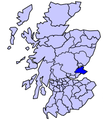
Category:Locator maps of Fife
Jump to navigation
Jump to search
Council areas (municipalities) of Scotland: Fife · Outer Hebrides ·
Traditional counties (shires) of Scotland: Fife ·
| NO WIKIDATA ID FOUND! Search for Locator maps of Fife on Wikidata | |
| Upload media |
Media in category "Locator maps of Fife"
The following 9 files are in this category, out of 9 total.
-
Balgonie Castle location.png 2,304 × 3,887; 2.32 MB
-
FifeBrit2.GIF 608 × 604; 14 KB
-
FifeBrit2.PNG 608 × 604; 20 KB
-
FifeTraditional.png 420 × 520; 12 KB
-
NHSfife.png 2,733 × 3,411; 221 KB
-
Scot1975Dunfermline.png 200 × 229; 30 KB
-
Scot1975Kirkcaldy.png 200 × 229; 30 KB
-
Scot1975NEFife.png 200 × 229; 30 KB
-
ScotlandFife.png 200 × 230; 4 KB


