Category:Locator maps of islands in Oceania
Jump to navigation
Jump to search
Subcategories
This category has the following 34 subcategories, out of 34 total.
+
A
F
I
K
M
N
P
V
Media in category "Locator maps of islands in Oceania"
The following 6 files are in this category, out of 6 total.
-
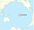
Caroline Island's location.JPG 720 × 641; 46 KB
-
LocationCarolineIslands.png 248 × 156; 3 KB
-
LocationGilbertandEllice.png 250 × 158; 7 KB
-
IOL - Namorik Atoll.JPG 335 × 480; 32 KB
-
LocationSamoaIslands.PNG 250 × 158; 5 KB
-
Tahiti.png 800 × 800; 213 KB


