Category:Locator maps of the Alps
Jump to navigation
Jump to search
Media in category "Locator maps of the Alps"
The following 55 files are in this category, out of 55 total.
-
 Alpenkarte.svg 3,178 × 1,871; 2.42 MB
-
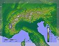
 Karte der Gebirgsgruppen in den Alpen.png 9,930 × 5,848; 9.32 MB
-
 Alpenregionen.png 2,000 × 1,472; 428 KB
-
 Alps - Dauphine.JPG 1,200 × 937; 210 KB
-
 Alps - Glarus.JPG 1,200 × 937; 209 KB
-
 Alps - Lepontine.JPG 1,200 × 937; 210 KB
-
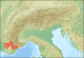
 Alps - Provence.JPG 1,200 × 937; 208 KB
-
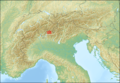
 Alps location map (Alpes de Provence, SOIUSA).png 2,000 × 1,381; 5.07 MB
-
 Alps location map (Alpes de Savoie, PWN).png 2,000 × 1,381; 5.09 MB
-
 Alps location map (Alpi Graie, PWN).png 2,000 × 1,381; 5.08 MB
-
 Alps location map (Alpi Graie, SOIUSA).png 2,000 × 1,381; 5.07 MB
-
 Alps location map (Bergell, AVE).png 2,000 × 1,381; 5.08 MB
-
 Alps location map (Berner Alpen i.w.S., SOIUSA).png 2,000 × 1,381; 5.08 MB
-
 Alps location map (Bernina-Alpen, AVE).png 2,000 × 1,381; 5.08 MB
-
 Alps location map (Berninagruppe, AVE).png 2,000 × 1,381; 5.08 MB
-
 Alps location map (Dachstein-Gosaukamm).png 2,000 × 1,381; 5.08 MB
-
 Alps location map (Dachsteingebirge).png 2,000 × 1,381; 5.08 MB
-
 Alps location map (Dolomiti, AVE).png 2,000 × 1,381; 5.08 MB
-
 Alps location map (Ennstaler Alpen, AVE).png 2,000 × 1,381; 5.08 MB
-
 Alps location map (Gailtaler Alpen).png 2,000 × 1,381; 5.08 MB
-
 Alps location map (Gosaugruppe, SOIUSA).jpg 3,279 × 2,265; 4.56 MB
-
 Alps location map (Gruppo Sobretta-Gavia, AVE).png 2,000 × 1,381; 5.08 MB
-
 Alps location map (Julijske Alpe).png 2,000 × 1,381; 5.08 MB
-
 Alps location map (Karnischer Hauptkamm, AVE).png 2,000 × 1,381; 5.08 MB
-
 Alps location map (Livigno-Alpen, AVE).png 2,000 × 1,381; 5.08 MB
-
 Alps location map (Prealpi Carniche & Karnischer Hauptkamm).png 2,000 × 1,381; 5.07 MB
-
 Alps location map (Prealpi Carniche, AVE).png 2,000 × 1,381; 5.08 MB
-
 Alps location map (Prealpi Gardesane, AVE).png 2,000 × 1,381; 5.08 MB
-
 Alps location map (Préalpes de Provence).png 2,000 × 1,381; 5.07 MB
-
 Alps location map (Puez-Geisler-Gruppe, AVE).png 2,000 × 1,381; 5.08 MB
-
 Alps location map (Salzburger Kalkalpen, PWN).png 2,000 × 1,381; 5.09 MB
-
 Alps location map (Salzburger Schieferalpen, AVE).png 2,000 × 1,381; 5.08 MB
-
 Alps location map (Schobergruppe).png 2,000 × 1,381; 5.08 MB
-
 Alps location map (Sesvennagruppe, AVE).jpg 3,279 × 2,265; 4.34 MB
-
 Alps location map (Stubaier Alpen).png 2,000 × 1,381; 5.08 MB
-
 Alps location map (Tennengebirge).png 2,000 × 1,381; 5.08 MB
-
 Alps location map (Totes Gebirge, AVE).png 2,000 × 1,381; 5.08 MB
-
 Alps location map (Venedigergruppe, AVE).png 2,000 × 1,381; 5.08 MB
-
 Alps location map (Zillertaler Alpen, AVE).png 2,000 × 1,381; 5.08 MB
-
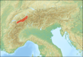
 Alps locator map (Alpi Lepontini).png 2,000 × 1,381; 4.7 MB
-
 Alps locator map (Appenzeller Alpen).png 2,000 × 1,381; 4.71 MB
-
 Alps locator map (Berner Alpen).png 2,000 × 1,381; 4.71 MB
-
 Alps locator map (Emmentaler Alpen).png 2,000 × 1,381; 4.71 MB
-
 Alps locator map (Glarner Alpen).png 2,000 × 1,381; 4.71 MB
-
 Alps locator map (Karawanken, Bachergebirge, AVE).png 2,000 × 1,381; 4.7 MB
-
 Alps locator map (Rätikon).png 2,000 × 1,381; 4.71 MB
-
 Alps locator map (Schwyzer Alpen).png 2,000 × 1,381; 4.71 MB
-
 Alps locator map (Urner Alpen).png 2,000 × 1,381; 4.71 MB
-
 Alps locator map (Walliser Alpen).png 2,000 × 1,381; 4.7 MB
-
 Alps locator map (Ötztaler Alpen).png 2,000 × 1,381; 4.71 MB
-
 Alps regions.png 2,000 × 1,472; 390 KB
-
 Alps regions.svg 406 × 299; 456 KB
-
 Europe Alps locator (cropped).png 325 × 270; 48 KB
-
 Europe Alps locator.png 454 × 422; 12 KB
-
 Karte Bayerische Voralpen.png 700 × 400; 496 KB


.png)
.png)
.png)
.png)
.png)
.png)
.png)
.png)
.png)
.png)
.png)
.png)
.png)
.jpg)
.png)
.png)
.png)
.png)
.png)
.png)
.png)
.png)
.png)
.png)
.png)
.png)
.jpg)
.png)
.png)
.png)
.png)
.png)
.png)
.png)
.png)
.png)
.png)
.png)
.png)
.png)
.png)
.png)
.png)


.png)

