Category:Human Development Index maps
Jump to navigation
Jump to search
HDI. See: en:Human Development Index.
- (an) Mapa
- (ar) خريطة
- (ast) Mapa
- (bg) Карта
- (bn) মানচিত্র
- (bs) Karta
- (ca) Plànol
- (cs) Mapa
- (cy) Map
- (da) Kort (geografi)
- (de) Karte (Kartografie)
- (eo) Mapo
- (es) Mapa
- (et) Kaart (kartograafia)
- (fa) نقشه (زمین)
- (fi) Kartta
- (fr) Carte géographique
- (gan) 地圖
- (gl) Mapa
- (he) מפה
- (hi) मानचित्र
- (hr) Karta
- (hu) Térkép
- (id) Peta
- (is) Kort
- (it) Mappa
- (ja) 地図
- (ka) გეოგრაფიული რუკა
- (ko) 지도
- (la) Tabula geographica
- (lb) Landkaart
- (lt) Žemėlapis
- (ml) ഭൂപടം
- (ms) Peta
- (nl) Kaart (cartografie)
- (nn) Kart
- (no) Kart
- (oc) Mapa
- (pl) Mapa
- (pt) Mapa
- (ro) Hartă
- (ru) Географическая карта
- (sa) Хаарта
- (sco) Cairt
- (si) ple:Map
- (sk) Mapa
- (sl) Zemljevid
- (sq) Harta
- (sr) Карта (мапа)
- (su) Atlas
- (sv) Karta
- (sw) Ramani
- (ta) நிலப்படம்
- (tg) Харита
- (th) แผนที่
- (tl) Mapa
- (tr) Harita
- (uk) Географічна карта
- (vi) Bản đồ
- (yi) מאפע
- (zh) 地图
- (zh-classical) 地圖
- (zh-yue) 地圖
Subcategories
This category has the following 6 subcategories, out of 6 total.
Media in category "Human Development Index maps"
The following 39 files are in this category, out of 39 total.
-
Angolan provinces by HDI (2017).svg 512 × 546; 134 KB
-
Armenian provinces by HDI (2017).svg 512 × 523; 83 KB
-
Austrian states by HDI (2017).svg 512 × 278; 72 KB
-
Azerbaijan regions by HDI.png 1,200 × 919; 642 KB
-
Belgian provinces by HDI (2017).svg 512 × 448; 142 KB
-
Belize districts by HDI.png 1,027 × 893; 39 KB
-
Bulgarian regions by HDI.webp 919 × 580; 333 KB
-
Counties of Croatia by HDI (2018).svg 512 × 514; 254 KB
-
Cuba HDI 2021.png 1,159 × 418; 105 KB
-
Dutch provinces by HDI (2017).svg 512 × 621; 102 KB
-
Greek regions by HDI.png 1,184 × 881; 103 KB
-
Guineabissau regions by HDI.png 1,181 × 746; 62 KB
-
Haiti regions by HDI.png 960 × 701; 67 KB
-
Human Development Index of Southern Cone Subregions..png 6,600 × 6,600; 2.6 MB
-
Human Development Index of the Municipalities of Santiago.png 2,858 × 2,480; 878 KB
-
Jamaica.png 1,082 × 659; 57 KB
-
Kuwait regions by HDI.png 1,085 × 888; 47 KB
-
Laos regions by HDI.png 985 × 890; 76 KB
-
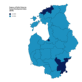
Map of NUTS3 regions of the Baltic States by Human Development Index.png 3,108 × 3,110; 396 KB
-
Montenegro regions by hdi.png 980 × 898; 76 KB
-
Myanmar regions by HDI.png 693 × 893; 72 KB
-
Namibia regions by HDI.png 1,211 × 892; 69 KB
-
Post-Soviet states by HDI (2020).png 5,281 × 2,185; 989 KB
-
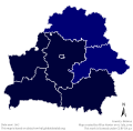
Regions of Belarus by HDI (2017).svg 512 × 503; 183 KB
-
Regions of Denmark by HDI (2017).svg 512 × 633; 135 KB
-
Regions of Finland by HDI (2017).svg 512 × 902; 106 KB
-
Regions of France by HDI (2017).svg 512 × 524; 104 KB
-
Regions of Ghana by HDI (2017).svg 512 × 735; 132 KB
-
Regions of Hungary by HDI (2017).svg 512 × 333; 121 KB
-
Regions of Italy by HDI (2017).svg 512 × 629; 236 KB
-
Regions of Kazakhstan by HDI (2018).svg 512 × 306; 208 KB
-
Regions of South Korea by HDI (2017).svg 512 × 792; 287 KB
-
Regions of Sweden by HDI (2017).svg 512 × 1,192; 105 KB
-
Saudiarabia regions by HDI.png 1,134 × 774; 69 KB
-
Serbia regions by hdi.png 729 × 720; 52 KB
-
Slovakia regions by HDI.png 962 × 440; 33 KB
-
South African provinces by HDI (2017).svg 512 × 453; 273 KB
-
Spanish autonomous communities by HDI (2017).svg 512 × 431; 216 KB
-
Índice de Desarrollo Humano de las Comunas de Santiago.png 2,858 × 2,480; 877 KB


