Category:Health maps
Jump to navigation
Jump to search
Subcategories
This category has the following 24 subcategories, out of 24 total.
Media in category "Health maps"
The following 11 files are in this category, out of 11 total.
-
Air Cancer Risk Camden City.jpg 981 × 1,278; 303 KB
-
AirToxScreen Cancer Risk.jpg 892 × 1,164; 268 KB
-
Alfred Yale Massey-map-1907-belgian congo-trypanosomiasis.jpg 379 × 590; 210 KB
-
DELEPINE; Investigations in the Public Healt Wellcome L0032434.jpg 4,391 × 4,192; 7.29 MB
-
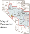
Map of Downwind Areas by the United States Department of Justice.png 200 × 228; 53 KB
-
Mercy EMS map.JPG 744 × 658; 56 KB
-
Spread of devil facial tumor disease as of 2015.jpg 600 × 660; 80 KB
-
WN spatial distribution 2010 2012.png 1,324 × 986; 288 KB
-
מפת התפשטות.png 1,452 × 851; 68 KB
-
口蹄疫-位置-地図.jpg 1,120 × 1,490; 578 KB


