Category:HDI maps of Africa
Jump to navigation
Jump to search
Subcategories
This category has the following 4 subcategories, out of 4 total.
E
- HDI maps of Egypt (2 F)
- HDI maps of Ethiopia (1 F)
N
- HDI maps of Nigeria (1 F)
S
- HDI maps of South Sudan (2 F)
Media in category "HDI maps of Africa"
The following 17 files are in this category, out of 17 total.
-
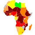
Africa HDI 2009.svg 1,000 × 1,000; 203 KB
-
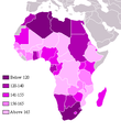
Africa by HDI, UNDP 2004.png 360 × 392; 13 KB
-
Africa by hdi.png 360 × 392; 9 KB
-
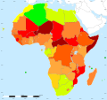
Africa UN Human Development Report 2015.svg 500 × 500; 164 KB
-
African countries by HDI (2019).png 4,665 × 4,670; 895 KB
-
African countries by HDI (2019).svg 1,430 × 1,350; 1.16 MB
-
African countries by HDI (2020).svg 1,000 × 1,000; 185 KB
-
African countries by Human Development Index (2015).png 4,800 × 4,795; 1.3 MB
-
African countries by Human Development Index (2017).png 4,800 × 4,795; 1.32 MB
-
Belt Coup.png 4,800 × 4,795; 1.36 MB
-
HDI (Sahel).svg 1,426 × 631; 801 KB
-
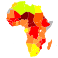
Hdi 2005 africa map.svg 1,000 × 1,000; 189 KB
-
HDI Africa-IDH África 2007.png 373 × 348; 10 KB
-
HDI-AFRICA-2009.png 837 × 607; 78 KB
-
HDImap spectrum2006 Africa.png 356 × 344; 12 KB
-
HumanDevelopmentIndexAfrica.tif 6,000 × 4,000; 5.61 MB
-
Newplace.tif 6,000 × 4,000; 5.62 MB


