Category:Historical maps of ethnic groups in Serbia
Jump to navigation
Jump to search
Subcategories
This category has the following 6 subcategories, out of 6 total.
*
A
Y
Media in category "Historical maps of ethnic groups in Serbia"
The following 55 files are in this category, out of 55 total.
-
Voivodeship of serbia ethnic map 1855.jpg 1,751 × 1,211; 1.15 MB
-
Albania-ethnique1898.jpg 342 × 568; 81 KB
-
Backa ethnic map 1715.png 1,202 × 1,958; 269 KB
-
Backa ethnic map 1720.png 1,202 × 1,767; 239 KB
-
Balan UZM.jpg 1,300 × 1,906; 1.46 MB
-
Balkans-ethnic (1861) (2).jpg 1,864 × 1,915; 2.01 MB
-
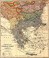
Balkans-ethnique.JPG 1,258 × 1,266; 457 KB
-
Banatul la 1774.jpg 2,526 × 2,168; 2.83 MB
-
Bevoelkerungsgruppen-Jugoslawien hu.svg 896 × 896; 255 KB
-
Bevoelkerungsgruppen-Jugoslawien.png 700 × 700; 231 KB
-
Bulgar-Morava-map.jpg 2,855 × 3,200; 1.6 MB
-
Bulgarians in 1912.jpg 2,696 × 1,964; 2.05 MB
-
Bunjevci migrations hu.svg 937 × 900; 88 KB
-
Bunjevci migrations-sr.png 937 × 900; 107 KB
-
Bunjevci migrations.png 937 × 900; 128 KB
-
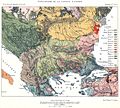
Carte ethnographique de la Péninsule balkanique, cropped.jpg 436 × 394; 305 KB
-
Dispersal of Slavs as of 1900 (1910 map).jpg 1,200 × 1,031; 212 KB
-
Edward Stanford 1877 - mistakes.JPG 1,350 × 1,589; 1.05 MB
-
Edward Stanford 1877.jpg 1,350 × 1,287; 1.17 MB
-
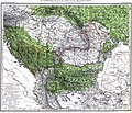
Ernst-Ravenstein-Balkans-Ethnic-Map-1880.jpg 716 × 563; 160 KB
-
Ethnic Germans in Hungary and parts of adjacent Austrian territories.JPG 3,930 × 2,842; 4.68 MB
-
Ethnographic map Ami Boué, 1847.jpg 2,364 × 2,348; 1.83 MB
-
Ethnographic map of austrian monarchy czoernig 1855.jpg 7,997 × 5,862; 23.73 MB
-
Ethnographic map of Czoernig.jpg 1,202 × 910; 372 KB
-
Ethnographic map of hungary 1910 by teleki carte rouge.jpg 4,962 × 3,509; 5.18 MB
-
Ethnographic map of Slavs, Lubor Niederle.JPG 1,017 × 847; 366 KB
-
Ethnographic map of the South Balkans, Pallas Nagy Lexikon, 1897.jpg 613 × 791; 580 KB
-
Ethnographic map of the Southern Slavs, 1913 part.png 395 × 443; 414 KB
-
Ethnographic map of the Southern Slavs, 1913.jpg 1,943 × 1,254; 1.19 MB
-
Ethnographical map of Hungary based on density of population, Census of 1910.jpg 12,000 × 9,751; 25.69 MB
-
Ethnographische Karte der Österreichischen Monarchie - Kartenteil 1.png 9,410 × 7,131; 73.76 MB
-
Ethnographische Karte der Österreichischen Monarchie - Kartenteil 4.png 9,429 × 7,116; 67.8 MB
-
Hungary-ethnic groups.jpg 2,913 × 2,250; 2.18 MB
-
Kogutowicz Károly Magyarország Néprajzi Térképe.jpg 2,062 × 1,372; 4.06 MB
-
Magiarizzazione in Ungheria (1890).png 1,064 × 766; 193 KB
-
Magyarization of Vojvodina, 1720-1910.png 1,179 × 1,248; 84 KB
-
Magyars (Hungarians) in Hungary, census 1890.jpg 1,064 × 800; 760 KB
-
Meyers b12 s0486a.jpg 2,048 × 1,683; 1.35 MB
-
NationalitiesOfSoutheasternEuropePallasNagyLexikon.jpg 695 × 1,136; 700 KB
-
RizMap19.jpg 4,056 × 4,122; 5.67 MB
-
RizMap20.jpg 5,000 × 5,708; 4.66 MB
-
RizMap22.jpg 770 × 600; 172 KB
-
RizMap23.jpg 3,200 × 3,110; 6.71 MB
-
RizMap24.jpg 2,046 × 1,839; 2.78 MB
-
Romanians before WW1.jpg 800 × 640; 229 KB
-
S. Srbija.pdf 1,708 × 1,370; 15.87 MB
-
Slaven.jpg 3,216 × 2,754; 5.22 MB
-
StariVlah (1861).jpg 2,900 × 1,598; 1.53 MB
-
Toplica-Morava Andreemap.jpg 284 × 234; 49 KB
-
Toplica-Morava- Shepherdmap.jpg 357 × 288; 51 KB
-
Toplica-Morava-Ravensteinmap.jpg 268 × 236; 26 KB
-
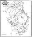
ZANETOV-MORAVA.jpg 796 × 1,151; 345 KB


