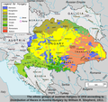
Category:Ethnographic maps of Austria-Hungary
Jump to navigation
Jump to search
Slovenščina: Etnografski zemljevidi Avstro-Ogrske.
Subcategories
This category has the following 4 subcategories, out of 4 total.
Media in category "Ethnographic maps of Austria-Hungary"
The following 65 files are in this category, out of 65 total.
-
Krain ETHNIC 1910 Pict 1.JPG 208 × 232; 14 KB
-
1899 ethnographic map of Austria-Hungary.jpg 7,712 × 6,417; 9.51 MB
-
1910年奧匈帝國民族組成.svg 1,360 × 1,052; 919 KB
-
A-H ethnic 1910 Pict 4.JPG 263 × 421; 47 KB
-
Austria hungary 1911 and post war borders.jpg 1,525 × 1,166; 389 KB
-
Austria hungary 1911.gif 907 × 687; 397 KB
-
Austria hungary 1911.jpg 1,521 × 1,155; 1.76 MB
-
Austria Hungary ethnic RU.svg 512 × 396; 275 KB
-
Austria Hungary ethnic UK.svg 512 × 396; 287 KB
-
Austria Hungary ethnic-ar.svg 1,360 × 1,052; 1,000 KB
-
Austria Hungary ethnic-pt.svg 1,360 × 1,052; 911 KB
-
Austria Hungary ethnic.svg 1,360 × 1,052; 1.56 MB
-
Austria-Hungary (ethnic 1890, with red 1914 and blue 1920 borders).jpg 5,150 × 3,395; 3.39 MB
-
Austria-Hungary (ethnic).JPG 5,150 × 3,395; 4.73 MB
-
Austria-Hungary (ethnic).jpg 4,314 × 2,820; 3.63 MB
-
Austria-Hungary ethnic map from Abbot.tif 2,328 × 1,884; 25.07 MB
-
Austria-Hungary ethnic map.jpg 1,623 × 1,276; 312 KB
-
Austro-Ungaria si Romania (harta etnica).jpg 6,245 × 3,505; 6.73 MB
-
Autriche-Hongrie-Nationalités1914.jpg 4,552 × 2,807; 2.93 MB
-
Avusturya-Macaristan İmparatorluğu Etnik Dağılımı 1910.png 1,080 × 1,080; 1.07 MB
-
C. 1890 Austro-Hungarian Empire.jpg 1,735 × 1,379; 1.53 MB
-
Croatia-Slavonia ethnography 1910.jpg 1,000 × 561; 163 KB
-
Czechs and Slovaks in Austria-Hungary, 1917.jpg 671 × 869; 451 KB
-
Ethnic map (1914).jpg 1,396 × 998; 562 KB
-
Ethno Hung.1910.png 1,103 × 1,039; 473 KB
-
Ethnographic map of austrian monarchy czoernig 1855 - cut of Bohemia, Moravia, Silesia.jpg 2,812 × 1,716; 2.42 MB
-
Ethnographic map of austrian monarchy czoernig 1855.jpg 7,997 × 5,862; 23.73 MB
-
Ethnographic map of Slavs, Lubor Niederle.JPG 1,017 × 847; 366 KB
-
Ethnographic map of the Ruthenian populaton of Galicia and Bukovina 1878.jpg 2,650 × 1,881; 2.23 MB
-
Ethnographische Karte der Österreichischen Monarchie - Kartenteil 1.png 9,410 × 7,131; 73.76 MB
-
Ethnographische Karte der Österreichischen Monarchie - Kartenteil 2.png 9,429 × 7,116; 81.38 MB
-
Ethnographische Karte der Österreichischen Monarchie - Kartenteil 3.png 9,429 × 7,116; 71.65 MB
-
Ethnographische Karte der Österreichischen Monarchie - Kartenteil 4.png 9,429 × 7,116; 67.8 MB
-
EtničkaKartaAU.png 3,000 × 3,000; 164 KB
-
Europe ethnic map 1897 (hungarian).jpg 2,316 × 1,800; 907 KB
-
German1910.png 1,031 × 650; 60 KB
-
Germans in western Austro-Hungaria.gif 626 × 427; 206 KB
-
Juden 1881.JPG 4,782 × 3,936; 3.96 MB
-
Krain SCHPRACHEN-KARTE 1880 Pict 1.JPG 763 × 632; 250 KB
-
Linguistic map of the Austro-Hungarian Monarchy.jpg 3,534 × 2,772; 2.5 MB
-
Mediaeval and modern history (1905) (14594813918).jpg 2,864 × 1,774; 569 KB
-
Meyers b12 s0486a.jpg 2,048 × 1,683; 1.35 MB
-
Mitteleuropa – Völker und Sprachgebiete 1904.jpg 5,625 × 4,153; 16.82 MB
-
Modern history; Europe (1904) (14785707023).jpg 2,960 × 2,020; 1.51 MB
-
Narody-Austro-Wegier-1910.png 5,667 × 4,383; 3.75 MB
-
Nationalitätenkarte von Österreich-Ungarn.jpg 1,201 × 1,203; 266 KB
-
Oberdeutsches Sprachgebiet-1937.PNG 1,031 × 651; 62 KB
-
Slovenia and surroundings (languages).jpg 3,497 × 2,550; 4.16 MB
-
Sprachenkarte Boehem Heinrich Rauchberg 1904 Bohemia.jpg 13,040 × 10,806; 27.64 MB
-
Sprachenkarte Deutschland1880.png 1,513 × 1,166; 356 KB
-
Subject Nationalities of the German Alliance (1917).jpg 9,500 × 5,878; 10.47 MB
-
Treaty of Rapallo.png 964 × 683; 51 KB
-
Ukrainians in Austria-Hungary 1911.gif 591 × 497; 187 KB
-
Zarubezhnaia Rus.jpg 5,125 × 3,689; 3.38 MB
-
Österreich-Ungarn (Sprachen) .png 775 × 599; 102 KB
-
Восточнославянский-клин.png 800 × 544; 854 KB
-
Этническая карта Австро-Венгрии на 1910 г.jpg 1,539 × 953; 371 KB
-
מפה אתנית של אסטרו הונגריה.png 1,102 × 899; 313 KB
-
מפת אתנית אסטרו הונגריה.png 1,024 × 791; 245 KB
Categories:
- Maps of Austria-Hungary
- Ethnographic maps of the Habsburg Monarchy
- World War I origins
- Historical maps of ethnic groups in Europe
- Historical maps of ethnic groups in Austria
- Historical maps of ethnic groups in the Czech Republic
- Historical maps of ethnic groups in Hungary
- Historical maps of ethnic groups in Italy
- Historical maps of ethnic groups in Poland
- Historical maps of ethnic groups in Romania
- Historical maps of ethnic groups in Transylvania
- Historical maps of ethnic groups in Serbia
- Historical maps of ethnic groups in Vojvodina
- Historical maps of ethnic groups in Montenegro
- Historical maps of ethnic groups in Bosnia and Herzegovina
- Historical maps of ethnic groups in Croatia
- Historical maps of ethnic groups in Slovakia
- Historical maps of ethnic groups in Slovenia
- Historical maps of ethnic groups in Ukraine
- Historical maps of ethnic groups in the Balkans


