Category:Historical maps of ethnic groups in Greece
Jump to navigation
Jump to search
Media in category "Historical maps of ethnic groups in Greece"
The following 41 files are in this category, out of 41 total.
-
Griechenland BV043564451.jpg 1,475 × 583; 843 KB
-
A Synvet 1877.jpg 1,339 × 1,381; 857 KB
-
Albania-ethnique1898.jpg 342 × 568; 81 KB
-
Altserbien-und-Makedonien-map.jpg 2,829 × 1,385; 893 KB
-
Anachronistic Map of the Balkans (English).svg 1,873 × 1,245; 2.79 MB
-
AnachronisticMapBalkans.png 755 × 550; 160 KB
-
Balkans-ethnic (1861) (2).jpg 1,864 × 1,915; 2.01 MB
-
Balkans-ethnic (1861).jpg 6,280 × 5,072; 3.98 MB
-
Balkans-ethnic (1877).jpg 2,020 × 2,084; 1.14 MB
-
Balkans-ethnique.JPG 1,258 × 1,266; 457 KB
-
Bulgarians in 1912.jpg 2,696 × 1,964; 2.05 MB
-
CarlSaxET1877.jpg 3,100 × 2,968; 7.57 MB
-
Crete - ethnic map, 1861.jpg 1,380 × 548; 235 KB
-
Edward Stanford 1877 - mistakes.JPG 1,350 × 1,589; 1.05 MB
-
Edward Stanford 1877.jpg 1,350 × 1,287; 1.17 MB
-
Ernst-Ravenstein-Balkans-Ethnic-Map-1880.jpg 716 × 563; 160 KB
-
Ethnigraphic map of Macedonia by Yordan Ivanov.jpg 3,513 × 2,550; 1.97 MB
-
Ethnographic map Ami Boué, 1847.jpg 2,364 × 2,348; 1.83 MB
-
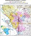
Ethnographic map of Epirus, based on P. Aravandinos, 1878.jpg 2,696 × 3,101; 2.55 MB
-
Ethnographic map of Epirus, based on P. AravandinosPocesta 1878.jpg 2,696 × 3,101; 3.95 MB
-
Ethnographic map of Macedonia, G. Lejean (ca. 1861).jpg 408 × 283; 80 KB
-
Ethnographic map of the South Balkans, Pallas Nagy Lexikon, 1897.jpg 613 × 791; 580 KB
-
Ethnographische Karte von Makedonien (1899).jpg 3,065 × 3,535; 1.14 MB
-
Greece at the time of the Dorian Migration (Spruner-Menke, Atlas Antiquus, 1865).jpg 6,935 × 5,554; 28.82 MB
-
Greece ethnic 1897.JPG 2,268 × 2,358; 901 KB
-
Kanchov Macedonia Map.jpg 2,900 × 2,650; 2.01 MB
-
Macedonia - Point of View of the Bulgarians.jpg 2,240 × 2,248; 999 KB
-
Macedonia - Point of View of the Serbs.jpg 2,216 × 2,295; 992 KB
-
NationalitiesOfSoutheasternEuropePallasNagyLexikon.jpg 695 × 1,136; 700 KB
-
Pelopones ethnic.JPG 2,334 × 1,918; 929 KB
-
RizMap19.jpg 4,056 × 4,122; 5.67 MB
-
RizMap22.jpg 770 × 600; 172 KB
-
RizMap23.jpg 3,200 × 3,110; 6.71 MB
-
RizMap24.jpg 2,046 × 1,839; 2.78 MB
-
Southwestern Balkans 1890.JPG 2,985 × 2,124; 2.47 MB
-
The Balkan Peninsula, Distribution of Races. EB 1911.png 1,057 × 1,510; 91 KB
-
BASA-1932K-1-432-7-Map of Macedonia.jpg 4,946 × 3,173; 2.06 MB


