Category:Geological maps of Norway
Jump to navigation
Jump to search
Subcategories
This category has the following 8 subcategories, out of 8 total.
Media in category "Geological maps of Norway"
The following 45 files are in this category, out of 45 total.
-
271 of 'Elements of Geology' (11004451953).jpg 1,097 × 597; 171 KB
-
Alpine permafrost in Scandinavia 07.jpg 1,506 × 1,370; 857 KB
-
Avalonia Baltica geologi.png 949 × 898; 737 KB
-
Bergens Museums aarbok (1920) (20356715992).jpg 3,456 × 1,980; 1.98 MB
-
Dalane geologi 01.jpg 400 × 301; 33 KB
-
Das Obersilur im Malmögebiete.jpg 3,317 × 5,206; 3.38 MB
-
Die Hauptverwerfungslinien im inneren Kristianiafjord.jpg 1,833 × 2,991; 1.67 MB
-
Fensfeltet 01.jpg 280 × 301; 17 KB
-
Fensfeltet.svg 744 × 1,052; 125 KB
-
Fjaeregranitt.jpg 614 × 661; 142 KB
-
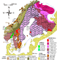
Geo map Balt shield1 no Precambrian.png 620 × 650; 231 KB
-
Geo map Balt shield1 no.PNG 620 × 650; 236 KB
-
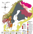
Geo map Balt shield3 no.PNG 620 × 650; 237 KB
-
Geo map Balt shield4 no.PNG 620 × 650; 229 KB
-
Geo Oslofeltet map no 01.JPG 700 × 1,200; 266 KB
-
Geo Oslofeltet map no 02.JPG 700 × 1,200; 263 KB
-
Geokarte kongsberg.jpg 6,302 × 5,169; 635 KB
-
Geologische Kartenskizze des Oberilurs in Asker.jpg 3,216 × 1,972; 1.61 MB
-
Geologische Kartenskizze des Obersilurs in Bærum.jpg 3,044 × 1,972; 1.33 MB
-
Geologisk kart over den sydlige del af Bergens halvø.jpg 3,042 × 2,198; 1.1 MB
-
Geologisk Oversigtskart over det sydlige Norge (Kjerulf-Hauan).jpg 4,712 × 5,392; 3.78 MB
-
Geologisk Oversigtskart over det sydlige Norge.jpg 8,653 × 11,600; 26.41 MB
-
Geoviden-1-2011-Nordsøens-geologi.png 1,024 × 880; 212 KB
-
Hornelen Basin geology.png 2,758 × 1,605; 3.42 MB
-
Jan Mayen geology-fr.png 2,187 × 2,068; 449 KB
-
Kart over Salangen jernmalmsfelt fra ukjent årstall.png 3,012 × 4,089; 35.25 MB
-
Kart over Verdalsraset.jpg 5,015 × 2,218; 2.16 MB
-
Kjerulf - Geologische Uebersichtskarte des Christiania-Silurbeckens.jpg 5,488 × 7,288; 10.15 MB
-
Kvamshesten Basin geology.png 2,641 × 1,415; 4.63 MB
-
Lofoten and Vesteraalen geology.png 1,864 × 2,071; 595 KB
-
NGU Rombaksvinduet.png 1,756 × 1,640; 3.98 MB
-
Nw europe grav plot 2.png 742 × 841; 880 KB
-
OD Kontinentalsokkelkart 2016.pdf 5,075 × 6,735; 5.92 MB
-
Overview Baltic shield.png 2,103 × 2,196; 765 KB
-
Overview Baltic shield.tiff 2,103 × 2,196; 1.07 MB
-
Regional map of the North East Atlantic Ocean.jpg 603 × 480; 71 KB
-
Solund Basin geology.png 2,592 × 2,018; 3.22 MB
-
Svalbard geology v2.jpg 427 × 520; 52 KB
-
Swenska wetenskaps academiens handlingar (1895) (14579640597).jpg 2,194 × 3,234; 2.45 MB
-
Uebergangs-Territorium von Christiania..jpg 7,720 × 12,592; 11.55 MB
-
Uebersichtskarte des Kristiania-Silurgebietes.jpg 1,580 × 2,968; 1.07 MB
-
Verdalsraset.jpg 3,776 × 1,523; 3.22 MB
-
Übersichtskarte des Obersilurs auf Hadeland.jpg 1,960 × 2,752; 1.65 MB


