Category:Geological maps of Germany
Jump to navigation
Jump to search
Federal states of Germany:
Subcategories
This category has the following 6 subcategories, out of 6 total.
*
A
K
Media in category "Geological maps of Germany"
The following 44 files are in this category, out of 44 total.
-
Alps geology map en.jpg 3,338 × 1,607; 1.86 MB
-
Avalonia Baltica geologi.png 949 × 898; 737 KB
-
Deutschland - geologish bearbeitet von Rudolph Ludwig in Darmstadt - btv1b53064379h.jpg 6,490 × 5,363; 6.23 MB
-
EisrandlagenNorddeutschland.png 474 × 405; 349 KB
-
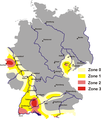
Erdbebenzonen.png 1,902 × 2,248; 144 KB
-
France geological map-fr.svg 1,636 × 1,753; 3.27 MB
-
French Hercynian massifs BR.svg 850 × 590; 274 KB
-
French Hercynian massifs EN.svg 850 × 590; 274 KB
-
French Hercynian massifs NL.svg 850 × 590; 273 KB
-
Gebiete mit Schiefergaspotenzialen in Deutschland (Karte).png 1,075 × 1,273; 334 KB
-
Geologie massif du Jura.svg 882 × 1,170; 178 KB
-
Geologische Karte des Harzes (K Stedingk) (page 1 crop).jpg 3,441 × 2,078; 727 KB
-
Geologische Karte des Harzes (K Stedingk).jpg 3,024 × 1,830; 620 KB
-
Geologische Karte des Harzes (K Stedingk).pdf 1,754 × 1,239; 232 KB
-
Geologische Karte von Deutschland - bearbeitet von Dr. H. von Decher... - btv1b53085911p.jpg 10,320 × 11,688; 17.68 MB
-
Geomap Germany.png 2,495 × 4,577; 618 KB
-
Gliederung der Varisziden in Deutschland.jpg 1,323 × 1,356; 273 KB
-
Gliederung der Varisziden in Mitteleuropa.jpg 1,910 × 1,290; 510 KB
-
Haupteinheitengruppen westliches Schichtstufenland.png 1,000 × 1,020; 1.81 MB
-
Hercynian structures Europe-en.svg 850 × 555; 131 KB
-
Hercynian structures Europe-es.svg 2,239 × 1,455; 516 KB
-
Hercynian structures Europe-it.svg 850 × 555; 104 KB
-
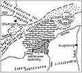
Historische, geologische Karte der Ostalb vor 250 J.jpg 2,414 × 2,156; 1.07 MB
-
Hobräcke Formation.jpg 1,444 × 728; 2.78 MB
-
Journal.pone.0025693.g001.png 600 × 412; 73 KB
-
Karbonat-Aufschluesse Deutschland.jpg 1,255 × 1,661; 2.17 MB
-
Karst springs Germany.PNG 938 × 1,240; 53 KB
-
Karte Geologische Strukturen des Rheinischen Schiefergebirges.png 2,341 × 1,329; 5.14 MB
-
Lauchert Bittelschießer-Täle Schwäbische Alb 5.jpg 800 × 1,200; 308 KB
-
Mansfeld geological map2 300dpi.jpg 13,299 × 7,699; 4.23 MB
-
Meyers b4 s0802a.jpg 2,048 × 1,632; 726 KB
-
Nauener Platte.png 1,815 × 1,421; 362 KB
-
Nw europe grav plot 2.png 742 × 841; 880 KB
-
Nw europe grav plot.png 475 × 548; 318 KB
-
Nördl.Kalkalpen,farbig.PNG 1,809 × 1,263; 453 KB
-
Schéma des 2 marges continentales des alpes.png 705 × 454; 127 KB
-
Streichen Deutschland.png 2,282 × 2,892; 8.81 MB
-
The Roer Valley rift system and bouguer anomalies.png 640 × 436; 593 KB
-
Varisztidák.png 603 × 288; 116 KB
-
Meyers geographischer Handatlas 1928 (95274888).jpg 6,149 × 4,653; 3.5 MB
-
Physikalisch-statistischer Atlas des Deutschen Reichs 1878 (131438759).jpg 11,970 × 9,502; 50.99 MB
-
Sydow-Wagners Methodischer Schul-Atlas 1904 (138940774).jpg 7,816 × 8,996; 64.09 MB


