Category:Geological maps of Belgium
Jump to navigation
Jump to search
Media in category "Geological maps of Belgium"
The following 36 files are in this category, out of 36 total.
-
Agrarverfassung und Landwirtschaft in Belgien (1909) (14594669997).jpg 2,946 × 2,586; 1.91 MB
-
Agrarverfassung und Landwirtschaft in Belgien (1909) (14778815634).jpg 2,946 × 2,576; 1.82 MB
-
Avalonia Baltica geologi.png 949 × 898; 737 KB
-
Belgique. Carte géologique - btv1b84592124.jpg 5,328 × 4,079; 3.48 MB
-
Benelux geol.svg 662 × 971; 1.01 MB
-
Brussels sands.PNG 470 × 599; 241 KB
-
France geological map-fr.svg 1,636 × 1,753; 3.27 MB
-
French Hercynian massifs BR.svg 850 × 590; 274 KB
-
French Hercynian massifs EN.svg 850 × 590; 274 KB
-
French Hercynian massifs NL.svg 850 × 590; 273 KB
-
Geol Benelux.png 295 × 278; 118 KB
-
Geologische Übersicht - Ardennen.png 1,694 × 1,360; 333 KB
-
Geology of the Rhenish Massif.png 2,152 × 1,822; 582 KB
-
Hercynian structures Europe NL.svg 850 × 555; 131 KB
-
Hercynian structures Europe-en.svg 850 × 555; 131 KB
-
Hercynian structures Europe-es.svg 2,239 × 1,455; 516 KB
-
Hercynian structures Europe-fr.svg 850 × 575; 129 KB
-
Hercynian structures Europe-it.svg 850 × 555; 104 KB
-
KarstBelge-Stub.svg 744 × 638; 25 KB
-
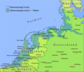
Nordsee plus 1m.png 1,500 × 1,283; 567 KB
-
Nw europe grav plot 2.png 742 × 841; 880 KB
-
Nw europe grav plot.png 475 × 548; 318 KB
-
Olne-geologie-gen.jpeg 1,721 × 1,361; 888 KB
-
PSM V51 D451 Geology and elevation of belgium.png 1,522 × 1,564; 749 KB
-
Roerdal graben map DE.svg 724 × 558; 596 KB
-
Roerdal graben map EN.svg 724 × 558; 572 KB
-
Roerdal graben map NL.svg 724 × 558; 573 KB
-
Subcrop Quartair Vlaanderen.png 1,465 × 642; 370 KB
-
The Roer Valley rift system and bouguer anomalies.png 640 × 436; 593 KB
-
Varisztidák.png 603 × 288; 116 KB
-
Vereenvoudigde Quartairkaart Vlaanderen.png 1,477 × 631; 365 KB


