Category:Geological maps of Brazil
Jump to navigation
Jump to search
Countries of the Americas: Argentina · Belize · Bolivia · Brazil · Canada · Chile · Colombia · Costa Rica · Ecuador · El Salvador · Guatemala · Mexico · Nicaragua · Panama · Paraguay · Peru · United States of America · Uruguay · Venezuela
Other areas: French Guiana · Greenland · Guadeloupe · Martinique · Puerto Rico
Other areas: French Guiana · Greenland · Guadeloupe · Martinique · Puerto Rico
Subcategories
This category has the following 3 subcategories, out of 3 total.
H
- Hydrological maps of Brazil (3 F)
M
- Mining maps of Brazil (1 F)
Media in category "Geological maps of Brazil"
The following 44 files are in this category, out of 44 total.
-

-
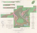
 Araripe Basin map - formations and resources.jpg 1,546 × 734; 483 KB
-
 Brasilmarvermelho1.jpg 2,095 × 1,682; 4.22 MB
-
 Bulletin of the Geological Society of America (1911) (19827180414).jpg 2,888 × 2,276; 1.51 MB
-
 CAMP Magmatism in the context of Pangea.jpg 553 × 625; 40 KB
-
 Carta Geologica do Estado de S. Paulo (Brasil), Acervo do Museu Paulista da USP (cropped).jpg 5,642 × 3,600; 15.42 MB
-
 Carta Geologica do Estado de S. Paulo (Brasil), Acervo do Museu Paulista da USP.jpg 7,216 × 5,412; 19.64 MB
-
 Cprm.png 637 × 393; 105 KB
-
 Cratons brasileiros.jpg 425 × 275; 27 KB
-
 Cráton do São Francisco Bahia.png 314 × 355; 86 KB
-
 Esboço geológico de parte do norte-nordeste brasileiro.png 928 × 491; 358 KB
-
 Exudações de óleo na Bacia do Paraná no estado de São Paulo.jpg 472 × 678; 45 KB
-
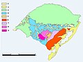
 Formações Geológicas Paleorrota.jpg 691 × 589; 61 KB
-
 Geologic map listing the gold mines of Minas Gerais.jpg 1,313 × 814; 277 KB
-
 Geologic map of the Parnaíba Basin.jpg 768 × 839; 356 KB
-

-

-
 Lineamento e a posição dos pipes nas proximidades da faixa Brasília.png 454 × 254; 106 KB
-
 Localizacao Carajas.jpg 560 × 720; 95 KB
-

-
 Localização do Supergrupo Espinhaço.png 424 × 562; 141 KB
-
 Map of Parnaíba Basin and surrounding areas.jpg 1,077 × 841; 516 KB
-
 Mapa Barreiras.png 741 × 729; 1.08 MB
-
-
 Mapa divisões Planalto brasileiro.jpg 607 × 600; 106 KB
-
 Mapa geologico do Rio Grande do Sul - Brasil.JPG 697 × 520; 41 KB
-
 Mapa Geológico Carajás.png 602 × 705; 239 KB
-
 Mapa Geológico de SP e exemplares de minerais.jpg 2,048 × 1,536; 515 KB
-
 Mapa Geológico do Estado de Goiaz, Acervo do Museu Paulista da USP.jpg 5,412 × 7,216; 20.29 MB
-
 Mapa Geológico do Estado do Paraná, Acervo do Museu Paulista da USP.jpg 7,216 × 5,412; 22.95 MB
-

-
 Mapa geológico simplificado do Cráton São Luís.png 793 × 826; 606 KB
-
 Oil shale in Brazil.png 952 × 883; 116 KB
-
 Paranabecken.jpg 670 × 689; 97 KB
-
 Planície chaco-pampeana.png 762 × 1,091; 425 KB
-
 Processos Minerários no Cráton São Luís, Maranhã e Pará, Brasil (em outubro de 2020).png 3,155 × 1,845; 471 KB
-
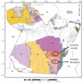 Províncias Tectônicas Carajás.png 602 × 595; 310 KB
-
 Quadrilatero Ferrifero, plate 1.pdf 5,841 × 5,245; 7.56 MB
-
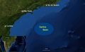 Santos basin map.png 990 × 609; 550 KB
-
 Serraesquema.jpg 1,000 × 845; 664 KB
-
 The Late Cretaceous Impact of the Trindade Mantle Plume.png 437 × 540; 137 KB
-
 Tupi.jpg 1,836 × 1,836; 239 KB
-
 Área de estudo santa fé.jpg 419 × 511; 51 KB
-
 НГП Сантоса.png 2,218 × 1,480; 639 KB
.jpg)


_(19827180414).jpg)

,_Acervo_do_Museu_Paulista_da_USP_(cropped).jpg)
,_Acervo_do_Museu_Paulista_da_USP.jpg)


.jpg)


.png)


