Category:Geological maps of Colombia
Jump to navigation
Jump to search
Subcategories
This category has the following 3 subcategories, out of 3 total.
H
M
S
Media in category "Geological maps of Colombia"
The following 21 files are in this category, out of 21 total.
-
2019 earthquake.png 700 × 893; 715 KB
-
AGHRC (1890) - Carta XVII - Geología de Colombia, Venezuela y Ecuador.jpg 4,272 × 3,455; 5.42 MB
-
Baudó-range-Colombia-USGS.png 328 × 480; 48 KB
-
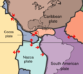
Cocos-Caribbean.jpg 1,258 × 744; 686 KB
-
Coiba & Malpelo Plates and major seismic faults of Colombia.jpg 768 × 759; 476 KB
-
Colombiatectonic.png 249 × 223; 86 KB
-
Geological Map of Colombia.jpg 850 × 1,143; 238 KB
-
Geologische kaart van Valle del Cauca.png 1,557 × 1,153; 129 KB
-
HGeoSumapaz.png 368 × 485; 432 KB
-
MAGMAARC1.jpg 384 × 580; 39 KB
-
Mapa de Amenaza Sísmica de Colombia.png 2,000 × 2,290; 4.7 MB
-
Mapa geologico valle del cauca.png 1,557 × 1,153; 105 KB
-
Mexico tectonic plates.png 717 × 596; 168 KB
-
North Andes Plate map-es.png 602 × 355; 137 KB
-
NorthAndesPlate.png 564 × 472; 101 KB
-
Panama Plate map-fr.png 628 × 342; 71 KB
-
PanamaPlate.png 564 × 384; 94 KB
-
Sismico.jpg 280 × 305; 45 KB
-
Topographic Map of the Cesar-Ranchería Basin - Colombia.jpg 1,429 × 788; 821 KB


