Category:Fountains Fell, North Yorkshire
Jump to navigation
Jump to search
mountain in United Kingdom | |||||
| Upload media | |||||
| Instance of | |||||
|---|---|---|---|---|---|
| Location |
| ||||
| Mountain range | |||||
| Topographic prominence |
| ||||
| Elevation above sea level |
| ||||
| Parent peak | |||||
 | |||||
Subcategories
This category has the following 4 subcategories, out of 4 total.
Media in category "Fountains Fell, North Yorkshire"
The following 52 files are in this category, out of 52 total.
-
A bit of a climb on the Pennine Way - geograph.org.uk - 3051561.jpg 3,872 × 2,592; 5.11 MB
-
Boundary wall on Fountains Fell - geograph.org.uk - 2308197.jpg 640 × 426; 223 KB
-
Churn Milk Hole - geograph.org.uk - 934604.jpg 640 × 479; 92 KB
-
Coming off Fountains Fell - geograph.org.uk - 270561.jpg 640 × 321; 124 KB
-
Disused Weather Station - geograph.org.uk - 252027.jpg 640 × 480; 113 KB
-
Dry stone wall across Fountains Fell - geograph.org.uk - 2308206.jpg 640 × 426; 223 KB
-
Follow the Wall to Fountains Fell - geograph.org.uk - 258387.jpg 640 × 362; 106 KB
-
Fountains Fell - geograph.org.uk - 238121.jpg 640 × 480; 103 KB
-
Fountains Fell - geograph.org.uk - 238161.jpg 640 × 311; 43 KB
-
Fountains Fell - geograph.org.uk - 252024.jpg 640 × 480; 104 KB
-
Fountains Fell - geograph.org.uk - 4567525.jpg 3,648 × 2,736; 4.38 MB
-
Fountains Fell and Out Sleets. - geograph.org.uk - 262200.jpg 640 × 480; 44 KB
-
Fountains Fell from Middle House Hill - geograph.org.uk - 131979.jpg 640 × 480; 93 KB
-
Fountains Fell summit plateau - geograph.org.uk - 301089.jpg 640 × 437; 56 KB
-
Fountains Fell Tarn - geograph.org.uk - 2308207.jpg 640 × 426; 234 KB
-
Fountains Fell Tarn - geograph.org.uk - 252045.jpg 640 × 480; 97 KB
-
Fountains Fell Tarn - geograph.org.uk - 402701.jpg 640 × 493; 118 KB
-
Gate and Wall on Fountains Fell. - geograph.org.uk - 261427.jpg 640 × 480; 93 KB
-
Gate on track to Rough Close - geograph.org.uk - 238135.jpg 640 × 480; 89 KB
-
Heading up Fountains Fell on the Pennine Way - geograph.org.uk - 4519746.jpg 4,320 × 3,240; 4.92 MB
-
High Cow Close - geograph.org.uk - 238116.jpg 640 × 480; 127 KB
-
Knowe Fell and area of potholes - geograph.org.uk - 247979.jpg 480 × 640; 99 KB
-
Miners' track up Fountains Fell - geograph.org.uk - 402628.jpg 640 × 480; 143 KB
-
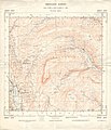
Ordnance Survey Sheet SD 87 Published 1957.jpg 5,643 × 6,595; 4.28 MB
-
Pennine Way descending off Fountains Fell - geograph.org.uk - 3233611.jpg 4,320 × 3,240; 3.24 MB
-
Pennine Way near Tennant Gill - geograph.org.uk - 1490001.jpg 640 × 480; 144 KB
-
Pennine Way on Fountains Fell - geograph.org.uk - 1490005.jpg 640 × 480; 132 KB
-
Pennine Way on Fountains Fell - geograph.org.uk - 1490018.jpg 640 × 480; 141 KB
-
Pennine Way on Fountains Fell - geograph.org.uk - 2308218.jpg 640 × 426; 269 KB
-
Pennine Way on Fountains Fell - geograph.org.uk - 3177653.jpg 2,048 × 1,536; 545 KB
-
Pennine Way on Fountains Fell - geograph.org.uk - 6511361.jpg 1,024 × 636; 154 KB
-
Pennine Way towards Tennant Gill - geograph.org.uk - 1490039.jpg 640 × 480; 153 KB
-
Penyghent from Fountains Fell - geograph.org.uk - 46243.jpg 640 × 480; 137 KB
-
Sannat Hall Farm - geograph.org.uk - 1525481.jpg 640 × 480; 87 KB
-
Shooting House and Fountains Fell - geograph.org.uk - 238159.jpg 640 × 276; 39 KB
-
Sign on Fountains Fell. - geograph.org.uk - 262186.jpg 640 × 480; 122 KB
-
Small Tarn on Fountains Fell - geograph.org.uk - 2308187.jpg 640 × 426; 274 KB
-
South ridge of Fountains Fell - geograph.org.uk - 76325.jpg 640 × 480; 142 KB
-
Stream coming off Fountains Fell - geograph.org.uk - 23991.jpg 640 × 480; 162 KB
-
The conical cairns on Fountains Fell - geograph.org.uk - 1077279.jpg 640 × 480; 81 KB
-
The Pennine Way coming off Fountains Fell - geograph.org.uk - 3051863.jpg 3,872 × 2,592; 5.1 MB
-
The Pennine Way near the northern edge of Fountains Fell - geograph.org.uk - 3051691.jpg 3,872 × 2,592; 4.7 MB
-
The slopes of Fountains Fell - geograph.org.uk - 1077280.jpg 480 × 640; 109 KB
-
The Winter Sun Rises Over Fountains Fell - geograph.org.uk - 459441.jpg 1,024 × 768; 229 KB
-
View from the Pennine Way - geograph.org.uk - 246634.jpg 640 × 480; 74 KB
-
View through the gap - geograph.org.uk - 261761.jpg 640 × 480; 69 KB
-
Wall junction and Fountains Fell - geograph.org.uk - 1402329.jpg 640 × 480; 147 KB


