Category:Halton Gill
Jump to navigation
Jump to search
village in North Yorkshire, England, United Kingdom  | |||||
| Upload media | |||||
| Instance of | |||||
|---|---|---|---|---|---|
| Location | Craven, North Yorkshire, Yorkshire and the Humber, England | ||||
| Population |
| ||||
 | |||||

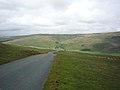
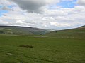
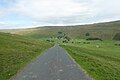
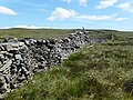
English: Halton Gill is a hamlet and civil parish in the Yorkshire Dales in North Yorkshire, England. It is situated near Litton and another hamlet, Foxup.
Subcategories
This category has the following 2 subcategories, out of 2 total.
D
P
- Plover Hill (29 F)
Media in category "Halton Gill"
The following 200 files are in this category, out of 664 total.
(previous page) (next page)-
 'Help yourself' cafe, Halton Gill - geograph.org.uk - 6280634.jpg 1,024 × 768; 214 KB
-
 15^ sign - geograph.org.uk - 6189563.jpg 1,024 × 683; 486 KB
-
 2-10pm the summit of Pen-y-ghent - geograph.org.uk - 5430959.jpg 1,200 × 799; 249 KB
-
 2-21pm, Trip point, Pen-y-ghent - geograph.org.uk - 5469557.jpg 1,200 × 799; 367 KB
-
 2-24pm Path off Pen-y-Ghent summit - geograph.org.uk - 5469561.jpg 1,200 × 799; 163 KB
-
 2-26pm, path towards Gavel Rigg - geograph.org.uk - 5469566.jpg 1,200 × 799; 222 KB
-
 2-29pm looking back towards Pen-y-Ghent summit - geograph.org.uk - 5469578.jpg 1,200 × 799; 276 KB
-
 2-29pm, path towards Gavel Rigg - geograph.org.uk - 5469574.jpg 1,200 × 799; 228 KB
-
 2-32pm, path towards Gavel Rigg - geograph.org.uk - 5469582.jpg 1,200 × 799; 267 KB
-
 2-33pm, path towards Gavel Rigg - geograph.org.uk - 5469585.jpg 1,200 × 799; 325 KB
-
 2-35pm, path towards Gavel Rigg - geograph.org.uk - 5469662.jpg 1,200 × 799; 305 KB
-
 2-38pm, fingerpost near Gavel Rigg - geograph.org.uk - 5469669.jpg 1,200 × 799; 333 KB
-
 2-39pm, summit of Pen-y-ghent - geograph.org.uk - 5469691.jpg 1,200 × 799; 208 KB
-
 A bitter night on Pen-y-ghent - geograph.org.uk - 6556810.jpg 1,024 × 768; 408 KB
-
 A brow in the road to Halton Gill - geograph.org.uk - 5968713.jpg 1,600 × 1,201; 335 KB
-
 A landscape of barns - geograph.org.uk - 4058179.jpg 4,320 × 3,240; 4.76 MB
-
 A long shadow on Pen-y-ghent - geograph.org.uk - 6556800.jpg 1,024 × 768; 551 KB
-
 A prospect of Halton Gill - geograph.org.uk - 5420604.jpg 640 × 480; 325 KB
-

-
 A view from Fountains fell. - geograph.org.uk - 3918159.jpg 640 × 367; 50 KB
-
 Abandoned Sheepfold by Cosh Beck - geograph.org.uk - 3293018.jpg 4,320 × 3,240; 4.73 MB
-
 Above Littondale - geograph.org.uk - 4488446.jpg 640 × 428; 78 KB
-
 Above the Halton Gill Road - geograph.org.uk - 1343571.jpg 640 × 480; 101 KB
-
 Across Hesleden Bergh - geograph.org.uk - 4488438.jpg 640 × 428; 94 KB
-
 Across to Pen-t-Ghent - geograph.org.uk - 4487630.jpg 640 × 428; 93 KB
-
 All that's needed for the final ascent of Pen-y-ghent - geograph.org.uk - 2056250.jpg 3,872 × 2,475; 2.69 MB
-
 An Almost Dry Stream - geograph.org.uk - 4085616.jpg 2,560 × 1,920; 3.32 MB
-
 An easy section of the path climbing Pen-y-ghent - geograph.org.uk - 6558848.jpg 1,024 × 768; 525 KB
-
 Ancient Bridge - geograph.org.uk - 4085478.jpg 2,560 × 1,920; 3.51 MB
-
 Anything but straight^ - geograph.org.uk - 4044393.jpg 4,320 × 3,240; 4.6 MB
-
 Approaching a cattle grid - geograph.org.uk - 3471588.jpg 640 × 427; 94 KB
-
 Approaching a cattle grid - geograph.org.uk - 6189110.jpg 1,024 × 683; 445 KB
-
 Approaching cows and sheep - geograph.org.uk - 3471558.jpg 640 × 427; 84 KB
-
 Approaching Pen-y-Ghent House - geograph.org.uk - 3638355.jpg 4,320 × 3,240; 5.63 MB
-
 Approaching Penyghent - geograph.org.uk - 3915685.jpg 640 × 480; 36 KB
-
 Approaching the Summit of Pen y Ghent - geograph.org.uk - 3521166.jpg 4,320 × 3,240; 3.69 MB
-
 Approaching Upper Hesleden - geograph.org.uk - 3637723.jpg 4,320 × 3,240; 4.47 MB
-
 Ascent of Pen y Ghent - geograph.org.uk - 2206407.jpg 640 × 480; 83 KB
-
 Barn above Cosh House - geograph.org.uk - 4567505.jpg 800 × 600; 171 KB
-
 Barn at Halton Gill - geograph.org.uk - 3117059.jpg 3,260 × 1,632; 1.43 MB
-
 Barn beside the road - geograph.org.uk - 6190356.jpg 1,024 × 683; 508 KB
-
 Barn in Halton Gill - geograph.org.uk - 6189591.jpg 1,024 × 683; 485 KB
-
 Beck above Halton Gill - geograph.org.uk - 1343531.jpg 640 × 480; 114 KB
-
 Beck passing under the road - geograph.org.uk - 1343526.jpg 640 × 480; 126 KB
-
 Below Hesleden High Bergh - geograph.org.uk - 4488462.jpg 640 × 428; 72 KB
-
 Bench mark on a gatepost near Foxup, Littondale - geograph.org.uk - 6129830.jpg 1,200 × 1,600; 772 KB
-
 Bench mark on Brankett Barns (south) - geograph.org.uk - 6130082.jpg 1,201 × 1,600; 714 KB
-
 Bench mark on Ellergill Bunk Barn, Littondale - geograph.org.uk - 6129797.jpg 1,198 × 1,600; 733 KB
-
 Bench mark on Foxup Bridge, Littondale - geograph.org.uk - 6129868.jpg 1,200 × 1,600; 742 KB
-
 Bench mark on gatepost for Nether Hesleden - geograph.org.uk - 6130156.jpg 1,200 × 1,600; 673 KB
-
 Bench mark on gatepost in Littondale - geograph.org.uk - 6129993.jpg 1,199 × 1,600; 732 KB
-
 Bench mark on Halton Gill Bridge - geograph.org.uk - 6129465.jpg 1,200 × 1,600; 705 KB
-
 Bench mark on St John the Baptist church, Halton Gill - geograph.org.uk - 6129501.jpg 1,200 × 1,600; 677 KB
-
 Benchmark on 'Dale Head' - geograph.org.uk - 4734717.jpg 1,024 × 683; 298 KB
-
 Benchmark on the barn at Dale Head - geograph.org.uk - 3176054.jpg 2,048 × 1,536; 507 KB
-
 Blanket bog at Horse Head - geograph.org.uk - 3538442.jpg 1,024 × 768; 114 KB
-
 Blanket bog on the ridgetop west of Little Fell - geograph.org.uk - 3538402.jpg 1,024 × 768; 126 KB
-
 Blaydike Moss - geograph.org.uk - 4083532.jpg 2,560 × 1,920; 3.86 MB
-
 Blishmire Barn - geograph.org.uk - 258285.jpg 640 × 223; 102 KB
-
 Blishmire House - geograph.org.uk - 4044243.jpg 4,320 × 3,240; 5.92 MB
-
 Blishmire House and Penyghent - geograph.org.uk - 5414352.jpg 640 × 480; 290 KB
-
 Blishmire House below Pen-y-ghent - geograph.org.uk - 2626518.jpg 1,024 × 768; 209 KB
-
 Bog cotton and blanket bog - geograph.org.uk - 3538448.jpg 968 × 581; 109 KB
-
 Boulder field on the nose - geograph.org.uk - 5413427.jpg 640 × 427; 197 KB
-
 Boulder field, Pen-y-ghent - geograph.org.uk - 3943640.jpg 640 × 425; 199 KB
-
 Boundary Fence on Little Fell - geograph.org.uk - 3267255.jpg 4,320 × 3,240; 4.67 MB
-
 Boundary wall and footpath, Little Fell - geograph.org.uk - 3538429.jpg 1,024 × 768; 146 KB
-

-
 Boundary wall heading east to Horse Head - geograph.org.uk - 3537872.jpg 1,024 × 768; 127 KB
-

-
 Boundary Wall on Ber Gill - geograph.org.uk - 3293023.jpg 4,320 × 3,240; 3.61 MB
-
 Boundary Wall on Eller Carr Moss - geograph.org.uk - 3266354.jpg 4,320 × 3,240; 3.41 MB
-
 Boundary Wall on Horse Head - geograph.org.uk - 3267275.jpg 4,320 × 3,240; 4.16 MB
-
 Boundary Wall on Horse Head Moor - North West - geograph.org.uk - 3268263.jpg 4,320 × 3,240; 4.28 MB
-
 Boundary Wall on Horse Head Moor - South East - geograph.org.uk - 3268265.jpg 4,320 × 3,240; 4.62 MB
-
 Brackenbottom path junction below Pen-y-ghent - geograph.org.uk - 3176050.jpg 2,048 × 1,536; 612 KB
-
 Brankett Barns (south) and a bench mark - geograph.org.uk - 6130097.jpg 1,600 × 1,200; 560 KB
-
 Bridge Farm, Foxup - geograph.org.uk - 4085689.jpg 2,560 × 1,920; 3.4 MB
-
 Bridge leading to Halton Gill Hamlet - geograph.org.uk - 3171268.jpg 1,843 × 1,195; 2.2 MB
-
 Bridge over Halton Gill Beck - geograph.org.uk - 5968708.jpg 1,600 × 1,201; 447 KB
-
 Bridleway at Halton Gill - geograph.org.uk - 4149559.jpg 4,000 × 3,000; 7.72 MB
-
 Bridleway at Halton Gill - geograph.org.uk - 4149565.jpg 4,000 × 3,000; 5.53 MB
-
 Bridleway leading to Foxup - geograph.org.uk - 3795833.jpg 4,320 × 3,240; 4.25 MB
-
 Broken stile, Little Fell - geograph.org.uk - 3538419.jpg 1,024 × 768; 125 KB
-
 Broken Wall on Sugar Loaf - geograph.org.uk - 3268271.jpg 4,320 × 3,240; 4.51 MB
-
 Building west of Giant's Grave Cairn - geograph.org.uk - 1767955.jpg 640 × 480; 140 KB
-
 By Heselden Beck - geograph.org.uk - 2890346.jpg 4,320 × 3,240; 4.12 MB
-
 Cairn at Sugar Loaf - geograph.org.uk - 4627248.jpg 2,048 × 1,536; 985 KB
-
 Cairn on Pen-y-Ghent - geograph.org.uk - 2614546.jpg 3,072 × 2,304; 1.78 MB
-
 Cairns on Fountains Fell - geograph.org.uk - 3970282.jpg 640 × 426; 164 KB
-
 Cairns on Fountains Fell - geograph.org.uk - 6522646.jpg 1,024 × 637; 192 KB
-
 Cattle grid at Hesleden Bergh - geograph.org.uk - 2044489.jpg 640 × 426; 301 KB
-
 Cattle grid on Heselden Bergh - geograph.org.uk - 6280728.jpg 1,024 × 768; 228 KB
-

-

-
 Cave entrance - geograph.org.uk - 220721.jpg 480 × 640; 167 KB
-
 Checking the map at Churn Milk Hole - geograph.org.uk - 3711284.jpg 640 × 480; 56 KB
-
 Church Cottage (former school), Halton Gill - geograph.org.uk - 6280630.jpg 1,024 × 768; 234 KB
-
 Churn Milk Hole - geograph.org.uk - 3052604.jpg 3,872 × 2,592; 4.88 MB
-
 Churn Milk Hole - geograph.org.uk - 5822466.jpg 1,500 × 1,125; 1.51 MB
-
 Churn Milk Hole - geograph.org.uk - 6103638.jpg 4,288 × 2,848; 5.08 MB
-
 Churn Milk Hole - geograph.org.uk - 6103640.jpg 4,288 × 2,848; 5.41 MB
-
 Climbing up Fountains Fell - geograph.org.uk - 3177095.jpg 800 × 600; 125 KB
-
 Coke oven, Fountains Fell - geograph.org.uk - 6511338.jpg 1,024 × 683; 232 KB
-
 Contrasting walls on Little Fell - geograph.org.uk - 3538439.jpg 1,024 × 768; 163 KB
-
 Corner of Enclosure on the Flanks of Plover Hill - geograph.org.uk - 3794836.jpg 4,320 × 3,240; 3.76 MB
-
 Cosh - splendid isolation^ - geograph.org.uk - 4569155.jpg 640 × 480; 81 KB
-
 Cosh Beck - geograph.org.uk - 1848012.jpg 2,592 × 1,944; 1.12 MB
-
 Cosh Beck - geograph.org.uk - 3292890.jpg 4,320 × 3,240; 3.72 MB
-
 Cosh Beck - geograph.org.uk - 4228081.jpg 4,320 × 3,240; 4.67 MB
-
 Cosh Beck - geograph.org.uk - 5968556.jpg 1,600 × 1,064; 324 KB
-
 Cosh Beck - geograph.org.uk - 5968697.jpg 1,600 × 1,112; 263 KB
-
 Cosh Beck Head Cave - geograph.org.uk - 4569522.jpg 640 × 480; 96 KB
-
 Cosh Beck in autumn - geograph.org.uk - 4228069.jpg 4,320 × 3,240; 4.72 MB
-
 Cosh Outside - geograph.org.uk - 4569507.jpg 800 × 600; 79 KB
-

-
 Cosh Outside Trig - geograph.org.uk - 4085001.jpg 2,560 × 1,920; 3.24 MB
-
 Cosh, Yorkshire Dales - geograph.org.uk - 3298524.jpg 4,000 × 3,000; 4.62 MB
-
 Cows above Halton Gill - geograph.org.uk - 3471577.jpg 640 × 427; 98 KB
-
 Cycling above Halton Gill - geograph.org.uk - 4955009.jpg 640 × 427; 95 KB
-
 Cyclist above Halton Gill - geograph.org.uk - 4955007.jpg 640 × 427; 96 KB
-
 Cyclist heading for Halton Gill - geograph.org.uk - 4488511.jpg 428 × 640; 66 KB
-
 Cyclists above Halton Gill - geograph.org.uk - 3471586.jpg 427 × 640; 88 KB
-
 Cyclists on the road to Littondale - geograph.org.uk - 3177083.jpg 800 × 603; 107 KB
-
 Dale Head - geograph.org.uk - 3053055.jpg 3,872 × 2,592; 4.56 MB
-
 Dale Head - geograph.org.uk - 3176056.jpg 2,048 × 1,536; 533 KB
-
 Dale Head - geograph.org.uk - 3233589.jpg 4,320 × 3,240; 2.64 MB
-
 Dale Head - geograph.org.uk - 4256721.jpg 640 × 480; 68 KB
-
 Dale Head - geograph.org.uk - 814191.jpg 640 × 478; 230 KB
-
 Darnbrook Fell - geograph.org.uk - 4488116.jpg 640 × 428; 79 KB
-
 Darnbrook Fell and Pen-y-Ghent - geograph.org.uk - 4488490.jpg 640 × 428; 77 KB
-
 Dawn on Pen-y-ghent - geograph.org.uk - 2134583.jpg 640 × 480; 111 KB
-
 Dawson Close - geograph.org.uk - 4345136.jpg 640 × 480; 82 KB
-
 Dawson Close stream - geograph.org.uk - 6435408.jpg 1,600 × 778; 581 KB
-

-
 Derelict field barn at Heber Side Barns - geograph.org.uk - 6305127.jpg 533 × 800; 174 KB
-

-
 Descending Pen-y-ghent - geograph.org.uk - 3991779.jpg 1,200 × 1,600; 766 KB
-
 Descending to Foxup (1) - geograph.org.uk - 3293045.jpg 4,320 × 3,240; 4.35 MB
-
 Descending to Foxup (2) - geograph.org.uk - 3293084.jpg 4,320 × 3,240; 4.37 MB
-
 Descending to Horse Head Gate - geograph.org.uk - 4627280.jpg 2,048 × 1,536; 1,023 KB
-
 Descending towards Halton Gill - geograph.org.uk - 6189446.jpg 1,024 × 683; 477 KB
-
 Descent from Fountains Fell - geograph.org.uk - 3936899.jpg 800 × 604; 84 KB
-
 Descent from Pen-y-Ghent - geograph.org.uk - 3172301.jpg 1,024 × 768; 180 KB
-
 Descent to Halton Gill - geograph.org.uk - 1343556.jpg 640 × 480; 108 KB
-
 Descent to Halton Gill - geograph.org.uk - 6189418.jpg 1,024 × 683; 474 KB
-
 Disused mineshaft, Fountains Fell - geograph.org.uk - 3970294.jpg 640 × 575; 372 KB
-
 Door to Door - geograph.org.uk - 3042991.jpg 1,200 × 1,600; 407 KB
-
 Down Littondale - geograph.org.uk - 814205.jpg 640 × 478; 217 KB
-
 Down the road to Halton Gill - geograph.org.uk - 6189566.jpg 1,024 × 683; 465 KB
-
 Downstream along the River Skirfare - geograph.org.uk - 6189577.jpg 1,024 × 683; 577 KB
-
 Dry riverbed - geograph.org.uk - 6190372.jpg 1,024 × 683; 456 KB
-
 Dry stone pillar above Cosh Outside - geograph.org.uk - 5121979.jpg 1,024 × 683; 138 KB
-
 Dry Stone Wall above Cosh Outside - geograph.org.uk - 4125090.jpg 5,184 × 3,456; 6.86 MB
-
 Dry stone wall above Littondale - geograph.org.uk - 4228056.jpg 4,320 × 3,240; 4.63 MB
-
 Dry stone wall and Pen-y-ghent - geograph.org.uk - 2797397.jpg 640 × 480; 159 KB
-
 Dry Stone Wall leading down to Foxup Beck - geograph.org.uk - 3793522.jpg 4,320 × 3,240; 3.67 MB
-
 Dry stone wall south-west of Plover Hill - geograph.org.uk - 4552576.jpg 4,320 × 3,240; 4.54 MB
-
 Drystone Wall above Cow Close. - geograph.org.uk - 261438.jpg 640 × 480; 66 KB
-
 Drystone Wall and Fence on Horse Head. - geograph.org.uk - 285548.jpg 640 × 480; 188 KB
-
 Eller Carr Moss - geograph.org.uk - 1848081.jpg 2,592 × 1,944; 1.11 MB
-
 Ellergill Barn accommodation - geograph.org.uk - 5968792.jpg 1,600 × 1,201; 350 KB
-
 Ellergill Bunk Barn, Littondale - geograph.org.uk - 6129809.jpg 1,600 × 1,200; 417 KB
-
 Etapes cyclists - geograph.org.uk - 4488530.jpg 640 × 428; 73 KB
-
 Farm lane at Foxup - geograph.org.uk - 5968546.jpg 1,600 × 1,018; 387 KB
-
 Farm road to Nether Hesleden Farm - geograph.org.uk - 5420624.jpg 640 × 480; 255 KB
-
 Farmland near Halton Gill - geograph.org.uk - 4955017.jpg 640 × 427; 96 KB
-
 Fell Running up a shrouded Pen-y-ghent - geograph.org.uk - 3793697.jpg 4,608 × 3,456; 3.17 MB
-
 Fence near Sugar Loaf - geograph.org.uk - 4627255.jpg 2,048 × 1,536; 867 KB
-
 Fenced off Penyghent Fell area - geograph.org.uk - 252018.jpg 640 × 480; 136 KB
-
 Field dykes in Littondale - geograph.org.uk - 5968538.jpg 1,600 × 1,200; 363 KB
-
 Field next to Halton Gill Bridge - geograph.org.uk - 6189575.jpg 1,024 × 683; 468 KB
-
 Field on the banks of the River Skirfare - geograph.org.uk - 6189574.jpg 1,024 × 683; 502 KB
-
 Field south of the Skirfare - geograph.org.uk - 6189570.jpg 1,024 × 683; 480 KB
-
 Field System off Potts Moor - geograph.org.uk - 302830.jpg 640 × 480; 91 KB
-
 Fields above Foxup, Littondale - geograph.org.uk - 6104640.jpg 1,280 × 720; 371 KB
-

-
 Fingerpost on Foxup Moor - geograph.org.uk - 3793537.jpg 4,320 × 3,240; 4.06 MB
-
 Flagstone path - geograph.org.uk - 5413434.jpg 640 × 427; 187 KB
-
 Flight over Littondale - geograph.org.uk - 2687604.jpg 1,024 × 685; 149 KB
-
 Flush bracket S5776 - geograph.org.uk - 3946905.jpg 584 × 640; 269 KB
-
 Flush Bracket, Pen-y-ghent Triangulation Pillar - geograph.org.uk - 5463465.jpg 4,000 × 3,000; 4.74 MB
-

-
 Footpath above Pen-y-Ghent Gill - geograph.org.uk - 3638377.jpg 4,320 × 3,240; 6.19 MB
-
 Footpath at Halton Gill Bridge - geograph.org.uk - 3009348.jpg 3,264 × 1,632; 1.2 MB
-
 Footpath bridge over Cosh Beck - geograph.org.uk - 3298500.jpg 4,000 × 3,000; 4.54 MB
-
 Footpath down Littondale - geograph.org.uk - 5420609.jpg 640 × 480; 274 KB
-
 Footpath to Plover Hill - geograph.org.uk - 3793748.jpg 4,608 × 3,456; 3.39 MB
-
 Ford along Dawson Close - geograph.org.uk - 4256731.jpg 640 × 480; 97 KB
-
 Ford, Dawson Close - geograph.org.uk - 4345132.jpg 640 × 480; 105 KB
-
 Fording Cosh Beck Head - geograph.org.uk - 4569532.jpg 800 × 603; 169 KB
-
 Former church at Halton Gill - detail - geograph.org.uk - 6280625.jpg 1,024 × 768; 164 KB
-
 Former church at Halton Gill - geograph.org.uk - 6280615.jpg 1,024 × 768; 229 KB
-

-
 Foxup Beck - geograph.org.uk - 2233479.jpg 1,600 × 1,200; 525 KB
-
 Foxup Bridge - geograph.org.uk - 3009297.jpg 2,198 × 2,177; 1.78 MB
-
 Foxup Bridge - geograph.org.uk - 3298496.jpg 4,000 × 3,000; 4.66 MB
-
 Foxup Road - geograph.org.uk - 2233487.jpg 1,600 × 1,200; 340 KB
-
 Foxup viewed from Low Bergh - geograph.org.uk - 5485029.jpg 1,024 × 672; 225 KB
-
 Frost covered tent - geograph.org.uk - 5883898.jpg 1,024 × 768; 494 KB


_-_geograph.org.uk_-_6130082.jpg)


_and_a_bench_mark_-_geograph.org.uk_-_6130097.jpg)


,_Halton_Gill_-_geograph.org.uk_-_6280630.jpg)


_-_geograph.org.uk_-_3293045.jpg)
_-_geograph.org.uk_-_3293084.jpg)


