Category:Malham Moor
Jump to navigation
Jump to search
civil parish in the Craven district of North Yorkshire, England   | |||||
| Upload media | |||||
| Instance of | |||||
|---|---|---|---|---|---|
| Location | Craven, North Yorkshire, Yorkshire and the Humber, England | ||||
| Population |
| ||||
 | |||||
Subcategories
This category has the following 3 subcategories, out of 3 total.
D
F
M
Media in category "Malham Moor"
The following 200 files are in this category, out of 834 total.
(previous page) (next page)-
 A bit of a climb on the Pennine Way - geograph.org.uk - 3051561.jpg 3,872 × 2,592; 5.11 MB
-
 A chimney on the moor - geograph.org.uk - 1896518.jpg 4,592 × 3,056; 3.27 MB
-
 A crucial stile - geograph.org.uk - 1896326.jpg 4,592 × 3,056; 5.03 MB
-
 A few rocks on Lee Gate High Pasture - geograph.org.uk - 2951646.jpg 3,872 × 2,592; 4.73 MB
-
 A gentle descent - geograph.org.uk - 1896431.jpg 4,592 × 3,056; 3.56 MB
-
 A mini bridge with a large cairn beyond - geograph.org.uk - 2070585.jpg 4,592 × 3,056; 4.37 MB
-
 A shake hole by the Pennine Way - geograph.org.uk - 3050303.jpg 3,872 × 2,592; 5.94 MB
-
 A stile on the Monk's Road - geograph.org.uk - 1895706.jpg 4,592 × 3,056; 5.04 MB
-
 A tiny patch of sunlight near Haw - geograph.org.uk - 5476135.jpg 3,240 × 4,320; 3.06 MB
-
 A Tiny Trickle - geograph.org.uk - 3710628.jpg 2,951 × 2,753; 2.25 MB
-
 A View Down Smearbottoms Lane - geograph.org.uk - 4080269.jpg 2,560 × 1,920; 2.93 MB
-
 Above Darnbrook Beck - geograph.org.uk - 2976397.jpg 4,320 × 3,240; 5.98 MB
-

-
 Along Henside Road - geograph.org.uk - 6188866.jpg 1,024 × 683; 514 KB
-
 An Old Coal Road on Fountains Fell - geograph.org.uk - 6131862.jpg 3,000 × 4,000; 3.51 MB
-
 An OS marker at the summit of Parson's Pulpit - geograph.org.uk - 1896341.jpg 4,592 × 3,056; 7.31 MB
-
 An OS marker at the summit of Parson's Pulpit - geograph.org.uk - 1896362.jpg 4,592 × 3,056; 3.03 MB
-
 Ancient Settlements on Dew Bottoms - geograph.org.uk - 4416030.jpg 640 × 427; 509 KB
-
 Angled Wall - geograph.org.uk - 2081794.jpg 1,024 × 683; 254 KB
-
 Antiquity at summit of Great Close Hill - geograph.org.uk - 6535228.jpg 1,999 × 1,369; 2.22 MB
-
 Approaching Mastiles Lane - geograph.org.uk - 2224259.jpg 2,816 × 2,112; 1.05 MB
-
 Approaching Middle House - geograph.org.uk - 1375243.jpg 640 × 480; 95 KB
-
 Approaching Rough Close - geograph.org.uk - 3234787.jpg 4,320 × 3,240; 3.96 MB
-
 Autumn trees at Malham Tarn - geograph.org.uk - 5968888.jpg 1,600 × 1,157; 644 KB
-
 Back Pasture - geograph.org.uk - 4415132.jpg 427 × 640; 516 KB
-
 Bales beside the road - geograph.org.uk - 6188839.jpg 1,024 × 683; 489 KB
-
 Barn above Cowside Beck - geograph.org.uk - 2095585.jpg 640 × 480; 92 KB
-
 Barn beside Henside Road - geograph.org.uk - 6188872.jpg 1,024 × 683; 538 KB
-
 Barn by the Malham to Arncliffe Road - geograph.org.uk - 2083525.jpg 2,592 × 1,944; 1.4 MB
-
 Barn conversion near Capon Hall - geograph.org.uk - 3058499.jpg 3,872 × 2,592; 3.32 MB
-
 Barn east of Capon Hall - geograph.org.uk - 1991016.jpg 640 × 480; 113 KB
-
 Barn near Thoragill Beck House - geograph.org.uk - 4081498.jpg 1,600 × 1,064; 784 KB
-
 Barn near Water Houses - geograph.org.uk - 401066.jpg 640 × 480; 118 KB
-
 Barn on the Arncliffe to Malham Road - geograph.org.uk - 5138818.jpg 1,800 × 1,013; 1.59 MB
-

-

-

-

-
 Benchmark on gatepost beside track to Dale Head - geograph.org.uk - 4734697.jpg 683 × 1,024; 245 KB
-
 Benchmark on Malham Tarn House - geograph.org.uk - 6484405.jpg 674 × 1,024; 288 KB
-

-

-

-

-
 Benchmark on Shepherds Cottage - geograph.org.uk - 6484277.jpg 683 × 1,024; 289 KB
-
 Benchmark on stone in roadside dry stone wall - geograph.org.uk - 5721837.jpg 1,024 × 683; 378 KB
-
 Benchmark on stone in roadside wall - geograph.org.uk - 5721833.jpg 1,024 × 683; 260 KB
-

-
 Benchmark on stone in wall beside track - geograph.org.uk - 5721844.jpg 1,024 × 633; 312 KB
-
 Bend in the bridleway near East Great Close - geograph.org.uk - 3561629.jpg 1,600 × 1,200; 428 KB
-
 Birch woodland, Malham Tarn - geograph.org.uk - 5476092.jpg 4,320 × 3,240; 5.79 MB
-
 Black Hill - geograph.org.uk - 4083552.jpg 2,560 × 1,920; 3.41 MB
-
 Black Hill - geograph.org.uk - 5240388.jpg 640 × 428; 64 KB
-
 Blind valley near Outside - geograph.org.uk - 5476122.jpg 4,320 × 3,240; 3.31 MB
-
 Blishmire House - geograph.org.uk - 4044243.jpg 4,320 × 3,240; 5.92 MB
-
 Blishmire House below Pen-y-ghent - geograph.org.uk - 2626518.jpg 1,024 × 768; 209 KB
-

-
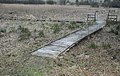
 Boardwalk (Field Studies Centre end) - geograph.org.uk - 5029672.jpg 5,152 × 3,864; 7.61 MB
-

-
 Boardwalk in nature reserve - geograph.org.uk - 6377779.jpg 4,032 × 3,024; 4.58 MB
-
 Boardwalk into Tarn Moss Nature Reserve - geograph.org.uk - 1095703.jpg 640 × 404; 118 KB
-
 Boat house on north shore of Malham Tarn - geograph.org.uk - 6534301.jpg 2,000 × 1,096; 2.28 MB
-
 Boat house west of Malham Tarn House - geograph.org.uk - 2628460.jpg 1,024 × 768; 402 KB
-
 Boat house, Malham Tarn - geograph.org.uk - 4959804.jpg 5,152 × 3,864; 7.66 MB
-
 Boathouse on Malham tarn. - geograph.org.uk - 3967608.jpg 640 × 381; 37 KB
-
 Boggy ground - geograph.org.uk - 5661216.jpg 1,024 × 768; 177 KB
-
 Boggy valley to the west of Malham Tarn - geograph.org.uk - 5476115.jpg 4,320 × 3,240; 3.44 MB
-
 Boulder in grass field NW of Higher Trenhouse - geograph.org.uk - 5721856.jpg 1,024 × 683; 259 KB
-
 Boulder, and wall at the edge of the moor, Knowe Fell - geograph.org.uk - 4616658.jpg 1,995 × 1,464; 852 KB
-
 Boulders on Great Close - geograph.org.uk - 2710138.jpg 4,320 × 3,240; 3.85 MB
-
 Boundary Stone - geograph.org.uk - 847114.jpg 640 × 480; 148 KB
-
 Boundary Stone, Lee Gate High Pasture - geograph.org.uk - 4453512.jpg 640 × 480; 107 KB
-
 Boundary Wall above Scab Hill - geograph.org.uk - 2710159.jpg 4,320 × 3,240; 3.47 MB
-
 Branch of Thoragill Beck above the road - geograph.org.uk - 2627206.jpg 1,024 × 768; 208 KB
-
 Bridge over Thoragill Beck - geograph.org.uk - 2654376.jpg 1,500 × 1,000; 203 KB
-
 Bridleway across Malham Moor - geograph.org.uk - 2308154.jpg 640 × 426; 424 KB
-
 Bridleway descending towards Gordale Beck - geograph.org.uk - 3562137.jpg 1,600 × 1,200; 493 KB
-
 Bridleway gate above Henside - geograph.org.uk - 3177667.jpg 2,048 × 1,536; 587 KB
-
 Bridleway near Clapham High Mark - geograph.org.uk - 3561626.jpg 1,600 × 1,200; 454 KB
-
 Bridleway on the Flanks of Knowe Fell - geograph.org.uk - 2451902.jpg 4,320 × 3,240; 3.85 MB
-
 Bridleway to Tennant Gill - geograph.org.uk - 3640074.jpg 1,024 × 682; 186 KB
-
 Bridleway towards Bordley, north of Lee Gate - geograph.org.uk - 3343591.jpg 2,048 × 1,536; 610 KB
-
 Bridleway towards Malham Tarn - geograph.org.uk - 5476129.jpg 3,240 × 4,320; 3.23 MB
-
 Bridleway towards Tennant Gill - geograph.org.uk - 2308211.jpg 640 × 426; 363 KB
-
 Broken Wall on Knowe Fell - geograph.org.uk - 2452269.jpg 4,320 × 3,240; 3.92 MB
-
 Broken Walls above Far Fell - geograph.org.uk - 2452283.jpg 4,320 × 3,240; 3.21 MB
-
 Buildings at Darnbrook Farm - geograph.org.uk - 4081407.jpg 1,600 × 1,064; 830 KB
-
 Buildings at Darnbrook Farm - geograph.org.uk - 4081421.jpg 1,600 × 1,064; 664 KB
-
 Buildings at Home Farm - geograph.org.uk - 6483729.jpg 1,024 × 683; 171 KB
-
 Buildings at Middle House Farm - geograph.org.uk - 6535183.jpg 2,000 × 1,219; 1.77 MB
-
 Cairn near Fountains Fell. - geograph.org.uk - 262192.jpg 640 × 480; 89 KB
-
 Cairns and old working on Fountains Fell - geograph.org.uk - 3177656.jpg 2,048 × 1,536; 680 KB
-
 Cairns on Fountains fell. - geograph.org.uk - 3918164.jpg 640 × 398; 51 KB
-
 Capon Hall - geograph.org.uk - 2450548.jpg 4,320 × 3,240; 3.08 MB
-
 Capon Hall - geograph.org.uk - 3058460.jpg 3,872 × 2,592; 4.42 MB
-
 Capon Hall - geograph.org.uk - 3450150.jpg 1,600 × 1,200; 399 KB
-
 Capon Hall - geograph.org.uk - 3640098.jpg 1,024 × 682; 213 KB
-
 Capon Hall - geograph.org.uk - 5091483.jpg 5,096 × 2,953; 1.72 MB
-
 Capon Hall - geograph.org.uk - 5091485.jpg 4,396 × 2,062; 1.95 MB
-
 Capon Hall - geograph.org.uk - 5092414.jpg 5,184 × 2,264; 1.76 MB
-
 Capon Hall - geograph.org.uk - 5223664.jpg 1,600 × 960; 642 KB
-
 Capon Hall - geograph.org.uk - 5243921.jpg 640 × 428; 52 KB
-
 Capon Hall - geograph.org.uk - 6188844.jpg 1,024 × 683; 558 KB
-
 Capon Hall from Black Hall - geograph.org.uk - 3730345.jpg 640 × 564; 100 KB
-
 Cattle alongside Mastiles Lane - geograph.org.uk - 6188727.jpg 1,024 × 683; 452 KB
-
 Cattle and hay making - geograph.org.uk - 6188759.jpg 1,024 × 683; 500 KB
-
 Cattle grid - geograph.org.uk - 3730349.jpg 640 × 480; 89 KB
-
 Cattle Grid at Dale Head - geograph.org.uk - 5504862.jpg 1,024 × 768; 530 KB
-
 Cattle grid at Stangill Barn - geograph.org.uk - 2308220.jpg 640 × 426; 226 KB
-
 Cattle grid near Chapel Fell - geograph.org.uk - 4081502.jpg 1,600 × 1,064; 515 KB
-
 Cattle grid near Low Trenhouse - geograph.org.uk - 5223644.jpg 1,600 × 800; 452 KB
-
 Cattle grid near Thoragill Beck Pasture - geograph.org.uk - 4081493.jpg 1,600 × 1,064; 608 KB
-
 Cattle grid near Washing Close - geograph.org.uk - 4081497.jpg 1,600 × 1,064; 691 KB
-
 Cattle grid on Cove Road towards Malham - geograph.org.uk - 4081522.jpg 1,600 × 1,175; 562 KB
-
 Cattle grid on Henside Road - geograph.org.uk - 6188873.jpg 1,024 × 683; 509 KB
-
 Cattle grid on road west of Malham Tarn - geograph.org.uk - 5223661.jpg 1,600 × 960; 620 KB
-
 Cattle near Dale Head - geograph.org.uk - 6189094.jpg 1,024 × 683; 467 KB
-
 Cattlegrid at Dale Head - geograph.org.uk - 6188906.jpg 1,024 × 683; 435 KB
-
 Chimney - geograph.org.uk - 1991041.jpg 640 × 480; 96 KB
-
 Clapham High Mark - geograph.org.uk - 4074469.jpg 2,494 × 1,830; 3.24 MB
-
 Clapper bridge over Cowside Beck - geograph.org.uk - 2083531.jpg 2,592 × 1,944; 1.72 MB
-
 Coke oven, Fountains Fell - geograph.org.uk - 6511338.jpg 1,024 × 683; 232 KB
-
 Comb Hill - geograph.org.uk - 5091513.jpg 5,184 × 3,315; 1.67 MB
-
 Comb Scar - geograph.org.uk - 4572887.jpg 640 × 426; 114 KB
-
 Comb Scar - geograph.org.uk - 4572898.jpg 640 × 426; 119 KB
-
 Coming up from Calton Moor - geograph.org.uk - 1745006.jpg 640 × 427; 303 KB
-
 Converted barn near Capon Hall - geograph.org.uk - 2625380.jpg 1,024 × 768; 196 KB
-
 Corner on the Pennine Way - geograph.org.uk - 5507569.jpg 640 × 480; 66 KB
-
 Cottages in the Malham Tarn Estate - geograph.org.uk - 3049917.jpg 3,872 × 2,592; 4.77 MB
-
 Cotton Grass on Turf Hill - geograph.org.uk - 2452298.jpg 4,320 × 3,240; 3.96 MB
-
 Countryside postbox - geograph.org.uk - 3679237.jpg 1,000 × 750; 281 KB
-
 Cove Road - geograph.org.uk - 4530994.jpg 1,600 × 1,200; 263 KB
-
 Cove Road - geograph.org.uk - 5092433.jpg 5,063 × 3,345; 1.89 MB
-
 Cove Road crossroads - geograph.org.uk - 6188836.jpg 1,024 × 683; 464 KB
-
 Cove Road towards Malham - geograph.org.uk - 4081518.jpg 1,600 × 1,064; 473 KB
-
 Cow Gill Cote - geograph.org.uk - 2071811.jpg 4,592 × 3,056; 3.7 MB
-
 Cow Pasture - geograph.org.uk - 3640114.jpg 1,024 × 682; 200 KB
-
 Cow Pasture at Malham Tarn - geograph.org.uk - 4572945.jpg 3,648 × 2,736; 4.74 MB
-
 Cow Pasture to Chapel Fell - geograph.org.uk - 4572952.jpg 3,648 × 2,736; 4.77 MB
-
 Cow Side - geograph.org.uk - 5093029.jpg 3,627 × 1,455; 1.91 MB
-
 Cows in the woods - geograph.org.uk - 3058961.jpg 3,872 × 2,592; 5.95 MB
-
 Cows on Torlery Edge - geograph.org.uk - 5661213.jpg 1,024 × 768; 172 KB
-
 Cowside Beck valley after a day of rain - geograph.org.uk - 2202347.jpg 1,024 × 681; 101 KB
-
 Cowside Beck valley, from Flask - geograph.org.uk - 2203503.jpg 1,024 × 681; 118 KB
-

-
 Crossroads at Streets - geograph.org.uk - 2625349.jpg 1,024 × 768; 180 KB
-
 Crossroads at Streets - geograph.org.uk - 2654328.jpg 1,500 × 1,000; 100 KB
-
 Culvert under the Pennine Way - geograph.org.uk - 2308219.jpg 640 × 426; 422 KB
-
 Cut Bench Mark, Malham Tarn House - geograph.org.uk - 3639953.jpg 1,024 × 682; 304 KB
-
 Cyclists approaching the top of Pen-y-Ghent Gill - geograph.org.uk - 6280748.jpg 1,024 × 768; 154 KB
-
 Dale Head - geograph.org.uk - 4483155.jpg 640 × 428; 89 KB
-
 Dale Head - geograph.org.uk - 6189093.jpg 1,024 × 683; 417 KB
-
 Danebrook Barn - geograph.org.uk - 2657016.jpg 1,500 × 988; 193 KB
-
 Darnbrook Beck - geograph.org.uk - 2976393.jpg 4,320 × 3,240; 5.96 MB
-
 Darnbrook Cottage - geograph.org.uk - 5239881.jpg 1,024 × 683; 303 KB
-

-
 Darnbrook plantation. - geograph.org.uk - 3918170.jpg 640 × 376; 64 KB
-
 Dean Moor - geograph.org.uk - 1896509.jpg 4,592 × 3,056; 6.25 MB
-
 Dean Moor - geograph.org.uk - 4572937.jpg 3,648 × 2,736; 4.7 MB
-
 Dean Moor Hill - geograph.org.uk - 5092413.jpg 5,183 × 2,920; 1.73 MB
-
 Depression next to Middle House Hill - geograph.org.uk - 2942223.jpg 3,872 × 2,592; 5.51 MB
-
 Descent to Great Close - geograph.org.uk - 2951655.jpg 3,872 × 2,592; 4.62 MB
-
 Distressed Stone Wall on Freer Hood - geograph.org.uk - 2976354.jpg 4,320 × 3,240; 4.83 MB
-
 Disused Quarry - geograph.org.uk - 3679218.jpg 1,000 × 750; 207 KB
-
 Disused Quarry off Henside Road - geograph.org.uk - 2451894.jpg 4,320 × 3,240; 3.49 MB
-
 Down Henside Road - geograph.org.uk - 6188863.jpg 1,024 × 683; 542 KB
-
 Driveway to Malham Tarn House - geograph.org.uk - 5414401.jpg 480 × 640; 367 KB
-
 Driveway to Rough Close, Malham Moor - geograph.org.uk - 4614825.jpg 2,048 × 1,536; 777 KB
-

-
 Dry Stone Wall - geograph.org.uk - 4415120.jpg 640 × 427; 505 KB
-
 Dry stone wall and Westside House - geograph.org.uk - 3058293.jpg 3,872 × 2,592; 5.1 MB
-
 Dry stone wall at Darnbrook Cowside - geograph.org.uk - 2083575.jpg 2,592 × 1,944; 1.63 MB
-
 Dry stone wall beside rural road - geograph.org.uk - 5721838.jpg 1,024 × 683; 331 KB
-
 Dry stone wall near Dew Bottoms - geograph.org.uk - 2943823.jpg 3,872 × 2,592; 4.99 MB
-
 Dry stone wall north of Dean Moor Hill - geograph.org.uk - 6107059.jpg 1,600 × 998; 500 KB
-
 Dry stone wall over stream - geograph.org.uk - 5914342.jpg 5,315 × 3,517; 4.78 MB
-
 Dry stone wall with stream - geograph.org.uk - 6427451.jpg 533 × 800; 136 KB
-
 Dry Stone Wall, Out Pasture - geograph.org.uk - 4416003.jpg 427 × 640; 533 KB
-
 Dry Stone Wall, Stangill Fell - geograph.org.uk - 3639977.jpg 1,024 × 682; 202 KB
-
 Dry stone walling - geograph.org.uk - 4149627.jpg 4,000 × 3,000; 6.56 MB
-
 Dry Valley - geograph.org.uk - 4752481.jpg 4,000 × 3,000; 5.04 MB
-
 Dry Valley at Comb Scar - geograph.org.uk - 4752499.jpg 4,000 × 3,000; 4.98 MB
-
 Dry Valley at Ing Scar and Watlowes - geograph.org.uk - 4752507.jpg 4,000 × 3,000; 4.97 MB
-
 Dry Valley below the Water Sink - geograph.org.uk - 4572871.jpg 640 × 426; 61 KB
-
 Dry Valley below the Water Sink - geograph.org.uk - 4572874.jpg 640 × 426; 71 KB
-
 Dry Valley below the Water Sink - geograph.org.uk - 4572884.jpg 640 × 426; 60 KB
-
 Dry Valley below Water Sinks - geograph.org.uk - 4752455.jpg 4,000 × 3,000; 5.15 MB
-
 Dry valley south of Water Sinks - geograph.org.uk - 6309956.jpg 6,000 × 4,000; 5.91 MB
-
 Dry waterfall, Watlowes Dry Valley - geograph.org.uk - 4572908.jpg 640 × 426; 134 KB
-
 Dry waterfall, Watlowes Dry Valley - geograph.org.uk - 4572910.jpg 640 × 426; 121 KB
-
 Dyke, Fountains Fell - geograph.org.uk - 6511318.jpg 1,024 × 686; 227 KB
-
 East Great Close - geograph.org.uk - 1896405.jpg 4,592 × 3,056; 3.51 MB
-

-
 Empty pasture near Mastiles - geograph.org.uk - 5507602.jpg 640 × 480; 54 KB
-
 Enclosed trees on Great Close Hill - geograph.org.uk - 471167.jpg 640 × 480; 65 KB
-
 Entrance to Malham Tarn Estate - geograph.org.uk - 4081503.jpg 1,600 × 1,064; 744 KB
-
 Entrance to National Trust at Malham Tarn - geograph.org.uk - 2219359.jpg 1,600 × 1,198; 474 KB
-
 Estate houses near Home Farm, Water Houses - geograph.org.uk - 2628487.jpg 1,024 × 768; 231 KB
-
 Ewes And Lambs - geograph.org.uk - 4080535.jpg 2,410 × 1,351; 2.75 MB
-
 Extensive grazing land south of Malham Tarn - geograph.org.uk - 6107054.jpg 1,600 × 995; 473 KB


_-_geograph.org.uk_-_5029672.jpg)


