Category:Floor plans of fortresses
Jump to navigation
Jump to search
Subcategories
This category has the following 9 subcategories, out of 9 total.
Media in category "Floor plans of fortresses"
The following 200 files are in this category, out of 283 total.
(previous page) (next page)-
"A New and Accurate Plan of the town of St. Augustine" (9126561850).jpg 2,500 × 953; 3.48 MB
-
Vestingwerken schema.svg 1,024 × 1,100; 585 KB
-
10-07 Heenvliet Bleydestein plattegrond 14e eeuw.jpg 2,453 × 2,672; 1.84 MB
-
6485 - Fürigen - Festung Fürigen - Entry Map.JPG 3,648 × 2,736; 2.23 MB
-
A north view of Fort Frederic or Crown Point (NYPL NYPG94-F42-419804).jpg 4,013 × 3,264; 3.89 MB
-
Accespunt.gif 497 × 308; 230 KB
-
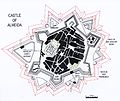
Almeida fortress.jpg 7,690 × 6,467; 4.62 MB
-
Angled bastions in Xifa Shenji.png 3,066 × 4,000; 683 KB
-
Antverpia 308.jpg 1,106 × 803; 166 KB
-
Bastion i przeciwstraż.PNG 582 × 409; 13 KB
-
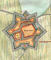
Bastion van grol.jpg 671 × 147; 78 KB
-
Bastioni, no language.png 700 × 483; 116 KB
-
Bastioni.png 948 × 483; 109 KB
-
Bastioni.svg 546 × 278; 142 KB
-
Bastions-2.jpg 1,018 × 634; 139 KB
-
Bastions.png 1,018 × 634; 72 KB
-
Bastions.svg 800 × 498; 51 KB
-
Bhangarh Guide Map.jpg 3,488 × 3,488; 3.26 MB
-
Bhangarh rajasthan.jpg 1,200 × 1,600; 607 KB
-
BhangarhGuideMap.jpg 1,200 × 900; 291 KB
-
Bolwark.png 640 × 480; 230 KB
-
Bolwerk rondeel bastei.png 1,012 × 628; 553 KB
-
Bolwerk rondeel bastei.svg 798 × 498; 20 KB
-
Bolwerk-rondeel.png 1,016 × 524; 19 KB
-
Bolwerk-rondeel.svg 988 × 524; 22 KB
-
Bredevoort 1711-1732.png 882 × 1,260; 2.54 MB
-
Bredevoort 1750.png 790 × 646; 487 KB
-
Bredevoort 1760 recontruction.png 1,012 × 602; 58 KB
-
Bredevoort 1800 plan.JPG 3,264 × 2,448; 2.49 MB
-
Bredevoort vestingwerken.jpg 1,465 × 1,079; 2.44 MB
-
Bredevoort1600.jpg 446 × 526; 49 KB
-
Breevoorde JVD Bredevoort.jpg 500 × 500; 124 KB
-
Brockhaus and Efron Encyclopedic Dictionary b32 897-0.jpg 1,089 × 1,086; 275 KB
-
Brockhaus and Efron Encyclopedic Dictionary b81 076-1.jpg 548 × 251; 37 KB
-
Brockhaus and Efron Encyclopedic Dictionary b81 076-2.jpg 543 × 258; 39 KB
-
Brockhaus and Efron Encyclopedic Dictionary b81 076-3.jpg 449 × 262; 39 KB
-
Brockhaus and Efron Encyclopedic Dictionary b81 077-1.jpg 575 × 776; 83 KB
-
Brockhaus and Efron Encyclopedic Dictionary b81 077-2.jpg 535 × 522; 73 KB
-
Brücktor1.jpg 1,536 × 1,418; 251 KB
-
Bulwark1 (PSF).png 430 × 186; 31 KB
-
BurchtTiryns.jpg 973 × 2,610; 240 KB
-
BureCampPlan.jpg 1,024 × 497; 57 KB
-
C+B-Fortress-Fig1-HazorRuinsPlanAndIllustration.PNG 400 × 440; 45 KB
-
Canea in Candia - Sandrart Jacob Von - 1687.jpg 1,500 × 889; 933 KB
-
Castello Estense, Ferrara 2014 139.jpg 5,184 × 3,456; 4.53 MB
-
Castellum de Sainte-Ode selon Adrien Hock 1897.jpg 473 × 749; 70 KB
-
Coevorden.jpg 1,000 × 903; 200 KB
-
Coffre de Contrescarpe.jpg 774 × 542; 37 KB
-
Coffre-contrescarpe.svg 2,105 × 1,488; 6.79 MB
-
Cormontei bastion.jpg 428 × 317; 78 KB
-
Corona imperiale dell' architettura militare (1618) (14781814961).jpg 2,298 × 2,704; 1.23 MB
-
Couvre face contregarde.png 1,014 × 410; 17 KB
-
Couvre face contregarde.svg 1,014 × 410; 18 KB
-
Curupayty trench.png 419 × 205; 131 KB
-
Daugavgriva1601.jpg 800 × 551; 185 KB
-
Defensielijnen.png 1,018 × 600; 111 KB
-
Denah Fort Tabanio.jpg 1,280 × 810; 122 KB
-
Embrasure zool.png 1,018 × 600; 112 KB
-
Embrasure-zool.svg 700 × 475; 76 KB
-
Encyclopédie méthodique - Art militaire, T7, Pl1.png 2,598 × 3,300; 2.46 MB
-
Evolusie van motte noar stad.jpg 640 × 640; 60 KB
-
Festung.png 206 × 197; 22 KB
-
FestungSkizze.gif 1,175 × 510; 17 KB
-
Festungsquerschnitt.gif 570 × 355; 5 KB
-
Finnish Foxhole.PNG 343 × 482; 50 KB
-
Fort barraux Ercole Negro.gif 800 × 584; 367 KB
-
Fort Frederick (plan). (3990715756).jpg 760 × 608; 91 KB
-
Fort Frontenac 1750.jpg 705 × 518; 66 KB
-
Fort mit Kehlkoffer.PNG 952 × 604; 52 KB
-
Fort Monckton Plan 1892.jpg 2,112 × 988; 205 KB
-
Fort Wagner.png 699 × 471; 660 KB
-
Fortbourtange.jpg 548 × 407; 21 KB
-
Fortifikationsmodell - Skoklosters slott - 93155.tif 3,270 × 2,628; 24.61 MB
-
Fortifikationsmodell - Skoklosters slott - 93157.tif 2,922 × 2,892; 24.2 MB
-
Fortifikationsmodell - Skoklosters slott - 93158.tif 2,736 × 2,832; 22.19 MB
-
Fortifikationsmodell - Skoklosters slott - 93159.tif 2,898 × 2,334; 19.38 MB
-
Fortifikationsmodell - Skoklosters slott - 93164.tif 3,474 × 3,168; 31.51 MB
-
Fortress of Almeida.jpg 2,393 × 1,880; 529 KB
-
Fortress of Brum in Pernambuco WDL1034.png 1,145 × 1,024; 1.63 MB
-
Fortress of Concepcion-Layout1.png 2,401 × 3,151; 137 KB
-
Fortress of Concepcion.jpg 2,401 × 3,151; 578 KB
-
Fortune chain boom.png 552 × 272; 265 KB
-
Fotothek df tg 0000034 Stadt ^ Festung.jpg 800 × 695; 298 KB
-
Fotothek df tg 0000036 Stadt ^ Festung.jpg 800 × 700; 273 KB
-
Fotothek df tg 0000242 Geometrie ^ Architektur ^ Festungsbau.jpg 800 × 509; 170 KB
-
Fotothek df tg 0001875 Architektur ^ Festungsbau.jpg 800 × 588; 189 KB
-
Fotothek df tg 0001884 Architektur ^ Festungsbau.jpg 800 × 423; 154 KB
-
Fotothek df tg 0003941 Architektur ^ Festungsbau.jpg 800 × 541; 156 KB
-
Fotothek df tg 0003945 Architektur ^ Festungsbau.jpg 800 × 546; 230 KB
-
Fotothek df tg 0006354 Architektur ^ Festungsbau ^ Wehranlage.jpg 488 × 820; 197 KB
-
Fotothek df tg 0006910 Festungsbau ^ Fort.jpg 800 × 645; 216 KB
-
Grabenstreiche.PNG 952 × 604; 19 KB
-
Grabenstreiche1.PNG 952 × 604; 39 KB
-
Grondplan citadel Lille.JPG 2,560 × 1,920; 1.98 MB
-
Ground plan of ohaeawai.jpg 810 × 516; 90 KB
-
Groundplan of Te Rangihaeata's pa Pauatahanui Inlet 1846.jpg 810 × 424; 63 KB
-
Grundplanskizze Burgstelle Wildberg.png 732 × 335; 587 KB
-
Grundskizze Radegg.jpg 536 × 319; 125 KB
-
Hoornwerk svg.svg 1,020 × 632; 20 KB
-
Hornwerk.png 312 × 319; 104 KB
-
Illustrirte Zeitung (1843) 13 199 2 Verlängerung der Facen.png 408 × 188; 33 KB
-
Illustrirte Zeitung (1843) 13 200 1 Aufstellung der Geschütze.png 397 × 114; 46 KB
-
Illustrirte Zeitung (1843) 17 262 1 Außenwerk.PNG 306 × 222; 26 KB
-
Illustrirte Zeitung (1843) 17 262 2 Kronwerk.PNG 517 × 385; 64 KB
-
Illustrirte Zeitung (1843) 17 263 2 Casematte.PNG 278 × 138; 13 KB
-
Illustrirte Zeitung (1843) 17 263 5 Cavalier.PNG 645 × 169; 33 KB
-
Illustrirte Zeitung (1843) 18 275 1 Tetragon.PNG 328 × 278; 36 KB
-
Illustrirte Zeitung (1843) 18 275 2 Hexagon.PNG 377 × 389; 59 KB
-
Illustrirte Zeitung (1843) 18 275 3 Pentagon.PNG 514 × 476; 62 KB
-
Illustrirte Zeitung (1843) 19 299 2 abgerundete Contrescarpe.PNG 861 × 416; 102 KB
-
Italiaans stelsel.png 1,014 × 622; 13 KB
-
Karnakoski pohjapiirros.png 1,218 × 1,486; 414 KB
-
Kasteel elementen.png 1,000 × 600; 66 KB
-
Kastellet rampart pano, Copenhagen.jpg 13,112 × 2,429; 14.99 MB
-
Kloosterschans bredevoort.jpg 1,000 × 600; 274 KB
-
Krak des chevaliers - plan.jpg 990 × 615; 652 KB
-
Kroonwerk.png 1,020 × 632; 22 KB
-
Kuhorn.jpg 428 × 406; 103 KB
-
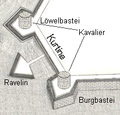
Kurtine.gif 800 × 495; 330 KB
-
Lageplay Veste Otzberg2.jpg 1,375 × 1,710; 406 KB
-
Lambert-van-den-Bos-Schauplatz-des-Krieges MG 9501.tif 5,292 × 3,288; 49.82 MB
-
Loviisan linnoitus pohjapiirros.png 1,115 × 1,500; 142 KB
-
Lunetten.png 916 × 614; 21 KB
-
Manesson-Travaux-de-Mars 9554.tif 3,344 × 5,072; 48.56 MB
-
Manesson-Travaux-de-Mars 9596.tif 3,392 × 5,272; 51.2 MB
-
Manesson-Travaux-de-Mars 9715.tif 3,424 × 5,320; 52.15 MB
-
Manesson-Travaux-de-Mars 9730.tif 3,480 × 5,488; 54.67 MB
-
Manesson-Travaux-de-Mars 9924.tif 3,436 × 5,160; 50.76 MB
-
Map of Bredevoort, Netherlands 1684.jpg 378 × 327; 73 KB
-
Map of Geneva in 1841.jpg 1,306 × 1,024; 1.01 MB
-
Maquette Oud-Italiaans stelsel.jpg 1,745 × 1,360; 441 KB
-
Map of Masada.svg 1,292 × 675; 392 KB
-
Masada (Conder 01).jpg 1,248 × 743; 477 KB
-
Masada (Conder 02).jpg 934 × 1,203; 719 KB
-
Masada (Tristram).jpg 2,000 × 1,100; 573 KB
-
Meyers b5 s1007 b1.png 112 × 68; 839 bytes
-
Meyers b6 s0106 b1.png 348 × 78; 2 KB
-
Meyers b6 s0106 b2.png 348 × 78; 2 KB
-
Meyers b6 s0107 b1.png 724 × 171; 7 KB
-
Meyers b6 s0180 b1.png 379 × 106; 9 KB
-
Meyers b6 s0180 b2.png 381 × 192; 16 KB
-
Meyers b6 s0181 b1.png 418 × 310; 35 KB
-
Meyers b6 s0181 b2.png 731 × 93; 7 KB
-
Meyers b6 s0182 b1.png 299 × 119; 5 KB
-
Meyers b6 s0182 b2.png 381 × 212; 18 KB
-
Meyers b6 s0182 b3.png 330 × 200; 11 KB
-
Misterpoort bredevoort reconstructie.png 2,000 × 1,216; 1.01 MB
-
Misterpoort-ravelijn.gif 1,016 × 486; 49 KB
-
Muxrani castle plan uk.svg 465 × 577; 37 KB
-
Muxrani castle plan.svg 465 × 577; 35 KB
-
Nagysurány vár.gif 1,106 × 915; 211 KB
-
Neuitalienische Manier.png 366 × 179; 27 KB
-
Nimrod-fortress-schema.JPG 800 × 345; 18 KB
-
Nomenclatura Fortificazione alla moderna.jpg 631 × 643; 98 KB
-
Novotalijanska bastionska škola - razvijeni bastionski front.jpg 372 × 208; 58 KB
-
Old Riga.jpg 502 × 421; 193 KB
-
Olomouc map 1757.jpg 640 × 604; 362 KB
-
Opril in bastion.png 960 × 640; 30 KB
-
Opril.svg 1,271 × 745; 10 KB
-
Papenmuts2.png 1,020 × 632; 17 KB
-
PikiWiki Israel 47151 Patish Fortress.JPG 4,608 × 3,456; 3.89 MB
-
Perspective cavaliere fortification.jpg 742 × 361; 76 KB
-
Pl fortim vc do itapema sec xviii.jpg 550 × 682; 72 KB
-
Plan de la forteresse de Castel-Cran.jpg 427 × 655; 291 KB
-
Plan du château de Kergounadeach.jpg 456 × 318; 32 KB
-
Plan Fort Barrancas.png 952 × 604; 196 KB
-
Plan fort Dabou.jpg 737 × 800; 87 KB


