Category:Floor plans of castles
Jump to navigation
Jump to search
This category contains floor plans. A floor plan is a drawing, usually to scale, of the relationships between rooms, spaces and other physical features at one level of a structure.
For other architectural drawings like elevations and sections please use the right subcategories of Category:Architectural drawings by type. See also:
- Category:Castles for photos
- Category:Palace drawings and Category:Palaces
Subcategories
This category has the following 4 subcategories, out of 4 total.
?
F
T
Media in category "Floor plans of castles"
The following 68 files are in this category, out of 68 total.
-
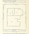
133 of 'Somma Lombardo- storia, descrizione e illustrazioni' (11275397006).jpg 852 × 1,736; 177 KB
-
177 of 'Chinon et ses environs ... Préface par G. d'Espinay' (11248951623).jpg 3,056 × 1,493; 418 KB
-
20230830.Burgruine Kirchschlag.-010.jpg 9,248 × 6,936; 18.76 MB
-
222 of 'The History of the County of Monaghan' (11132969645).jpg 1,798 × 1,991; 533 KB
-
Araburg 9730.jpg 2,112 × 3,187; 2.33 MB
-
BabakaleCastlePlan.png 605 × 445; 10 KB
-
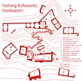
Buffavento.jpg 2,357 × 2,308; 2.05 MB
-
Castel di Somlo-Marsigli.jpg 2,000 × 1,331; 415 KB
-
Château de Pierrefonds - plan.png 2,018 × 1,198; 1.83 MB
-
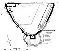
Ground Plan of Kenilworth Castle (combined) (11222653716).png 1,851 × 2,388; 3.04 MB
-
Ground-plan of the fortress of Lendva, 19th century.jpg 1,314 × 1,237; 1.38 MB
-
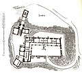
Grundriss Schloss Clerf.jpg 1,301 × 1,331; 196 KB
-
Grundriss Schloss Gross-Roop.jpg 1,590 × 1,096; 308 KB
-
Haapsalu linnuse asendiplaan.jpg 1,995 × 1,543; 544 KB
-
Hammershus grundplan jth.jpg 500 × 693; 419 KB
-
Hofwijck garden-plans drawing.png 1,001 × 760; 759 KB
-
Kasteel Batavia 1762.jpg 401 × 535; 106 KB
-
Kaart Bouillancourt-sous-Mianny 1800-2023.gif 500 × 574; 1.1 MB
-
Kantara Grundriss.jpg 3,311 × 2,131; 1.52 MB
-
Kastell Szentendre Grundriß.png 3,307 × 3,351; 560 KB
-
Kenilworth Castle - Ground Plan lower part (11222653716).jpg 2,080 × 1,350; 297 KB
-
Kulat.png 1,334 × 936; 549 KB
-
Lageplan Schloss Bloemendal.svg 3,657 × 3,636; 101 KB
-
Limassol Castle, ground plan 1918.jpg 755 × 571; 306 KB
-
Louňovice (půdorys, A. Martínek 1911).png 888 × 888; 181 KB
-
117314 a model of the crusader fortress chateau de rois PikiWiki Israel.jpg 4,032 × 3,024; 2.14 MB
-
Norwich Castle keep plan by William Wilkins.jpg 748 × 590; 131 KB
-
Norwich Castle Musem Plan.jpg 598 × 734; 142 KB
-
Norwich Castle, Wilkins plan (pub.1796).png 966 × 785; 359 KB
-
Othello Castle Famagusta 1918.jpg 758 × 575; 300 KB
-
Plan av Uranienborgs område.PNG 383 × 385; 32 KB
-
Plan d'un logis.jpg 190 × 180; 23 KB
-
Plan du Krak des Chevalier 1170 1180.png 1,268 × 1,556; 44 KB
-
Plan of the fortress of Lendva, 1769.jpg 1,340 × 1,186; 989 KB
-
Planritning över bottenvåning, Löfstad slott, 1600-tal - Skoklosters slott - 98973.tif 3,917 × 3,299, 2 pages; 36.99 MB
-
Richmond Castle plan, Clark.jpg 726 × 625; 162 KB
-
Ritning, 1600-tal - Skoklosters slott - 98982.tif 3,250 × 4,616, 2 pages; 42.95 MB
-
Ritning, 1600-tal - Skoklosters slott - 98983.tif 4,382 × 3,289, 2 pages; 41.26 MB
-
Ritning, 1600-tal - Skoklosters slott - 98985.tif 4,981 × 3,304, 2 pages; 47.11 MB
-
Rosenholm grundplan.jpg 1,627 × 1,568; 240 KB
-
Skizze Kastell Klosterneuburg.jpg 1,460 × 1,600; 277 KB
-
Steinvikholm 3.png 2,178 × 2,184; 2.9 MB
-
Steinvikholm kart.png 2,088 × 2,020; 2.45 MB
-
StHilarion-Grundriss.jpg 2,287 × 1,955; 1.4 MB
-
SøborgSlot-grundplan.png 800 × 776; 358 KB
-
Trogir scheme.jpg 886 × 886; 161 KB
-
Čazma u 17. st.png 2,192 × 1,600; 247 KB
-
Ərk qalasının planı.jpg 294 × 363; 32 KB
-
План дворца Каср Аль-Хейр Аль-Гарби.gif 451 × 400; 7 KB
-
مسقط لعقدة الجريسي.jpg 2,304 × 2,547; 2.62 MB


