Category:English-language maps of the United States
Jump to navigation
Jump to search
Countries of the Americas: Argentina · Belize · Bolivia · Brazil · Canada · Chile · Colombia · Costa Rica · Cuba · Dominican Republic · Guatemala · Guyana · Haiti · Honduras · Jamaica · Mexico · Nicaragua · Peru · United States · Uruguay · Venezuela
Other areas: French Guiana · Greenland · Guadeloupe
Other areas: French Guiana · Greenland · Guadeloupe
Subcategories
This category has the following 8 subcategories, out of 8 total.
C
E
Media in category "English-language maps of the United States"
The following 200 files are in this category, out of 235 total.
(previous page) (next page)-
(United States-including cities and administrative divisions) 4-75. LOC 76695655.jpg 11,048 × 9,049; 11.32 MB
-
1676 John Speed Map of Carolina - Geographicus - Carolina-speed-1676.jpg 5,000 × 3,783; 5.23 MB
-
1823 Melish Map of the United States of America - Geographicus - USA-melish-1822.jpg 3,500 × 2,749; 2.43 MB
-
1835 Webster Map of the United States - Geographicus - UnitedStates-webster-1835.jpg 4,000 × 3,330; 4.34 MB
-
1843 Gilbert Map of the United States - Geographicus - UnitedStates-gilbert-1843.jpg 2,000 × 2,459; 1.5 MB
-
1936 National Forests Map (27442970472).jpg 11,066 × 6,045; 15.47 MB
-
2020 Census - Majority-Indigenous Counties in the United States.png 7,000 × 4,000; 3.59 MB
-
2020 Census - U.S. Counties with significant Asian American populations.png 7,000 × 4,000; 3.61 MB
-
20220816 United States drought conditions.png 3,300 × 2,550; 392 KB
-
2023 soccer map.png 1,601 × 991; 599 KB
-
A map of the United States of North America LOC 2015588795.jpg 17,760 × 15,153; 34.51 MB
-
Abortion Laws by US State.png 1,182 × 796; 152 KB
-
Age restrictions on tattooing in the United States by State.png 5,000 × 3,500; 1.56 MB
-
Air line distances map United States - btv1b531895340.jpg 12,088 × 8,642; 12.18 MB
-
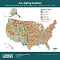
An Aging Nation - Change In Median Age by County - July 1, 2020, to July 1, 2021.jpg 1,080 × 1,080; 239 KB
-
ARPA1974english.JPG 813 × 472; 45 KB
-
Clason's guide map of the United States. LOC 2006626007.jpg 11,428 × 7,198; 13.03 MB
-
Colored Contoured Surface Map of the United States - NARA - 122206707.jpg 9,934 × 6,980; 10.53 MB
-
Cooperative economic insect report (1968) (20669949236).jpg 3,308 × 1,880; 934 KB
-
County population map.webp 2,066 × 1,369; 290 KB
-
Descriptive Map of Army Posts - NARA - 77452232.jpg 12,772 × 8,180; 17.07 MB
-
Dissected map of the United States. LOC 85697800.jpg 9,592 × 5,051; 6.72 MB
-
Distance map United States, Mexico and Canada. LOC 2006627699.jpg 10,264 × 6,424; 6.66 MB
-
Distribution of Americans claiming Polish Ancestry by county in 2018.png 6,900 × 4,275; 2.62 MB
-
Elementary physical geography; (1908) (14781420791).jpg 2,560 × 1,652; 889 KB
-
ERIC states as of 3-6-2023.png 4,384 × 2,963; 1.03 MB
-
Farm land, value of products, and tenancy in the southeast LOC 88691852.jpg 8,276 × 9,955; 8.67 MB
-
Forest cover map (28192734909).jpg 921 × 531; 67 KB
-
Hispanic and Latino Americans by county.png 7,500 × 4,000; 4.47 MB
-
Households without a vehicle (5457419583).jpg 3,251 × 2,550; 1.01 MB
-
Housing prices inflation.webp 2,828 × 1,776; 975 KB
-
Hydrographic Sketch of the Entrance of Big Sodus Bay at Lake Ontario - NARA - 109186609.jpg 7,424 × 5,312; 3.64 MB
-
Idaho Location of irrigated land - btv1b53200431z.jpg 7,138 × 11,803; 9 MB
-
Indian health facilities. LOC 00556795.jpg 6,456 × 5,044; 3.92 MB
-
Indian tribes, reservations and settlements in the United States LOC 2009579474.jpg 9,901 × 6,529; 5.5 MB
-
Indigenous Americans by county.png 7,500 × 4,000; 3.96 MB
-
Infographic explaining the hierarchy of the United States hydrologic unit system.png 2,550 × 5,549; 1.78 MB
-
Inner Harbor Oswego, New York - NARA - 128215717.jpg 4,944 × 3,991; 1.07 MB
-
Lake Ontario and Sodus Bay - NARA - 109186603.jpg 6,240 × 5,047; 3.18 MB
-
Lake Ontario at Sodus Village and Big Sodus Bay - NARA - 109186611.jpg 7,680 × 2,872; 1.83 MB
-
Map collections in Anglo-America, 1969. LOC gm70002871.jpg 12,112 × 7,808; 10.62 MB
-
Map of Activities of the Air Service - DPLA - 7a1843ab8b2681471f65b1c6a4791891.jpg 14,454 × 10,200; 13.61 MB
-
Map of Army Corps Areas - DPLA - 7181635a105eb1e1605704653399749b.jpg 5,692 × 3,887; 809 KB
-
Map of land-grant and bond-aided railroads of the United States. LOC 98688343.jpg 11,556 × 8,238; 12.66 MB
-
Map of principal transportation lines of the United States LOC 2007627464.jpg 8,395 × 6,258; 8.98 MB
-
Map of the United States - btv1b8442028v.jpg 6,455 × 5,049; 4.99 MB
-
Map of the United States of America - btv1b530604871.jpg 22,957 × 15,399; 44.37 MB
-
Map of the United States of America. LOC 98685265.jpg 12,983 × 10,149; 28.12 MB
-
Map of the United States. Wabash Railroad Company... 200 miles - btv1b53189562b.jpg 9,006 × 5,206; 9.12 MB
-
Map Showing Labor Unrest and Radical Meetings - DPLA - 7a1b59c28f39730b6e2b21664533aaaf.jpg 10,812 × 7,492; 9.76 MB
-
Map Showing Stations Occupied by the United States Army - DPLA - 344ab3b38113e5bf29379bc03d816623.jpg 12,765 × 10,516; 24.58 MB
-
Map showing the Norfolk & Western Railroad and its connections. LOC 98688740.jpg 8,696 × 6,912; 13.28 MB
-
Map-USA-Regions01.png 1,500 × 1,246; 661 KB
-
March 1, 2023 1730 UTC Day 2 Tornado Outlook.gif 815 × 555; 27 KB
-
Military map of the United States LOC 98685168.jpg 12,433 × 8,798; 18.12 MB
-
Most common ancestry in the United States by county.png 3,060 × 1,348; 359 KB
-
Most common U.S. county etymologies.png 6,900 × 4,326; 5.66 MB
-
National atlas. Indian tribes, cultures & languages - (United States) LOC 95682185.jpg 8,373 × 5,685; 8.98 MB
-
National political chart & map of the United States. LOC 2012586610.jpg 9,511 × 12,319; 18.68 MB
-
National system of interstate and defense highways - as of June, 1958 LOC 2011593044.jpg 15,008 × 10,364; 12.2 MB
-
Navy Reserve Force Map 2022.png 10,000 × 7,500; 20.15 MB
-
New York- Fort Ontario- Water Distribution - DPLA - 06909b7a58bc29e6b51b16dc1109bd6a.jpg 10,166 × 14,551; 12.13 MB
-
NIRSA USA Regions.svg 960 × 600; 233 KB
-
Number of President of the United States born in each State.png 5,285 × 3,762; 1.28 MB
-
Map of the United States (NYPL b20643960-5578061).jpg 9,723 × 6,956; 50.02 MB
-
Hypsometric map of the United States (NYPL b20643980-5652838).jpg 9,313 × 6,767; 43.44 MB
-
United States base map (NYPL b20644032-5831486).jpg 9,818 × 6,400; 51.83 MB
-
Official Parcel Post Map of the United States LOC hec.13388.jpg 10,203 × 8,105; 9.43 MB
-
Outline Military Map of the United States - DPLA - d28f5db4137602e82f1c05ddc1f4a19d.jpg 12,868 × 9,560; 9.54 MB
-
PAT - Central United States.gif 1,540 × 2,200; 1.53 MB
-
PAT - Continental United States.gif 2,400 × 1,800; 1.55 MB
-
Plat book of Andrew County, Missouri LOC 2007626744-31.jpg 4,550 × 2,778; 1.7 MB
-
Population speaking English at home by PUMA.png 8,000 × 4,000; 5.11 MB
-
Presidents of the united states primary affiliation.png 5,285 × 3,762; 1.28 MB
-
Proportion of land in agriculture by state 2012.png 5,100 × 3,300; 765 KB
-
Proposed Airways Systems of the United States - DPLA - 0ddd7041efce9e89c62baefd3a715f8c.jpg 9,561 × 6,248; 7.62 MB
-
Race and Hispanic origin population density of the United States- 1990 LOC 97682420.jpg 6,526 × 5,718; 5.71 MB
-
Recreational areas of the United States - DPLA - bd9cd5ef32696c324908a48b36ec8ee9.jpg 8,999 × 6,537; 8.05 MB
-
Rev MN Terr 1852 (2).jpg 1,800 × 1,421; 1.19 MB
-
Self Driving Cars Legalized States in USA Map.png 1,504 × 947; 359 KB
-
Severe Weather For the 29th.jpg 815 × 555; 71 KB
-
Soybeans 2020 US map.pdf 1,650 × 1,275; 883 KB
-
Soybeans 2021 US map.pdf 1,500 × 1,125; 127 KB
-
States with laws banning bumpstocks 2024.png 4,388 × 2,742; 853 KB
-
Statistical map of the United States of America LOC 99447171.jpg 9,342 × 6,011; 7.57 MB
-
The harbours and ports of Lake Ontario (1857) (14587258798).jpg 4,304 × 2,564; 1.11 MB
-
Thirteencolonies politics cropped-en.jpg 3,685 × 4,500; 5.95 MB
-
Unemployment by county in the United States.png 1,328 × 810; 572 KB
-
Unemployment in the United States (June 2023).png 1,943 × 1,044; 563 KB
-
United States base map - compiled by Henry Gannett - btv1b530645887.jpg 9,358 × 6,124; 7.69 MB
-
United States base map - compiled by Henry Gannett - btv1b53064631d.jpg 9,721 × 6,414; 8.02 MB
-
United States coal resources map LOC 79692712.jpg 23,670 × 14,823; 19.73 MB
-
United States contour map - compiled by Henry Gannett - btv1b530644039.jpg 9,624 × 6,377; 8.66 MB
-
United States contour map - compiled by Henry Gannett - btv1b530646947.jpg 9,707 × 6,393; 9.14 MB
-
United States contour map - Compiled by Henry Gannett - btv1b531972833.jpg 9,248 × 6,106; 7.94 MB
-
United States electoral college, votes by state LOC 2008626928.jpg 15,420 × 12,039; 5.95 MB
-
United States Land use adjustment areas - btv1b531954674.jpg 12,106 × 8,080; 10.86 MB
-
United States relief map (8346292791).jpg 800 × 489; 73 KB
-
United States relief map - btv1b53195468k.jpg 9,324 × 6,168; 7.48 MB
-
United States relief map. - Compiled by Henry Gannett - btv1b530644753.jpg 9,368 × 6,244; 8.56 MB
-
United States relief map. - Compiled by Henry Gannett - btv1b53064542w.jpg 9,544 × 6,232; 8.19 MB
-
United States relief map. - Compiled by Henry Gannett - btv1b53064802c.jpg 9,712 × 6,460; 8.52 MB
-
United States relief map. - Compiled by Henry Gannett - btv1b530648745.jpg 10,147 × 6,156; 7.94 MB
-
United States uranium resources map LOC 79692715.jpg 23,526 × 14,722; 24.24 MB
-
United States. LOC 00559160.jpg 2,444 × 3,102; 859 KB
-
United States. LOC 00562067.jpg 3,405 × 4,401; 2.14 MB
-
United States. LOC 2002622296.jpg 2,096 × 2,757; 805 KB
-
United States. LOC 2003629855.jpg 2,426 × 3,131; 798 KB
-
US intercity rail frequency map color 2023.svg 1,001 × 595; 167 KB
-
US map showing which states increased their minimum wage this year.png 1,542 × 1,167; 60 KB
-
US TV Market Map.svg 512 × 288; 5.28 MB
-
USA (lower 48) pictorial.jpg 3,024 × 1,965; 3.39 MB
-
USA Base Map.png 1,103 × 700; 359 KB
-
USDA plant hardiness zone map - (United States) LOC 2013585127.jpg 10,800 × 7,200; 6.88 MB
-
Violent Crime Rate by U.S. state.svg 1,199 × 593; 72 KB
-
Winter Wheat 2009 Planted by County.png 525 × 412; 196 KB
-
Colton's Map of the United States of America 1855 UTA.jpg 1,800 × 1,068; 2.15 MB
-
Cram Transcontinental Highways of the United States 1922 UTA (left).jpg 1,204 × 1,642; 2.51 MB
-
Cram Transcontinental Highways of the United States 1922 UTA (right).jpg 1,216 × 1,642; 2.51 MB
-
G. W. & C. B. Colton & Co. True Southern Pacific Railway c. 1881 UTA.jpg 9,594 × 3,594; 9.22 MB
-
Gilman (United States (after the Treaty of Guadalupe Hidalgo)) 1848 UTA.jpg 3,417 × 1,453; 7.6 MB


