Category:English-language maps of Canada
Jump to navigation
Jump to search
Countries of the Americas: Argentina · Belize · Bolivia · Brazil · Canada · Chile · Colombia · Costa Rica · Cuba · Dominican Republic · Guatemala · Guyana · Haiti · Honduras · Jamaica · Mexico · Nicaragua · Peru · United States of America · Uruguay · Venezuela
Other areas: French Guiana · Greenland · Guadeloupe
Other areas: French Guiana · Greenland · Guadeloupe
Subcategories
This category has only the following subcategory.
Media in category "English-language maps of Canada"
The following 49 files are in this category, out of 49 total.
-
1998 Ice Storm map.png 1,500 × 772; 519 KB
-
2015panamvenues.jpg 555 × 599; 79 KB
-
A". The Labrador Peninsula - btv1b53200590c.jpg 10,015 × 8,868; 10.93 MB
-
British Columbia 2006 population density.PNG 561 × 526; 101 KB
-
Ca-map.png 631 × 321; 31 KB
-
Canada (Maps 6,7,8,9,10,11,16,17) - DPLA - c8c22580a8b6b4a06f327c8116c49cb9.jpg 10,800 × 15,722; 18.9 MB
-
Canada - DPLA - 157b8492b18185ece1a2347334e8c24a.jpg 2,554 × 3,270; 5.83 MB
-
Canada - DPLA - 76571277b6e47577dabd38f2e5e527dd.jpg 2,550 × 3,278; 5.33 MB
-
Canada - DPLA - 79fd612551836475b3a9af7d1c3a4b50.jpg 2,552 × 3,268; 5.66 MB
-
Canada - DPLA - a1377b0f9499e05df9ebb223f9b83144.jpg 2,554 × 3,276; 5.18 MB
-
Canada Climate - DPLA - a3e8fccf029285230e51c3e948a039ec.jpg 6,440 × 3,335; 2.33 MB
-
Canada drainage map - en.svg 1,114 × 942; 429 KB
-
Canada Federal Election 2004-2011.gif 1,050 × 1,250; 459 KB
-
Canada geol.jpg 2,000 × 1,414; 464 KB
-
Canada Map 3 - Terrain - DPLA - 9d3a2bcd16e310769d57247c939b852b.jpg 16,898 × 11,340; 16.79 MB
-
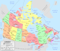
Canada political map - en.svg 1,114 × 942; 423 KB
-
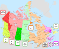
Canada time zone map - en.svg 1,114 × 942; 383 KB
-
Canada towns map east.png 300 × 325; 26 KB
-
Canada towns map trim 398 named.png 398 × 325; 33 KB
-
Canada towns map trim 398 unnamed.png 398 × 325; 33 KB
-
Canada towns map trim 430 named.png 430 × 325; 34 KB
-
Canada towns map trim 430 unnamed.png 430 × 325; 34 KB
-
Canada towns map west.png 300 × 325; 26 KB
-
Canada-CIA WFB Map.png 634 × 325; 28 KB
-
CPC Endorsements (2022-11-04).png 1,087 × 799; 341 KB
-
Eastern Canada electrical generating stations map, 1968.jpg 3,030 × 2,130; 2.02 MB
-
ECHO Canada Editable A4 Landscape.png 1,123 × 794; 519 KB
-
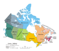
Geopolitical map of Canada.png 1,280 × 1,128; 545 KB
-
Hmap.jpg 8,302 × 5,585; 6.63 MB
-
Map Canada political 2.png 1,280 × 1,107; 387 KB
-
Map of Louisbourg 1758.png 1,390 × 873; 290 KB
-
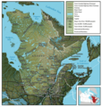
Map of Quebec.png 800 × 843; 316 KB
-
Map of the Dominiom of Canada ... - Topographical surveys branch - btv1b53198376r.jpg 12,158 × 7,019; 16.7 MB
-
Maple Leaf boundaries.PNG 659 × 524; 23 KB
-
Mineral map of the Dominion of Canada - btv1b53209827v.jpg 13,055 × 8,734; 20.21 MB
-
NORTHWEST Angle.png 488 × 403; 309 KB
-
PanAm Games Locations.svg 1,000 × 1,080; 234 KB
-
Political map of Canada ms.svg 1,097 × 930; 123 KB
-
Political map of Canada sr.png 1,280 × 1,107; 288 KB
-
Political map of Canada.png 1,280 × 1,107; 245 KB
-
Political map of Canada.svg 1,130 × 920; 295 KB
-
SaintJohn1894.jpg 1,169 × 792; 318 KB
-
The Mi'kmaq.png 2,360 × 1,650; 985 KB
-
Toronto 1894large.jpg 1,575 × 1,150; 383 KB
-
UCM.png 348 × 308; 20 KB
-
Wikivoyage Montreal district map.png 1,591 × 1,199; 452 KB
-
Laurie Fredonia or the United States of North America 1829 UTA.jpg 5,708 × 3,832; 6.5 MB


