Category:English-language maps of Costa Rica
Jump to navigation
Jump to search
Countries of the Americas: Argentina · Belize · Bolivia · Brazil · Canada · Chile · Colombia · Costa Rica · Cuba · Dominican Republic · Guatemala · Guyana · Haiti · Honduras · Jamaica · Mexico · Nicaragua · Peru · United States of America · Uruguay · Venezuela
Other areas: French Guiana · Greenland · Guadeloupe
Other areas: French Guiana · Greenland · Guadeloupe
Subcategories
This category has the following 2 subcategories, out of 2 total.
Media in category "English-language maps of Costa Rica"
The following 16 files are in this category, out of 16 total.
-
Costa Rica - DPLA - 8789450225080f86ab725c9f66202a4b (page 2).jpg 2,540 × 3,276; 5.44 MB
-
Costa Rica - DPLA - aed7a7825f96c267b08c59a4e52f7ab5.jpg 3,136 × 2,410; 1.21 MB
-
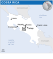
Costa Rica - Location Map (2013) - CRI - UNOCHA.svg 250 × 250; 222 KB
-
Costa Rica map detail.PNG 1,015 × 1,244; 1.7 MB
-
Costa Rica map shaded relief.png 982 × 1,226; 475 KB
-
Costa Rica map.png 329 × 355; 8 KB
-
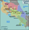
Costa Rica regions map.png 2,413 × 2,431; 1.06 MB
-
Costa Rica regions map.svg 893 × 900; 982 KB
-
Costa Rica Roads and Railroads - DPLA - 5c4ba1f56910de3177111b5de1695c95.jpg 10,172 × 10,687; 13.12 MB
-
Costa Rica UNOCHA.png 1,000 × 1,103; 115 KB
-
Costa Rica, summary map. LOC 92685726.jpg 8,906 × 3,875; 3.25 MB
-
Costa Rica-CIA WFB Map.png 328 × 353; 15 KB
-
Costa Rica. 5-51. LOC gm71002103.jpg 3,194 × 4,165; 1.23 MB
-
Costa Rica. Transportation map - btv1b53189500z.jpg 8,488 × 7,850; 4.54 MB
-
Costa-Rica GHI Solar-resource-map GlobalSolarAtlas World-Bank-Esmap-Solargis.png 1,842 × 2,262; 1.26 MB
-
SolarGIS-Solar-map-Costa-Rica-en.png 866 × 900; 517 KB


