Category:English-language maps of South Korea
Jump to navigation
Jump to search
한국어: 대한민국의 지도 (영어)
中文(繁體):英語韓國地圖
中文(简体):英语韩国地图
Media in category "English-language maps of South Korea"
The following 27 files are in this category, out of 27 total.
-
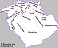
01-21-gwanak-en.svg 597 × 497; 419 KB
-
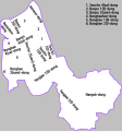
01-22-seocho-en.svg 597 × 640; 400 KB
-
01-23-gangnam-en.svg 597 × 544; 401 KB
-
9호선.svg 1,500 × 1,100; 296 KB
-
AMS L852 Map of Downtown Seoul.jpg 3,750 × 2,815; 6.99 MB
-
AMS L852 Map of Seoul Korea in front side.jpg 3,779 × 2,843; 6.71 MB
-
AMS L852 Map of Seoul Korea in reverse side.jpg 3,779 × 2,846; 7.55 MB
-
Battle of Kyongju.jpg 1,108 × 933; 520 KB
-
Communist Activity in South Korea - DPLA - 5f466910de7fe582c47ea8f4d78d8db8.jpg 3,512 × 3,339; 1.37 MB
-
ECHO Republic of Korea Editable A4 Portrait.png 794 × 1,123; 347 KB
-
Imjin river map.png 500 × 550; 70 KB
-
Inchon landing map (en).svg 702 × 462; 120 KB
-
KTX linemap en.svg 596 × 742; 1.05 MB
-
Naju-map.svg 1,500 × 1,171; 815 KB
-
Population Map of South Korea.jpg 911 × 1,157; 375 KB
-
S. Korea Land Utilization and Economic Activity.jpg 914 × 1,167; 377 KB
-
S. Korea NIS 41B 2.jpg 918 × 1,170; 504 KB
-
S. Korea NIS 41B 3.jpg 920 × 1,123; 385 KB
-
S. Korea NIS 41B.jpg 913 × 1,170; 487 KB
-
Seoul city plans 1946.jpg 7,681 × 6,463; 7.65 MB
-
SEUL and Environs 1912.jpg 1,709 × 1,248; 250 KB
-
South Korea Base Map.png 754 × 1,001; 335 KB
-
South Korea. LOC 2011585048.jpg 3,255 × 4,273; 1.95 MB
-
South Korea. LOC 2011585049.jpg 3,218 × 4,212; 1.91 MB
-
Trans-Korea Pipeline Map, 1985.gif 792 × 493; 38 KB
-
Usaf-korea-map.jpg 350 × 436; 37 KB


