Category:English-language maps of Egypt
Jump to navigation
Jump to search
Subcategories
This category has the following 2 subcategories, out of 2 total.
Media in category "English-language maps of Egypt"
The following 24 files are in this category, out of 24 total.
-
Atlas of the Middle East LOC 93676946-16.jpg 12,772 × 4,832; 7.4 MB
-
Cairo - Survey of Egypt - btv1b101042756.jpg 23,700 × 17,124; 68.04 MB
-
Egypt - DPLA - 618f73ea3749cf611aa7d9307df35cee.jpg 10,240 × 8,845; 6.6 MB
-
Egypt - DPLA - 66032ccdfbf4f28086dfa0704ecd9d60.jpg 4,159 × 5,495; 1.2 MB
-
Egypt - DPLA - 95da4abd36299cd4475db59a3474b645.jpg 10,296 × 8,873; 5.64 MB
-
Egypt - DPLA - bc99fefe6471c30a6028c3b60dc9ac9b.jpg 4,150 × 5,478; 1.24 MB
-
Egypt - DPLA - d03a9cce38f8bbcc927968d519b0fa17.jpg 2,554 × 3,274; 4.73 MB
-
Egypt - DPLA - d0b3d9bc52228cde42564d64b4ab6d01.jpg 2,562 × 3,288; 5.32 MB
-
Egypt - DPLA - e2689e6501bdf8979fa34a8d9b8af080.jpg 2,552 × 3,272; 5.51 MB
-
Egypt - Location Map (2013) - EGY - UNOCHA.svg 254 × 254; 634 KB
-
Egypt Map 2 - DPLA - ade7d85dc825032a6b6b96c9a98d9968.jpg 5,406 × 6,664; 3.9 MB
-
Egypt Population Density and Low Elevation Coastal Zones (5457306559).jpg 3,258 × 2,484; 894 KB
-
Egypt Population Density, 2000 (5457619456).jpg 2,528 × 3,260; 716 KB
-
Egypt Population Density, 2000 (6171907219).jpg 2,322 × 3,160; 638 KB
-
Egypt, administrative divisions. LOC 97687585.jpg 3,338 × 4,329; 1.48 MB
-
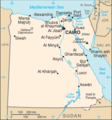
Egypt-CIA WFB Map.png 329 × 352; 12 KB
-
Egypt. LOC 2001628301.jpg 3,376 × 4,390; 1.73 MB
-
Egypt. LOC 94686072.jpg 6,737 × 6,435; 3.43 MB
-
General Geological Map - DPLA - d105b0c1df7d37fef67076767799ad32.jpg 8,094 × 7,168; 6.6 MB
-
General map of Cairo. LOC 2009580102.jpg 15,416 × 11,579; 21.27 MB
-
Geological map of Egypt - btv1b530648389.jpg 8,194 × 8,018; 7.2 MB
-
Map of Lower Egypt - NARA - 131043700.jpg 19,744 × 17,228; 26.25 MB
-
Maps of the world's nations. LOC 76602171-16.jpg 3,184 × 5,413; 1.39 MB
-
Population density of Egypt governorates.png 5,475 × 4,102; 689 KB


