Category:English-language maps of Japan
Jump to navigation
Jump to search
Subcategories
This category has the following 5 subcategories, out of 5 total.
Media in category "English-language maps of Japan"
The following 200 files are in this category, out of 672 total.
(previous page) (next page)-

-
 AichiMapCurrent.png 1,181 × 901; 30 KB
-
 Akashi in Hyogo Prefecture.png 1,001 × 901; 40 KB
-
 Akita in Akita Prefecture.png 981 × 901; 35 KB
-
 Akita Prefecture cities and towns 2.png 648 × 1,047; 137 KB
-
 Akita Prefecture cities and towns.png 738 × 954; 2.69 MB
-
 AkitaMapCurrent.png 981 × 901; 34 KB
-
 Amagasaki in Hyogo Prefecture.png 1,001 × 901; 40 KB
-
 Amami archaeology-en.png 1,500 × 1,540; 418 KB
-
 Amami Islands-en.png 1,500 × 1,540; 392 KB
-
 AomoriMapCurrent.png 1,081 × 801; 37 KB
-
 Aso map.png 1,024 × 885; 55 KB
-
 ChibaMapCurrent.png 981 × 801; 33 KB
-
 Chugoku.png 3,418 × 3,008; 1.71 MB
-
 Chugoku.svg 744 × 1,052; 889 KB
-
 Chūō Shinkansen map.png 1,070 × 320; 124 KB
-
 CIA Japan map marked for approx limits of Okinawa Prefecture.gif 326 × 350; 15 KB
-
 Cities in Western Tokyo Metropolis.png 793 × 750; 155 KB
-
 Daisen in Akita Prefecture.png 981 × 901; 35 KB
-
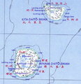
 Daito islands en.png 1,458 × 884; 324 KB
-
 Daito-shoto.png 489 × 507; 543 KB
-
 De Japanse Binnenzee.png 800 × 406; 110 KB
-
 Deployment of U.S. Forces in Japan outside Okinawa.jpg 374 × 396; 23 KB
-
 EhimeMapCurrent.png 1,281 × 801; 36 KB
-
 Fujioka in Gunma Prefecture.png 1,081 × 901; 42 KB
-
 Fujisato in Akita Prefecture.png 981 × 901; 35 KB
-
 FukuiMapCurrent.png 1,181 × 803; 34 KB
-
 FukuokaMapCurrent.png 1,081 × 901; 42 KB
-
 FukushimaMapCurrent.png 1,281 × 901; 50 KB
-
 GifuMapCurrent.png 1,101 × 901; 52 KB
-
 Gojome in Akita Prefecture.png 981 × 901; 35 KB
-
 Gokishichido.jpg 432 × 222; 12 KB
-
 Goshogawara in Aomori Prefecture.png 1,081 × 801; 38 KB
-
 Growth of official cities 1935-1940 - Department of State, Map Division - btv1b53196934s.jpg 8,368 × 8,582; 4.63 MB
-
 GunmaMapCurrent.png 1,081 × 901; 40 KB
-
 Hachinohe in Aomori Prefecture.png 1,081 × 801; 38 KB
-
 Hachirogata in Akita Prefecture.png 981 × 901; 35 KB
-
 Hakodate in Hokkaido en.png 1,400 × 1,000; 31 KB
-
 Happo in Akita Prefecture.png 981 × 901; 35 KB
-
 Higashinaruse in Akita Prefecture.png 981 × 901; 35 KB
-
 Himeji in Hyogo Prefecture.png 1,001 × 901; 19 KB
-
 Hirakawa in Aomori Prefecture.png 1,081 × 801; 38 KB
-
 Hiranai in Aomori Prefecture.png 1,081 × 801; 38 KB
-
 Hiroshima Peace Memorial Park.png 1,069 × 1,877; 678 KB
-
 Hiroshima Peace Memorial Park.svg 1,069 × 1,877; 1.44 MB
-
 HiroshimaMapCurrent.png 1,281 × 901; 44 KB
-
 Hokkaido (No title) - DPLA - 76b51ca8610843d01df129ffcfa6aa97.jpg 8,359 × 8,829; 8.14 MB
-
 HokkaidoMap Abashiri subprefecture en.png 1,400 × 1,000; 31 KB
-
 HokkaidoMap Hidaka subprefecture en.png 1,400 × 1,000; 30 KB
-
 HokkaidoMap Hiyama subprefecture en.png 1,400 × 1,000; 30 KB
-
 HokkaidoMap Iburi subprefecture en.png 1,400 × 1,000; 30 KB
-
 HokkaidoMap Ishikari subprefecture en.png 1,400 × 1,000; 30 KB
-
 HokkaidoMap Kamikawa subprefecture en.png 1,400 × 1,000; 31 KB
-
 HokkaidoMap Kushiro subprefecture en.png 1,400 × 1,000; 31 KB
-
 HokkaidoMap Nemuro subprefecture en.png 1,400 × 1,000; 31 KB
-
 HokkaidoMap Oshima subprefecture en.png 1,400 × 1,000; 30 KB
-
 HokkaidoMap Rumoi subprefecture en.png 1,400 × 1,000; 30 KB
-
 HokkaidoMap Shiribeshi subprefecture en.png 1,400 × 1,000; 30 KB
-
 HokkaidoMap Sorachi subprefecture en.png 1,400 × 1,000; 31 KB
-
 HokkaidoMap Soya subprefecture en.png 1,400 × 1,000; 30 KB
-
 HokkaidoMap Tokachi subprefecture en.png 1,400 × 1,000; 31 KB
-
 HokkaidoMapCurrent en.png 1,400 × 1,000; 38 KB
-
 Hokuriku Shinkansen 2024 Map.jpg 4,800 × 3,600; 1.94 MB
-
 HyogoMapCurrent.png 1,001 × 901; 38 KB
-
 IbarakiMapCurrent.png 1,001 × 901; 37 KB
-
 Ikawa in Akita Prefecture.png 981 × 901; 35 KB
-
 Isesaki in Gunma Prefecture.png 1,081 × 901; 42 KB
-
 IshikawaMapCurrent.png 981 × 901; 26 KB
-
 IwateMapCurrent.png 981 × 801; 32 KB
-
 Iwo jima location map.png 241 × 405; 46 KB
-
 Japan - 1st Edition - DPLA - 474da52ab6d9150b4c557f293630a8cd.jpg 12,528 × 15,004; 22.74 MB
-
 Japan - Aichi -Ken - DPLA - 70b68b27ee0b9318c245f607389bcf20.jpg 5,124 × 8,181; 4.69 MB
-
 Japan - btv1b84408191.jpg 8,472 × 8,731; 8.69 MB
-
 Japan - DPLA - 8c20c02ca777a245ef2894e6bd73cd3f.jpg 2,546 × 3,278; 5.23 MB
-
 Japan - DPLA - d4dd120bba01faf77cb4cf93756d7f35.jpg 2,558 × 3,282; 5.43 MB
-
 Japan - Hiroshima - Ken - DPLA - 455ba72cee893cf2e41bdce22781f98c.jpg 5,928 × 9,281; 5.7 MB
-

-
 Japan - Kyoto - Fu - DPLA - 3a6e483a8d0564834af956e6f1294be2.jpg 5,208 × 9,018; 5.86 MB
-
 Japan - Okayama - Ken - DPLA - 0a9d789453f7c287b916a0971c367457.jpg 5,040 × 9,065; 3.92 MB
-
 Japan - OSS - btv1b53196945n.jpg 7,974 × 10,454; 7.28 MB
-

-
 Japan - Shiga - Ken - DPLA - a63cc4d91d52a741570773b45bc4933f.jpg 4,990 × 7,127; 4.15 MB
-

-
 Japan administrative divisions. LOC 96685895.jpg 2,010 × 2,761; 930 KB
-
 Japan Base Map.png 2,910 × 2,153; 316 KB
-
 Japan Chubu Map.png 3,000 × 3,263; 1.35 MB
-
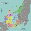 Japan chubu Map.svg 3,000 × 3,000; 1.19 MB
-
 Japan cities and towns (shi and machi) - IRIS - btv1b531969446.jpg 8,246 × 8,700; 11.16 MB
-
-

-
-
 Japan Growth of Official Cites 1930-1935 - DPLA - de3daa3b6ca481afc5f88ef07315af2d.jpg 8,244 × 8,924; 6.75 MB
-
 Japan Gunma Pref Map.png 1,010 × 1,244; 299 KB
-
 Japan Gunma Pref Map.svg 1,010 × 1,244; 274 KB
-
 Japan Kansai Map.png 2,871 × 3,000; 2.19 MB
-
 Japan Kansai Map.svg 3,003 × 3,003; 2.77 MB
-
 Japan Kanto Map.png 2,716 × 2,946; 2.37 MB
-
 Japan Kyushu Map.png 2,836 × 3,000; 1.89 MB
-
 Japan Kyushu Map.svg 2,838 × 3,005; 2.78 MB
-
 Japan Kyusyu Map.png 2,836 × 3,000; 1.84 MB
-
 Japan Kyusyu Map.svg 3,004 × 3,004; 2.77 MB
-
 Japan Okinawa OkinawaIslands Map1.png 2,999 × 2,046; 738 KB
-
 Japan ordinance designated cities (en).svg 457 × 839; 740 KB
-

-

-

-
 Japan Regions and Prefectures.png 1,397 × 1,593; 84 KB
-
 Japan regions map.png 2,430 × 3,000; 1.13 MB
-
 Japan regions map.svg 781 × 964; 1.47 MB
-
 Japan sea map.png 326 × 350; 13 KB
-
 Japan selected railroad - btv1b53196943r.jpg 7,986 × 7,726; 4.13 MB
-
-
 Japan Tohoku Map.png 2,538 × 3,000; 1.41 MB
-
 Japan Tohoku Map.svg 3,007 × 3,007; 779 KB
-
 Japan- Fukui-Ken - DPLA - e63a31404ff161f8c7bddcf2a8bd795b.jpg 8,136 × 6,325; 4.08 MB
-
 Japan- Hiroshima-Ken - DPLA - 8a8497410fac5f5a4913e0f54f8b242e.jpg 8,124 × 6,330; 4.81 MB
-
 Japan- Hokkaido-Cho - DPLA - ac29a20baaa64aab1a8176810d394926.jpg 8,184 × 6,325; 5 MB
-
 Japan- Iwate-Ken - DPLA - f6c18f191fdc2fb5d624ef976ea11c0d.jpg 8,064 × 6,335; 4.66 MB
-
 Japan- Nagasaki-Ken - DPLA - a79e6d0784faf2372fa62e0e625f6e53.jpg 8,112 × 6,300; 4.81 MB
-
 Japan- Nara - Ken - DPLA - 5d05854d157bdfc880a6b77cd30fe3ee.jpg 4,942 × 6,849; 4.21 MB
-
 Japan- Niigata-Ken - DPLA - 2b6405aa27af65a5233b572c12aa9e08.jpg 6,408 × 6,317; 3.12 MB
-
 Japan- Oita-Ken - DPLA - 2d4bd6d7fadacb615d4891d82e7e75a5.jpg 8,184 × 6,254; 3.85 MB
-
 Japan- Okayama-Ken - DPLA - 02740758bf20e9b3062b714d8b9a2ac3.jpg 8,136 × 6,332; 5.93 MB
-
 Japan- Okinawa-Ken - DPLA - 771def82d6e59d24d7bf45eefe92de2b.jpg 8,172 × 6,333; 4.3 MB
-
 Japan- Osaka-Fu - DPLA - 017fc342547e47e83b79e6b3362f9fbc.jpg 8,184 × 6,325; 4.74 MB
-
 Japan- Tottori-Ken - DPLA - 60edb82e8638a4dbccfabb3fe369606b.jpg 8,112 × 6,282; 5.14 MB
-
 Japan-kanto p23.png 1,200 × 1,200; 177 KB
-
 Japan-map.gif 326 × 350; 29 KB
-
 Japan-Yamagata-Ken - DPLA - e84792b5b3f7f563111cd9030d3aafaf.jpg 8,076 × 6,311; 4.12 MB
-
 Japan. LOC 96685774.jpg 1,996 × 2,733; 876 KB
-
 JapanCitiesTownsOMC.PNG 1,965 × 1,866; 227 KB
-
 JaponMarInterior1.PNG 3,075 × 1,751; 60 KB
-
 JREast Chiba RouteFigure.png 1,578 × 1,356; 243 KB
-
 JREast Chiba RouteFigure.svg 1,420 × 1,220; 120 KB
-
 KagawaMapCurrent.png 1,081 × 801; 30 KB
-
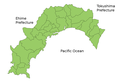
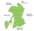
 KagoshimaMapCurrent.png 1,201 × 801; 34 KB
-
 Kakogawa in Hyogo Prefecture.png 1,001 × 901; 40 KB
-
 Kamikoani in Akita Prefecture.png 981 × 901; 35 KB
-
 KanagawaMapCurrent.png 1,281 × 801; 134 KB
-
 Katagami in Akita Prefecture.png 981 × 901; 35 KB
-
 Kawauchi, Futaba district, Fukushima Prefecture.svg 632 × 512; 32 KB
-
 Kazuno in Akita Prefecture.png 981 × 901; 36 KB
-
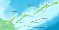
 Kerama Islands map.jpg 872 × 551; 191 KB
-
 Kikuchi in Kumamoto Prefecture.png 981 × 901; 42 KB
-
 Kikuyo in Kumamoto Prefecture.png 981 × 901; 42 KB
-
 Kinki-en.png 642 × 463; 269 KB
-
 Kiryu in Gunma Prefecture.png 1,081 × 901; 42 KB
-
 Kitaakita in Akita Prefecture.png 981 × 901; 36 KB
-
 Kobe in Hyogo Prefecture.png 1,001 × 901; 40 KB
-
 KochiMapCurrent 2.png 1,181 × 801; 30 KB
-
 Kosaka in Akita Prefecture.png 981 × 901; 35 KB
-
 Koshi in Kumamoto Prefecture.png 981 × 901; 42 KB
-
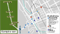
 Kotohira.png 3,008 × 1,709; 754 KB
-
 Kotohira.svg 1,880 × 1,073; 506 KB
-
 Kumamoto Prefecture shadow picture.svg 1,226 × 1,126; 50 KB
-
 KumamotoMapCurrent.png 981 × 901; 42 KB
-
 KumamotoMapCurrent.svg 1,226 × 1,126; 50 KB
-
 Kume-jima map.jpg 724 × 392; 115 KB
-
 Kurashiki.svg 1,869 × 1,084; 588 KB
-
 Kuril-Islands-Northern-Territories-of-Japan-Map.png 1,787 × 917; 415 KB
-
 Kyoto-railways.png 1,550 × 1,240; 281 KB
-
 Kyoto-railways.svg 744 × 595; 182 KB
-
 Kyotomap.png 1,000 × 816; 412 KB
-
 Kyotomap.svg 1,693 × 1,381; 1.35 MB
-
 KyotoMapCurrent.png 1,181 × 901; 42 KB
-
 Location-of-Awaji-island-en.png 640 × 480; 95 KB
-
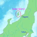 Location-of-Sadogashima-island-en.png 400 × 400; 14 KB
-
 Major US military bases in Japan.svg 1,407 × 1,359; 219 KB
-
 Map Abiko en.png 981 × 801; 33 KB
-
 Map Adachi-ku en.png 1,440 × 801; 43 KB
-
 Map Ainan,Ehime en.png 1,281 × 801; 48 KB
-
 Map Aisai en.png 1,181 × 901; 41 KB
-
 Map Aizumi en.png 1,281 × 801; 49 KB
-
 Map Akaiwa en.png 1,281 × 901; 49 KB
-
 Map Aki,Kochi en.png 1,181 × 801; 43 KB
-
 Map Akiruno en.png 1,440 × 801; 44 KB
-
 Map Akishima en.png 1,440 × 801; 44 KB
-
 Map Akitakata en.png 1,281 × 901; 44 KB
-
 Map Akune en.png 1,201 × 801; 34 KB
-
 Map Amakusa en.png 981 × 901; 41 KB
-
 Map Amakusa en.svg 1,226 × 1,126; 50 KB
-
 Map Amami en.png 1,201 × 801; 34 KB
-
 Map Anan,Tokushima en.png 1,281 × 801; 49 KB
-
 Map Arakawa-ku en.png 1,440 × 801; 42 KB
-
 Map Arao en.png 981 × 901; 41 KB
-
 Map Arao en.svg 1,226 × 1,126; 50 KB
-
 Map Arida en.png 1,001 × 801; 34 KB
-
 Map Aridagawa en.png 1,281 × 801; 49 KB
-
 Map Asahi, Chiba en.png 981 × 801; 34 KB
-
 Map Asakuchi en,.png 1,281 × 901; 49 KB
-
 Map Asakura, Fukuoka en.png 1,081 × 901; 42 KB
-
 Map Aso en.png 981 × 901; 41 KB
-
 Map Awa.Tokushima en.png 1,281 × 801; 49 KB
-
 Map Awara en.png 1,181 × 803; 46 KB
-
 Map Ayagawa en.png 1,081 × 801; 42 KB
-
 Map Beppu en.png 1,181 × 901; 34 KB
-
 Map Bizen en.png 1,281 × 901; 35 KB
-
 Map Bungo-ono en.png 1,181 × 901; 35 KB
-
 Map Bungotakada en.png 1,181 × 901; 35 KB
-
 Map Buzen en.png 1,081 × 901; 42 KB
%27_(11288734135).jpg)


_-_DPLA_-_76b51ca8610843d01df129ffcfa6aa97.jpg)


_-_IRIS_-_btv1b531969446.jpg)
_April_1947_-_DPLA_-_9d4ec9be37385899d5b3949bc81cabc2.jpg)


.svg)


