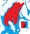
Category:Cowal
Jump to navigation
Jump to search
Traditional districts (lordships, provinces etc) of Scotland: The Aird · Annandale · Atholl · Boyne · Buchan · Badenoch · Breadalbane · Carrick · Clydesdale / Lanark · Cowal · Cunninghame · Eskdale · Fothriff · Galloway · Garioch · Garmoran · The Glenkens · Gowrie · Kintyre · Knapdale · Kyle · Lauderdale · Lennox · Liddesdale · Lochaber · Lorn · Lothian · Mar · Mearns · Menteith · Merse · Nithsdale · The Rhinns · Ross (Easter · Wester) · Stormont · Strathavon · Strathbogie · Strathearn · Strathgryfe · Strathnaver · Strathspey · Teviotdale · Tweeddale ·
peninsula in Argyll and Bute, Scotland, UK, extending into the Firth of Clyde | |||||
| Upload media | |||||
| Instance of | |||||
|---|---|---|---|---|---|
| Location | Argyll and Bute, Scotland | ||||
 | |||||
Subcategories
This category has the following 23 subcategories, out of 23 total.
A
- Ardlamont House (6 F)
- Ardlamont Point (17 F)
- Asgog Loch (7 F)
B
C
- Creag Tharsuinn (6 F)
D
G
- Glen Finart (13 F)
- Glen Fyne, Cowal (28 F)
- Glen Massan (32 F)
H
I
K
L
- Lachlan Castle (old) (26 F)
S
- Strathlachlan (253 F)
T
Media in category "Cowal"
The following 18 files are in this category, out of 18 total.
-
A crane in the anchorage near Caladh - geograph.org.uk - 378863.jpg 640 × 436; 58 KB
-
A crane in the anchorage near Caladh - geograph.org.uk - 378867.jpg 640 × 436; 56 KB
-
Black Craig Summit - Flickr - Graham Grinner Lewis (1).jpg 2,048 × 1,536; 633 KB
-
Cowal peninsula landsat.jpg 948 × 1,280; 340 KB
-
Cowal peninsula landsat.png 948 × 1,280; 2.19 MB
-
Cowal Way marker post above the Donich Water (geograph 5477451).jpg 4,896 × 3,672; 6.95 MB
-
Cowal.PNG 588 × 671; 20 KB
-
DSCF1242 (1330518866).jpg 1,024 × 768; 234 KB
-
Langhill, Inverkip, view to Dunoon.jpg 4,000 × 3,000; 1.78 MB
-
Ordnance Survey One-Inch Sheet 65 Dunoon & Loch Fyne, Published 1927.jpg 12,153 × 9,383; 11.77 MB
-
Ordnance Survey One-Inch Sheet 71 Island of Bute, Published 1925.jpg 12,190 × 11,123; 13.44 MB
-
Ordnance Survey One-Inch Sheet 71 Island of Bute, Published 1945.jpg 12,194 × 11,215; 14.01 MB
-
Ordnance Survey One-Inch Tourist Map of Rothesay and Firth of Clyde, Published 1920.jpg 8,604 × 11,534; 24.19 MB
-
Swallow Brae, Inverkip - geograph.org.uk - 1735753.jpg 3,872 × 2,592; 2.4 MB
-
The Allt a Chapuill burn - geograph.org.uk - 1308019.jpg 640 × 480; 98 KB
-
Cycle and footpath, Creag Liath - geograph.org.uk - 419939.jpg 640 × 480; 99 KB


