Category:Ardlamont Point
Jump to navigation
Jump to search
headland in Argyll and Bute, Scotland, UK  | |||||
| Upload media | |||||
| Instance of | |||||
|---|---|---|---|---|---|
| Location | Argyll and Bute, Scotland | ||||
 | |||||
Media in category "Ardlamont Point"
The following 17 files are in this category, out of 17 total.
-
 Admiralty Chart No 1906 Kyles of Bute and Inchmarnock Water, Published 1956.jpg 11,072 × 16,166; 18.63 MB
-
 Ardlamont Bay - geograph.org.uk - 377048.jpg 640 × 430; 94 KB
-
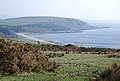
 Ardlamont Point (west) - geograph.org.uk - 2891606.jpg 640 × 480; 87 KB
-
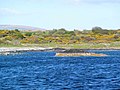
 Ardlamont Point (west) - geograph.org.uk - 2891613.jpg 640 × 480; 60 KB
-
 Ardlamont Point (west) - geograph.org.uk - 2891619.jpg 640 × 480; 85 KB
-
 Ardlamont Point - eastern tip - geograph.org.uk - 1303662.jpg 640 × 450; 58 KB
-
 Ardlamont Point - geograph.org.uk - 2742790.jpg 2,560 × 1,706; 662 KB
-
 Ardlamont Point - geograph.org.uk - 348828.jpg 640 × 480; 101 KB
-
 Ardlamont Point - western tip - geograph.org.uk - 1303633.jpg 640 × 480; 85 KB
-
 Ardlamont Point - western tip - geograph.org.uk - 1303650.jpg 640 × 476; 76 KB
-
 Ardlamont Point - western tip - geograph.org.uk - 1303654.jpg 640 × 480; 59 KB
-
-
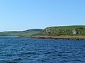
 Port a' Ghobhlain - geograph.org.uk - 2534924.jpg 640 × 481; 96 KB
-
 Sailing Past Ardlamont Point - geograph.org.uk - 2742802.jpg 2,560 × 1,706; 722 KB
-
 Southern tip of Sgat Beag - geograph.org.uk - 970112.jpg 640 × 480; 50 KB
-
 Trig point above Ardlamont Point - geograph.org.uk - 5144827.jpg 4,000 × 3,000; 2.68 MB
-
 View over the Kyles - geograph.org.uk - 1322346.jpg 480 × 640; 77 KB


_-_geograph.org.uk_-_2891606.jpg)
_-_geograph.org.uk_-_2891613.jpg)
_-_geograph.org.uk_-_2891619.jpg)


