Category:Wester Ross
Jump to navigation
Jump to search
Traditional districts (lordships, provinces etc) of Scotland: The Aird · Annandale · Atholl · Boyne · Buchan · Badenoch · Breadalbane · Carrick · Clydesdale / Lanark · Cowal · Cunninghame · Eskdale · Fothriff · Galloway · Garioch · Garmoran · The Glenkens · Gowrie · Kintyre · Knapdale · Kyle · Lauderdale · Lennox · Liddesdale · Lochaber · Lorn · Lothian · Mar · Mearns · Menteith · Merse · Nithsdale · The Rhinns · Ross (Easter · Wester) · Stormont · Strathavon · Strathbogie · Strathearn · Strathgryfe · Strathnaver · Strathspey · Teviotdale · Tweeddale ·
English: Wester Ross is a western area of the Highland council area, Scotland
Srpskohrvatski / српскохрватски: Wester Ross je zapadna oblast Rossa i Cromartyja, poznata po tome što sadrži sela na zapadnoj obali kao što su:
Main Wikipedia article: Wester Ross.
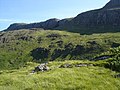
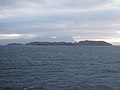
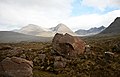
loosely defined area in the North West Highlands of Scotland  | |||||
| Upload media | |||||
| Instance of | |||||
|---|---|---|---|---|---|
| Location | Ross and Cromarty, Highland, Scottish Highlands, Scotland | ||||
 | |||||
Subcategories
This category has the following 32 subcategories, out of 32 total.
A
- A' Mhaighdean (42 F)
- Allt Loch Raa (12 F)
- An Teallach (122 F)
B
- Badluarach (18 F)
- Beinn Lair, Letterewe (22 F)
- Beinn Liath Mhòr (45 F)
C
- Càrn Bàn (4 F)
- Carn nan Fiaclan (2 F)
E
- Eididh nan Clach Geala (20 F)
F
- Flowerdale House (6 F)
- Fuar Tholl (22 F)
G
- Glen Docherty (24 F)
I
- Inverewe Garden (105 F)
- Isle of Ewe (33 F)
M
- Meall nan Ceapraichean (27 F)
- Mòruisg (39 F)
R
- Redpoint (59 F)
- River Carron, Wester Ross (10 F)
- River Kerry (6 F)
- Ruadh Stac Mòr (24 F)
S
- Sgurr nan Ceannaichean (12 F)
- Slioch (83 F)
U
W
Media in category "Wester Ross"
The following 29 files are in this category, out of 29 total.
-
 A moorland pool - geograph.org.uk - 585432.jpg 640 × 426; 120 KB
-
 Bealach na Bà in cloud.jpg 4,000 × 3,000; 1.84 MB
-
 Cliffs at Ardlair - geograph.org.uk - 76155.jpg 640 × 480; 136 KB
-
 Cliffs of Meallan Ghobhar - geograph.org.uk - 202746.jpg 640 × 480; 105 KB
-
 Climber on top pitch of Fionn Buttress - geograph.org.uk - 39010.jpg 640 × 419; 66 KB
-
 Driveway to Glen Mor Farm - geograph.org.uk - 181763.jpg 640 × 480; 80 KB
-
 Driveway to Tullich House - geograph.org.uk - 252376.jpg 640 × 480; 144 KB
-
 Garvie Bay - geograph.org.uk - 1460717.jpg 640 × 480; 67 KB
-
 Glas-leac Mor - geograph.org.uk - 1525586.jpg 640 × 480; 44 KB
-
 Gneiss (29537005127).jpg 3,362 × 2,495; 7.24 MB
-
 Inverasdale Primary School - geograph.org.uk - 35137.jpg 640 × 480; 118 KB
-
 Inverbroom, Scotland (50797570296).jpg 4,507 × 2,708; 10.22 MB
-
 Loch Torridon, Scotland P-SCO Banner.jpg 3,918 × 560; 462 KB
-
 Loch Torridon, Scotland.jpg 7,836 × 2,080; 11.46 MB
-
 Northwest Highlands The North.jpg 1,600 × 1,040; 485 KB
-
 Remains of old Sheepfold - geograph.org.uk - 1311279.jpg 640 × 426; 217 KB
-
 Robert McGregor Innes Ireland memorial - geograph.org.uk - 757690.jpg 480 × 640; 116 KB
-
 Ross and Cromarty Wikivoyage Banner.jpg 7,836 × 1,123; 6.34 MB
-
 Ruined Croft.JPG 3,872 × 2,592; 1.39 MB
-
 Sandstone block (geograph 4526119).jpg 640 × 409; 64 KB
-
 Shenavall River - Flickr - Graham Grinner Lewis.jpg 3,648 × 2,736; 2.57 MB
-
 Stag Near Altandhu.jpg 3,872 × 2,592; 7.25 MB
-
 The buildings at Glendhu - geograph.org.uk - 2431854.jpg 800 × 530; 153 KB
-
 The Dundonnell River at Airigh Ghiorid.jpg 3,024 × 4,032; 6.18 MB
-
 Track to Shenavall - geograph.org.uk - 1309253.jpg 640 × 426; 373 KB
-
 UGOR Bees & Foxglove.jpg 1,680 × 3,648; 1.42 MB
-
 Wester Ross. - panoramio (1).jpg 3,000 × 1,799; 2.97 MB
-
 Wester Ross. - panoramio.jpg 3,000 × 1,729; 5.92 MB
-
 Cottage near Achintraid Slipway - geograph.org.uk - 312741.jpg 640 × 480; 97 KB


.jpg)

.jpg)


.jpg)


.jpg)

