Category:Borough of Gravesham
Jump to navigation
Jump to search
local government district and borough in North West Kent, England  | |||||
| Upload media | |||||
| Instance of | |||||
|---|---|---|---|---|---|
| Location | Kent, South East England, England | ||||
| Capital | |||||
| Legislative body |
| ||||
| Population |
| ||||
| Area |
| ||||
| official website | |||||
 | |||||
English: Gravesham is a district in the county of Kent, England.
Subcategories
This category has the following 12 subcategories, out of 12 total.
Media in category "Borough of Gravesham"
The following 200 files are in this category, out of 1,397 total.
(previous page) (next page)-
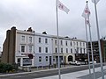
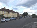
 1 Berkley Crescent - geograph.org.uk - 5457631.jpg 4,000 × 3,000; 3.56 MB
-

-
 109, Windmill Street - geograph.org.uk - 5072450.jpg 2,448 × 3,264; 2.38 MB
-
 14-31 Heritage Quay - geograph.org.uk - 5457022.jpg 4,000 × 3,000; 3.06 MB
-
 14-31 Heritage Quay - geograph.org.uk - 5457023.jpg 4,000 × 3,000; 4.3 MB
-
 20-24 Stone Street, Gravesend - geograph.org.uk - 3164785.jpg 4,288 × 3,216; 3.28 MB
-
 A Bench With a View, Northfleet - geograph.org.uk - 4136694.jpg 4,608 × 3,456; 3.43 MB
-
 A bend in the road - geograph.org.uk - 2476506.jpg 4,000 × 3,000; 4.49 MB
-
 A corner of Gravesend cemetery - geograph.org.uk - 2480011.jpg 640 × 480; 166 KB
-
 A motley tribe of horses - geograph.org.uk - 2480251.jpg 640 × 480; 104 KB
-
 A small green in Gravesend - geograph.org.uk - 1942442.jpg 1,280 × 960; 634 KB
-
 A Zig-Zag Footbridge, Northfleet - geograph.org.uk - 4147423.jpg 4,608 × 3,456; 3.64 MB
-
 A2 at A337 junction - geograph.org.uk - 3667422.jpg 2,320 × 998; 401 KB
-
 A2 Watling Street - geograph.org.uk - 4280709.jpg 3,264 × 2,448; 1.34 MB
-
 A2 Watling Street - geograph.org.uk - 4280715.jpg 3,264 × 2,448; 1.33 MB
-
 A2, Pepper Hill - geograph.org.uk - 3631374.jpg 640 × 480; 249 KB
-
 Abbey Road, Gravesend - geograph.org.uk - 4146815.jpg 3,488 × 2,616; 2.75 MB
-
 Access Gate 156, High Speed Line, near Ebbsfleet - geograph.org.uk - 4147437.jpg 4,608 × 3,456; 3.45 MB
-

-

-
 Alanbrooke, Gravesend - geograph.org.uk - 5267419.jpg 3,264 × 2,448; 1.58 MB
-
 Alanbrooke, Gravesend - geograph.org.uk - 5267421.jpg 3,264 × 2,448; 1.8 MB
-
 Albion Parade, Gravesend - geograph.org.uk - 4146834.jpg 3,488 × 2,616; 3.34 MB
-
 Albion Parade, Gravesend - geograph.org.uk - 4189678.jpg 3,128 × 2,346; 1.62 MB
-
 Albion Parade, Gravesend - geograph.org.uk - 4189679.jpg 3,128 × 2,346; 2.51 MB
-
 Albion Road, Milton - geograph.org.uk - 3666146.jpg 3,488 × 2,616; 2.22 MB
-
 Albion Road, Milton - geograph.org.uk - 4388643.jpg 2,272 × 1,704; 737 KB
-
 Albion Road, Milton - geograph.org.uk - 5267424.jpg 3,264 × 2,448; 1.85 MB
-
 Albion Terrace, Milton - geograph.org.uk - 4388638.jpg 2,272 × 1,704; 751 KB
-
 Albion Terrace, Milton - geograph.org.uk - 4388652.jpg 2,272 × 1,704; 651 KB
-
 Alex House - geograph.org.uk - 4598206.jpg 640 × 424; 59 KB
-
 Alexandra Road, Gravesend - geograph.org.uk - 3666050.jpg 3,488 × 2,616; 2.22 MB
-
 Alfred Road, Gravesend - geograph.org.uk - 4129203.jpg 3,488 × 2,616; 2.62 MB
-
 All Saints Road, Northfleet - geograph.org.uk - 3677777.jpg 3,488 × 2,616; 2.23 MB
-
 All Saints Road, Northfleet - geograph.org.uk - 5318197.jpg 3,264 × 2,448; 1.75 MB
-
 All Saints Road, Northfleet - geograph.org.uk - 5318201.jpg 3,264 × 2,448; 2.1 MB
-
 All Saints', Perry Street, Northfleet - geograph.org.uk - 3677781.jpg 3,488 × 2,616; 2.21 MB
-
 Alleyway from Guru Nanak Marg - geograph.org.uk - 5456325.jpg 3,000 × 4,000; 3.63 MB
-

-
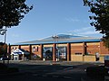 AMF Bowling Alley, Gravesend - geograph.org.uk - 3182514.jpg 4,288 × 3,216; 4.74 MB
-
 Anchor Cove - geograph.org.uk - 4597999.jpg 424 × 640; 58 KB
-
 Appleshaw Close, Gravesend - geograph.org.uk - 4561755.jpg 2,272 × 1,704; 725 KB
-
 Approach to Market Hall, Gravesend - geograph.org.uk - 4697933.jpg 480 × 640; 113 KB
-
 Arcadia Avenue, Istead Rise - geograph.org.uk - 4562196.jpg 2,272 × 1,704; 712 KB
-
 Arcadia Avenue, Istead Rise - geograph.org.uk - 4562206.jpg 2,272 × 1,704; 730 KB
-
 Arcadia Road, Istead Rise - geograph.org.uk - 3567343.jpg 3,201 × 2,480; 1.51 MB
-
 Ariel Close, Riverview Park - geograph.org.uk - 3899118.jpg 3,488 × 2,616; 2 MB
-
 Armoury Drive, Gravesend - geograph.org.uk - 5267416.jpg 2,879 × 2,159; 1.27 MB
-
 Arnold Road, Gravesend - geograph.org.uk - 4146766.jpg 3,488 × 2,616; 3.25 MB
-
 Arriva Bus Garage, Northfleet - geograph.org.uk - 5486415.jpg 2,592 × 1,944; 1.38 MB
-
 Arthur Street West, Gravesend - geograph.org.uk - 5318236.jpg 3,264 × 2,448; 1.68 MB
-
 Arthur Street, Gravesend - geograph.org.uk - 4129104.jpg 3,488 × 2,616; 2.88 MB
-
 Arthur Street, Gravesend - geograph.org.uk - 4408975.jpg 2,272 × 1,704; 739 KB
-
 Arthur Street, Gravesend - geograph.org.uk - 5267356.jpg 3,264 × 2,448; 1.55 MB
-
 Arthur Street, Gravesend - geograph.org.uk - 5318242.jpg 3,264 × 2,448; 1.75 MB
-
 Ascot Arms, Gravesend - geograph.org.uk - 4129291.jpg 3,488 × 2,616; 2.85 MB
-
 Ascot Road, Gravesend - geograph.org.uk - 4129281.jpg 3,488 × 2,616; 2.85 MB
-
 Ash Road, Gravesend - geograph.org.uk - 4129324.jpg 3,488 × 2,616; 2.43 MB
-
 Ashlen Down Nursing Home, Parrock Street - geograph.org.uk - 5070152.jpg 2,448 × 3,264; 2.31 MB
-
 Aspdin Road, Northfleet - geograph.org.uk - 4138957.jpg 3,488 × 2,616; 2.94 MB
-
 Aspdin Wharf - geograph.org.uk - 5525196.jpg 3,264 × 2,448; 3.81 MB
-
 Astra Drive, Riverview Park - geograph.org.uk - 3899012.jpg 3,488 × 2,616; 2.29 MB
-
 Augustine Road, Milton - geograph.org.uk - 4388648.jpg 2,272 × 1,704; 659 KB
-
 Austin Road, Northfleet - geograph.org.uk - 4129125.jpg 3,488 × 2,616; 3.39 MB
-
 Baltimore Terrace, Gravesend - geograph.org.uk - 3665974.jpg 3,488 × 2,616; 2.28 MB
-
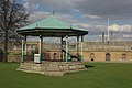 Bandstand - Fort Gardens, Gravesend - geograph.org.uk - 2863206.jpg 1,280 × 856; 146 KB
-
 Bandstand, Fort Gardens, Gravesend - geograph.org.uk - 4146846.jpg 3,488 × 2,616; 3.46 MB
-
 Bank Street, Gravesend - geograph.org.uk - 3942358.jpg 2,616 × 3,488; 2.06 MB
-
 Bankside, Northfleet - geograph.org.uk - 4297400.jpg 2,272 × 1,704; 1.06 MB
-
 Barr Road, Westcourt - geograph.org.uk - 3899209.jpg 3,488 × 2,616; 2.18 MB
-
 Barrack Row, Gravesend - geograph.org.uk - 4702899.jpg 3,264 × 2,448; 1.54 MB
-
 Bartlett Road, Gravesend - geograph.org.uk - 3677645.jpg 3,488 × 2,616; 2.27 MB
-
 Battle of Britain Pub Sign (2) - geograph.org.uk - 3164744.jpg 3,216 × 4,288; 3.38 MB
-
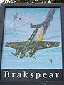 Battle of Britain Pub Sign, Gravesend - geograph.org.uk - 3164740.jpg 3,216 × 4,288; 3.58 MB
-
 Battle of Britain, Northfleet - geograph.org.uk - 1996123.jpg 3,198 × 2,398; 1.64 MB
-
 Beatrice Gardens, Northfleet - geograph.org.uk - 4561730.jpg 2,272 × 1,704; 852 KB
-
 Bedford Road, Northfleet - geograph.org.uk - 4129135.jpg 3,488 × 2,616; 2.76 MB
-
 Bellman Avenue, Gravesend - geograph.org.uk - 4146816.jpg 3,488 × 2,616; 2.63 MB
-
 Bentley Street, Gravesend - geograph.org.uk - 4146851.jpg 3,488 × 2,616; 2.43 MB
-
 Bentley Street, Gravesend - geograph.org.uk - 5267438.jpg 3,264 × 2,448; 1.69 MB
-
 Beresford Road, Northfleet - geograph.org.uk - 3677895.jpg 3,488 × 2,616; 2.17 MB
-
 Beresford Road, Northfleet - geograph.org.uk - 5318101.jpg 3,264 × 2,448; 2 MB
-
 Berkley Road, Gravesend - geograph.org.uk - 3665949.jpg 3,488 × 2,616; 2.25 MB
-
 Berkley Road, Gravesend - geograph.org.uk - 4388752.jpg 2,272 × 1,704; 754 KB
-
 Berkley Street, Gravesend - geograph.org.uk - 5267463.jpg 3,264 × 2,448; 1.68 MB
-
 Bernard Street, Gravesend - geograph.org.uk - 3665952.jpg 3,488 × 2,616; 2.25 MB
-
 Bernard Street, Gravesend - geograph.org.uk - 4388746.jpg 2,272 × 1,704; 739 KB
-
 Berries on the Wealdway - geograph.org.uk - 5099124.jpg 4,608 × 3,456; 3.38 MB
-
 Bevans 42 - geograph.org.uk - 4426106.jpg 2,592 × 1,944; 226 KB
-
 Bevans Wharf - geograph.org.uk - 4426050.jpg 640 × 480; 60 KB
-
 Blackberries on the Wealdway - geograph.org.uk - 5099117.jpg 4,608 × 3,456; 3.39 MB
-
 Blossom alongside the new A2 - geograph.org.uk - 5352741.jpg 4,000 × 3,000; 4.91 MB
-
 BMX Racetrack, Cyclopark - geograph.org.uk - 3164715.jpg 4,288 × 3,216; 3.52 MB
-
 Bonaventure Court, Riverview Park - geograph.org.uk - 3899078.jpg 3,488 × 2,616; 1.83 MB
-
 Botany Marsh - geograph.org.uk - 3748323.jpg 3,488 × 2,616; 2.31 MB
-
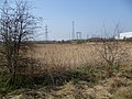 Botany Marshes - geograph.org.uk - 2863828.jpg 4,000 × 3,000; 3.98 MB
-
 Botany Marshes - geograph.org.uk - 3748319.jpg 3,488 × 2,616; 1.85 MB
-
 Botany Road, Northfleet - geograph.org.uk - 3748348.jpg 3,488 × 2,616; 934 KB
-
 Botany Road, Northfleet - geograph.org.uk - 3748349.jpg 3,488 × 2,616; 2.19 MB
-
 Botany Road, Northfleet - geograph.org.uk - 3748352.jpg 3,488 × 2,616; 1.56 MB
-
 Botany Road, Northfleet - geograph.org.uk - 3748356.jpg 3,488 × 2,616; 1.48 MB
-
 Botany Road, Northfleet - geograph.org.uk - 4181767.jpg 3,488 × 2,616; 2.18 MB
-
 Bowater Scott - Water Tower and former offices - geograph.org.uk - 3037836.jpg 2,791 × 4,203; 5.49 MB
-
 Bowling green at Clarence Place, Gravesend - geograph.org.uk - 1945078.jpg 1,280 × 960; 651 KB
-
 Brandon Street, Gravesend - geograph.org.uk - 4129107.jpg 3,488 × 2,616; 3.06 MB
-
 Brandon Street, Gravesend - geograph.org.uk - 4408974.jpg 2,272 × 1,704; 719 KB
-
 Brandon Street, Gravesend - geograph.org.uk - 5267354.jpg 3,264 × 2,448; 1.58 MB
-
 Brenchley Avenue, Gravesend - geograph.org.uk - 4562114.jpg 2,272 × 1,704; 740 KB
-
 Brenchley Avenue, Gravesend - geograph.org.uk - 4562147.jpg 2,272 × 1,704; 708 KB
-
 Brewhouse Yard, Gravesend - geograph.org.uk - 3677277.jpg 3,488 × 2,616; 2.28 MB
-
 Bridge leading over to Gordon Promenade East, Gravesend - geograph.org.uk - 4146835.jpg 3,488 × 2,616; 3.14 MB
-
 Bridge over entrance lock to Thames ^ Medway Canal Basin - geograph.org.uk - 5067702.jpg 3,264 × 2,448; 2.37 MB
-

-
 Britannia Drive, Riverview Park - geograph.org.uk - 3899014.jpg 3,488 × 2,616; 2.17 MB
-
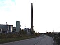
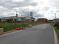 Britannia Refined Metals Plant, Botany Road, Northfleet (2) - geograph.org.uk - 4146553.jpg 4,608 × 3,456; 3.37 MB
-
 Britannia Refined Metals Plant, Botany Road, Northfleet - geograph.org.uk - 4146548.jpg 4,608 × 3,456; 3.42 MB
-
 Britannia Refined Metals, Northfleet - geograph.org.uk - 4181772.jpg 3,488 × 2,616; 2.21 MB
-
 Brook Road, Northfleet - geograph.org.uk - 3677778.jpg 3,488 × 2,616; 2.27 MB
-
 Brookside Road, Istead Rise - geograph.org.uk - 4562554.jpg 2,272 × 1,704; 808 KB
-
 Brown Road, Gravesend - geograph.org.uk - 4146819.jpg 3,488 × 2,616; 2.54 MB
-
 Bucks Cross Road, Northfleet - geograph.org.uk - 1996133.jpg 3,488 × 2,616; 2.16 MB
-
 Buddleia above the raised pavement in Cross Lane East - geograph.org.uk - 2475918.jpg 4,000 × 3,000; 4.4 MB
-
 Burch Road, Gravesend - geograph.org.uk - 3646847.jpg 640 × 360; 64 KB
-
 Burch Road, Rosherville - geograph.org.uk - 3677977.jpg 3,488 × 2,616; 2.21 MB
-
 Burch Road, Rosherville - geograph.org.uk - 3677981.jpg 3,488 × 2,616; 1.64 MB
-
 Burch Road, Rosherville - geograph.org.uk - 4136801.jpg 4,608 × 3,456; 3.63 MB
-
 Burnaby Road, Northfleet - geograph.org.uk - 3677916.jpg 3,488 × 2,616; 1.49 MB
-
 Burnaby Road, Northfleet - geograph.org.uk - 5318109.jpg 3,264 × 2,448; 2.63 MB
-
 Bycliffe Terrace, Northfleet - geograph.org.uk - 3677749.jpg 3,488 × 2,616; 2.23 MB
-
 B^M Home Store, 2-4, New Road - geograph.org.uk - 5527455.jpg 2,391 × 3,120; 1.81 MB
-
 Cambria Crescent, Riverview Park - geograph.org.uk - 3899107.jpg 3,488 × 2,616; 2.15 MB
-
 Cambrian Grove, Gravesend - geograph.org.uk - 4129092.jpg 3,488 × 2,616; 3.08 MB
-
 Cambrian Grove, Gravesend - geograph.org.uk - 5318245.jpg 3,041 × 2,281; 1.14 MB
-
 Campbell Road, Northfleet - geograph.org.uk - 3677757.jpg 3,488 × 2,616; 2.23 MB
-
 Canal footbridge near Gravesend - geograph.org.uk - 3645543.jpg 640 × 360; 105 KB
-
 Canterbury Road, Gravesend - geograph.org.uk - 3677597.jpg 3,488 × 2,616; 2.27 MB
-
 Cap George, Container Ship - geograph.org.uk - 2090061.jpg 2,560 × 1,920; 1.54 MB
-
 Cap George, Monrovia - geograph.org.uk - 2090068.jpg 2,560 × 1,920; 1.59 MB
-
 Captain Cabin of Princess Pocahontas at Gravesend Pier - geograph.org.uk - 3182549.jpg 4,288 × 3,216; 4.37 MB
-
 Caravan site at Denton - geograph.org.uk - 2375942.jpg 1,280 × 960; 613 KB
-
 Castlefields, Istead Rise - geograph.org.uk - 3427441.jpg 4,000 × 3,000; 4.3 MB
-
 Castlefields, Istead Rise - geograph.org.uk - 4562204.jpg 2,272 × 1,704; 738 KB
-
 Castlefields, Istead Rise - geograph.org.uk - 4562547.jpg 2,272 × 1,704; 809 KB
-
 Cecil Road, Northfleet - geograph.org.uk - 4129127.jpg 3,488 × 2,616; 2.74 MB
-
 Cedar Avenue, Gravesend - geograph.org.uk - 4129317.jpg 3,488 × 2,616; 2.47 MB
-
 Celebrating the Queen's 90th birthday - geograph.org.uk - 5007513.jpg 4,608 × 3,456; 3.9 MB
-
 Celebrating the Queen's 90th birthday - geograph.org.uk - 5007514.jpg 4,608 × 3,456; 3.89 MB
-
 Cement lorries at Northfleet - geograph.org.uk - 2073909.jpg 1,280 × 960; 577 KB
-
 Central Avenue, Gravesend - geograph.org.uk - 4129294.jpg 3,488 × 2,616; 3.14 MB
-
 Ceramic tiles, Gravesend High Street - geograph.org.uk - 3552290.jpg 473 × 1,000; 344 KB
-

-
 Chalk Quarry, Northfleet - geograph.org.uk - 4147515.jpg 2,712 × 2,034; 2.52 MB
-
 Chalk Road, Chalk - geograph.org.uk - 3899218.jpg 3,488 × 2,616; 1.34 MB
-
 Chalky Bank, Gravesend - geograph.org.uk - 4561750.jpg 2,272 × 1,704; 752 KB
-
 Chalky Bank, Gravesend - geograph.org.uk - 4561752.jpg 2,272 × 1,704; 791 KB
-
 Chapels, Northfleet Cemetery - geograph.org.uk - 2503576.jpg 640 × 480; 114 KB
-
 Chaucer Road, Northfleet - geograph.org.uk - 4138906.jpg 3,488 × 2,616; 3.91 MB
-
 Cherry blossom in Milton Churchyard - geograph.org.uk - 3900279.jpg 4,000 × 3,000; 4.28 MB
-
 Chiltern Road, Northfleet - geograph.org.uk - 4138945.jpg 3,488 × 2,616; 3.41 MB
-
 Chopped up telegraph poles - geograph.org.uk - 3138522.jpg 640 × 480; 136 KB
-
 Christ Church Crescent, Gravesend - geograph.org.uk - 4129433.jpg 3,488 × 2,616; 5.15 MB
-
 Christ Church Road, Gravesend - geograph.org.uk - 4129419.jpg 3,488 × 2,616; 3.37 MB
-
 Christ Church Road, Gravesend - geograph.org.uk - 5319229.jpg 3,264 × 2,448; 1.81 MB
-
 Christian Fields Avenue, Gravesend - geograph.org.uk - 4129326.jpg 3,488 × 2,616; 2.37 MB
-
 Christmas Shopping - geograph.org.uk - 4427343.jpg 2,592 × 3,872; 1.02 MB
-
 Church Lane, Chalk - geograph.org.uk - 3899240.jpg 3,488 × 2,616; 1.22 MB
-
 Church Lane, Chalk - geograph.org.uk - 3899241.jpg 3,488 × 2,616; 1.45 MB
-
 Church Lane, Chalk - geograph.org.uk - 3899245.jpg 3,488 × 2,616; 2.91 MB
-
 Church Lane, Chalk - geograph.org.uk - 3899252.jpg 3,488 × 2,616; 2.25 MB
-
 Church Path, Northfleet - geograph.org.uk - 3666210.jpg 3,488 × 2,616; 2.23 MB
-
 Church Road - geograph.org.uk - 3127615.jpg 640 × 480; 62 KB
-
 Church Walk, Gravesend - geograph.org.uk - 3677373.jpg 3,488 × 2,616; 2.23 MB
-
 Church Walk, Gravesend - geograph.org.uk - 3677425.jpg 3,488 × 2,616; 2.22 MB
-
 Churchill Road, Northfleet - geograph.org.uk - 5318226.jpg 3,121 × 2,341; 1.48 MB
-
 Churchill Road, Northfleet - geograph.org.uk - 5318227.jpg 3,125 × 2,345; 1.34 MB
-
 Cimba Wood, Riverview Park - geograph.org.uk - 4146793.jpg 3,488 × 2,616; 2.95 MB
-
 Cirrus Crescent, Riverview Park - geograph.org.uk - 3899069.jpg 3,488 × 2,616; 1.82 MB
-
 Clarence Place, Gravesend - geograph.org.uk - 1945384.jpg 1,280 × 960; 638 KB
-
 Clarence Place, Gravesend - geograph.org.uk - 4129415.jpg 3,488 × 2,616; 2.94 MB
-
 Clarence Place, Gravesend - geograph.org.uk - 4138791.jpg 3,488 × 2,616; 2.9 MB
-
 Clarence Place, Gravesend - geograph.org.uk - 5319220.jpg 3,264 × 2,448; 2.37 MB
-
 Clarence Place, Gravesend - geograph.org.uk - 5319223.jpg 3,264 × 2,448; 1.76 MB
-
 Clarence Row, Gravesend - geograph.org.uk - 4138789.jpg 3,488 × 2,616; 3.06 MB
-
 Clarence Row, Gravesend - geograph.org.uk - 5319242.jpg 3,264 × 2,448; 1.44 MB
-
 Clarendon Road, Gravesend - geograph.org.uk - 4388730.jpg 2,272 × 1,704; 783 KB
-
 Clarendon Road, Gravesend - geograph.org.uk - 5267453.jpg 3,264 × 2,448; 2.06 MB
-
 Clifton Marine Parade - geograph.org.uk - 5527382.jpg 3,264 × 2,448; 3.81 MB
-
 Clifton Marine Parade, Gravesend - geograph.org.uk - 1965222.jpg 3,488 × 2,616; 2.13 MB
-
 Clifton Marine Parade, Gravesend - geograph.org.uk - 4138810.jpg 3,488 × 2,616; 2.34 MB
-
 Clive Road, Gravesend - geograph.org.uk - 5092848.jpg 3,264 × 2,448; 2.17 MB
-
 Clubb's Jetty - geograph.org.uk - 4426135.jpg 2,592 × 1,944; 181 KB
-
 Co-operative food store, Istead Rise - geograph.org.uk - 2617289.jpg 640 × 480; 90 KB
-
 Cob pony, Filborough marshes - geograph.org.uk - 3561882.jpg 768 × 1,024; 179 KB
-
 Cobham Street, Gravesend - geograph.org.uk - 4129086.jpg 3,488 × 2,616; 2.59 MB
-
 Cobham Street, Gravesend - geograph.org.uk - 4408969.jpg 2,272 × 1,704; 740 KB
-
 Cobham Street, Gravesend - geograph.org.uk - 5267349.jpg 3,264 × 2,448; 1.59 MB
-
 College Road, Northfleet - geograph.org.uk - 4138835.jpg 3,488 × 2,616; 2.72 MB
-
 College Road, Northfleet - geograph.org.uk - 4138836.jpg 3,488 × 2,616; 2.92 MB
-
 College Road, Northfleet - geograph.org.uk - 4138840.jpg 3,488 × 2,616; 2.95 MB
-
 Collington Close, Northfleet - geograph.org.uk - 3677899.jpg 3,488 × 2,616; 2.23 MB


_-_geograph.org.uk_-_5602729.jpg)
_-_geograph.org.uk_-_5602736.jpg)


_-_geograph.org.uk_-_3164744.jpg)


_-_geograph.org.uk_-_4146553.jpg)


