Category:Shorne
Jump to navigation
Jump to search
English: Shorne is a village and civil parish in the Gravesham District of Kent, England. The parish is located to the south-east of Gravesend; the village is three miles (4.8km) from the town.
village in Kent, England, UK  | |||||
| Upload media | |||||
| Instance of | |||||
|---|---|---|---|---|---|
| Location | Gravesham, Kent, South East England, England | ||||
| Located in or next to body of water | |||||
| Population |
| ||||
| Said to be the same as | Shorne (Wikimedia duplicated page, civil parish) | ||||
 | |||||
Subcategories
This category has the following 11 subcategories, out of 11 total.
C
- The Copperfield, Shorne (4 F)
K
L
- Little St Katherine's (1 F)
O
- Oasts in Shorne (1 F)
- The Old Vicarage, Shorne (3 F)
P
R
- The Rose and Crown, Shorne (8 F)
S
- Shorne Ridgeway (9 F)
- Shorne War Memorial (1 F)
- Shornemead Fort (21 F)
V
- Shorne Village Sign (2 F)
Media in category "Shorne"
The following 200 files are in this category, out of 354 total.
(previous page) (next page)-
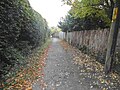
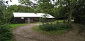 1st Shorne Scout Group - geograph.org.uk - 2112458.jpg 640 × 316; 82 KB
-
 A bay next to Higham Saltings - geograph.org.uk - 5560657.jpg 3,895 × 2,922; 2.1 MB
-
 A connection from Hoo Junction Up Yard - geograph.org.uk - 6520873.jpg 1,024 × 768; 460 KB
-
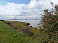
 A container ship heads upriver - geograph.org.uk - 5560863.jpg 4,000 × 3,000; 4.83 MB
-
 A drainage ditch on Shorne Marshes - geograph.org.uk - 5560642.jpg 4,000 × 3,000; 4.58 MB
-
 A Eurostar Cresting the Hill - geograph.org.uk - 329092.jpg 640 × 428; 100 KB
-
 A Javelin on its way to Gravesend - geograph.org.uk - 5462436.jpg 4,000 × 3,000; 4.73 MB
-
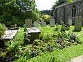 A Kent churchyard in summer - geograph.org.uk - 5461351.jpg 4,000 × 3,000; 4.87 MB
-
 A Pond in Shorne Wood - geograph.org.uk - 4598296.jpg 640 × 424; 108 KB
-
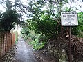
 A prescriptive prohibition, Shorne - geograph.org.uk - 2503292.jpg 640 × 480; 173 KB
-
 A2 at Cobham Services - geograph.org.uk - 4401650.jpg 1,600 × 1,046; 490 KB
-
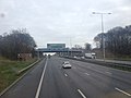
 A2 becomes M2 - geograph.org.uk - 1054042.jpg 640 × 481; 59 KB
-
 A2 Watling Street - geograph.org.uk - 4280717.jpg 3,264 × 2,448; 1.41 MB
-
 A2 Watling Street - geograph.org.uk - 4280721.jpg 3,264 × 2,448; 1.37 MB
-
 A2-M2 Junction - geograph.org.uk - 4401655.jpg 1,600 × 1,077; 466 KB
-
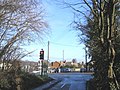 A226 crossroads, Higham - geograph.org.uk - 323049.jpg 640 × 481; 114 KB
-
 A289 Hasted Road - geograph.org.uk - 6046533.jpg 1,024 × 684; 192 KB
-
 A289 underpass, Crutches Lane - geograph.org.uk - 323063.jpg 640 × 480; 27 KB
-
 Anchor on a nautical grave, Shorne churchyard - geograph.org.uk - 3074053.jpg 694 × 1,024; 282 KB
-
 Approach to Thong - geograph.org.uk - 2604910.jpg 4,000 × 3,000; 4.23 MB
-
 Approaching Queen's Farm from the south - geograph.org.uk - 2936178.jpg 1,024 × 760; 115 KB
-
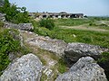
 Archaeologia cantiana (1900) (14597502970).jpg 2,388 × 3,194; 874 KB
-
 Astra Drive, Riverview Park - geograph.org.uk - 3899012.jpg 3,488 × 2,616; 2.29 MB
-
 Astra Drive, Riverview Park - geograph.org.uk - 4146797.jpg 3,488 × 2,616; 2.83 MB
-
 Aviary at Higham - geograph.org.uk - 2375842.jpg 1,280 × 960; 620 KB
-
 Bapchapshorne.jpg 600 × 502; 99 KB
-
 Base of an old gun emplacement on the Saxon Shore Way - geograph.org.uk - 5558763.jpg 4,000 × 3,000; 4.84 MB
-
 Base of the old Shornmead Light - geograph.org.uk - 6519478.jpg 1,024 × 768; 367 KB
-
 Bed of Thames and Medway Canal - geograph.org.uk - 6521513.jpg 1,024 × 768; 713 KB
-
 Bio-digester, Thorne Wood - geograph.org.uk - 3592499.jpg 2,592 × 1,944; 1.15 MB
-
 Biomass boiler, Shorne Wood - geograph.org.uk - 3592485.jpg 2,592 × 1,944; 1.12 MB
-
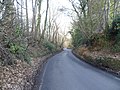
 Bowesden Lane, Shorne - geograph.org.uk - 1399167.jpg 640 × 480; 123 KB
-
 Bowesden Lane, Shorne - geograph.org.uk - 1399177.jpg 640 × 480; 116 KB
-
 Bowesden Lane, Shorne - geograph.org.uk - 5079060.jpg 3,264 × 2,448; 3.43 MB
-
 Brewers Road - geograph.org.uk - 2523244.jpg 640 × 480; 156 KB
-
 Brewers Road at the junction of Woodlands Lane - geograph.org.uk - 4651145.jpg 2,304 × 1,728; 827 KB
-
 Brewers Road at the junction of Woodlands Lane - geograph.org.uk - 4652448.jpg 2,304 × 1,728; 1.41 MB
-
 Brewers Road crossing the A2 - geograph.org.uk - 5176853.jpg 2,304 × 1,728; 1,009 KB
-
 Brewers Road, near Shorne - geograph.org.uk - 5079117.jpg 3,264 × 2,448; 2.52 MB
-
 Brewers Road, near Shorne - geograph.org.uk - 5079123.jpg 3,264 × 2,448; 2.38 MB
-
 Bridleway crosses Brewers Road - geograph.org.uk - 2003591.jpg 3,072 × 2,304; 2.01 MB
-
 Butchers Hill, Shorne - geograph.org.uk - 3899336.jpg 3,488 × 2,616; 1.63 MB
-
 Butchers Hill, Shorne - geograph.org.uk - 3899357.jpg 3,488 × 2,616; 2.19 MB
-
 Butchers Hill, Shorne - geograph.org.uk - 5175943.jpg 2,304 × 1,728; 837 KB
-
 Butchers Hill, Shorne - geograph.org.uk - 5176640.jpg 2,304 × 1,728; 1.29 MB
-
 Butchers Hill, Shorne - geograph.org.uk - 5184262.jpg 2,304 × 1,728; 1.74 MB
-
 By the old lighthouse - geograph.org.uk - 2480329.jpg 640 × 480; 127 KB
-
 Byway beside the Warren - geograph.org.uk - 1109648.jpg 640 × 481; 125 KB
-
 Canal Road, near Higham - geograph.org.uk - 3645529.jpg 640 × 360; 63 KB
-
 Car park and visitor centre, Shorne Wood - geograph.org.uk - 3592389.jpg 2,592 × 1,944; 856 KB
-
 Churchyard extension, Shorne - geograph.org.uk - 2503321.jpg 640 × 480; 127 KB
-
 City of London ^ Shornemead Fort - geograph.org.uk - 2408599.jpg 640 × 428; 62 KB
-
 Cob Drive, Shorne - geograph.org.uk - 3899362.jpg 3,488 × 2,616; 1.85 MB
-
 Coppiced woods in Shorne Wood - geograph.org.uk - 2003595.jpg 3,072 × 2,304; 2 MB
-
 Course of Thames and Medway Canal - geograph.org.uk - 6521360.jpg 1,024 × 768; 646 KB
-
 Crossing at Shorne - geograph.org.uk - 1323793.jpg 640 × 428; 61 KB
-
 Crossing at Shorne - geograph.org.uk - 1323794.jpg 640 × 428; 84 KB
-
 Crown Green, Shorne - geograph.org.uk - 3899366.jpg 3,488 × 2,616; 1.49 MB
-
 Crown Lane, Shorne - geograph.org.uk - 3899307.jpg 3,488 × 2,616; 3.71 MB
-
 Crown Lane, Shorne - geograph.org.uk - 3899319.jpg 3,488 × 2,616; 2.19 MB
-
 Crown Lane, Shorne - geograph.org.uk - 3899322.jpg 3,488 × 2,616; 2.01 MB
-
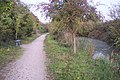
 Cycle path to Higham - geograph.org.uk - 1565263.jpg 640 × 427; 111 KB
-
 Cycle track between Gravesend and Higham - geograph.org.uk - 2113185.jpg 1,280 × 960; 629 KB
-

-
 Cyclepath beside the disused Canal - geograph.org.uk - 1565269.jpg 640 × 427; 110 KB
-
 Cycleway along old towpath - geograph.org.uk - 6521341.jpg 1,024 × 768; 448 KB
-
 Davys Place, Gravesend - geograph.org.uk - 4146802.jpg 3,488 × 2,616; 2.83 MB
-
 Detail of Shornmead Fort - geograph.org.uk - 6442204.jpg 4,000 × 3,000; 4.69 MB
-
 Disused Barn in Green Farm - geograph.org.uk - 1110568.jpg 640 × 481; 106 KB
-
 Disused Pit near Green Farm - geograph.org.uk - 1110573.jpg 640 × 481; 144 KB
-
 Ditch, Shorne Marshes - geograph.org.uk - 6520264.jpg 1,024 × 768; 529 KB
-
 Ditch, Shorne Marshes - geograph.org.uk - 6520283.jpg 1,024 × 768; 587 KB
-
 Drainage ditch and berries on Shorne Marshes - geograph.org.uk - 5552061.jpg 4,000 × 3,000; 4.96 MB
-
 Drainage ditch on Shorne Marshes - geograph.org.uk - 5551088.jpg 4,000 × 3,000; 4.99 MB
-
 Dyke on Shorne Marshes - geograph.org.uk - 2118856.jpg 1,280 × 960; 612 KB
-
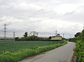
 Electricity pylons near Lower Road - geograph.org.uk - 2112570.jpg 640 × 427; 65 KB
-
 Entrance to Randall Bottom - geograph.org.uk - 2112519.jpg 640 × 329; 78 KB
-
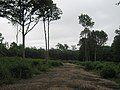
 Entry to Starmore Wood - geograph.org.uk - 2280086.jpg 1,024 × 768; 359 KB
-

-
 Farm building at Green Farm, Shorne - geograph.org.uk - 3074183.jpg 1,024 × 756; 148 KB
-
 Farm buildings at Green Farm - geograph.org.uk - 3566997.jpg 1,024 × 818; 209 KB
-
 Farm buildings at Green Farm, Shorne - geograph.org.uk - 3074165.jpg 752 × 1,024; 230 KB
-

-
 Fishing lake, Shorne Wood - geograph.org.uk - 3592523.jpg 2,592 × 1,944; 1.31 MB
-
 Flooded field, Higham - geograph.org.uk - 3840237.jpg 640 × 480; 103 KB
-
 Footpath alongside Red House - geograph.org.uk - 3320466.jpg 4,000 × 3,000; 3.96 MB
-
 Footpath junction on Muggins Lane - geograph.org.uk - 1110638.jpg 640 × 481; 92 KB
-
 Foreshore in front of Shornmead Fort - geograph.org.uk - 6518942.jpg 1,024 × 768; 358 KB
-
 Forge Lane, Shorne - geograph.org.uk - 3899370.jpg 3,488 × 2,616; 1.55 MB
-
 Forge Lane, Shorne - geograph.org.uk - 3899373.jpg 3,488 × 2,616; 1.64 MB
-
 Forge Lane, Shorne - geograph.org.uk - 3899375.jpg 3,488 × 2,616; 1.9 MB
-
 Former Carriage Drive - geograph.org.uk - 4598282.jpg 424 × 640; 106 KB
-
 Freight train waiting to pass Hoo Junction - geograph.org.uk - 5463377.jpg 4,000 × 3,000; 4.71 MB
-
 Gas Main Warning Sign - geograph.org.uk - 4188899.jpg 3,488 × 2,616; 2.17 MB
-
 Gazelle Glade, Riverview Park - geograph.org.uk - 3899009.jpg 3,488 × 2,616; 1.88 MB
-
 Genesta Glade, Riverview Park - geograph.org.uk - 3899004.jpg 3,488 × 2,616; 1.62 MB
-
 Glenrosa Gardens, Riverview Park - geograph.org.uk - 3899008.jpg 3,488 × 2,616; 1.95 MB
-
 Goods Train towards Gravesend - geograph.org.uk - 1089024.jpg 640 × 481; 65 KB
-
 Graffiti at Shornmead Fort - geograph.org.uk - 6442208.jpg 4,000 × 3,000; 4.96 MB
-
 Graffiti by the M2 - geograph.org.uk - 329120.jpg 640 × 428; 88 KB
-
 Gravesend Reach near Shornmead Fort - geograph.org.uk - 5552067.jpg 3,879 × 2,909; 2.27 MB
-
 Gravesend Road, Shorne - geograph.org.uk - 3899265.jpg 3,488 × 2,616; 1.65 MB
-
 Gravesend Road, Shorne - geograph.org.uk - 3899276.jpg 3,488 × 2,616; 1.76 MB
-
 Gravesend Road, Shorne - geograph.org.uk - 3899286.jpg 3,488 × 2,616; 1.87 MB
-
 Gravesend Road, Shorne - geograph.org.uk - 3899379.jpg 3,488 × 2,616; 2.16 MB
-
 Gravestone in Shorne Churchyard - geograph.org.uk - 5461361.jpg 4,000 × 3,000; 4.79 MB
-
 Gravestone in Shorne Churchyard - geograph.org.uk - 5461373.jpg 4,000 × 3,000; 4.91 MB
-
 Green Farm from Green Farm Road - geograph.org.uk - 3320459.jpg 4,000 × 3,000; 4.02 MB
-
 Green Farm Lane, Shorne - geograph.org.uk - 3899378.jpg 3,488 × 2,616; 1.76 MB
-
 Green Farm, just east of Chalk - geograph.org.uk - 1595443.jpg 640 × 480; 62 KB
-
 Green Farm, seen from the west - geograph.org.uk - 3074098.jpg 929 × 1,024; 213 KB
-
 Green Farm, Shorne, in July - geograph.org.uk - 3557967.jpg 759 × 1,024; 253 KB
-
 High tide at Shornmead - geograph.org.uk - 2118725.jpg 1,280 × 960; 604 KB
-
 High tide near Shornmead Fort - geograph.org.uk - 2118732.jpg 1,280 × 960; 639 KB
-
 Higham Saltings - geograph.org.uk - 5543192.jpg 3,895 × 2,922; 2.11 MB
-
 Higham village sign - geograph.org.uk - 3899390.jpg 3,488 × 2,616; 2.23 MB
-
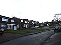
 Hollands Close, Shorne - geograph.org.uk - 3899342.jpg 3,488 × 2,616; 2.3 MB
-
 Hoo Junction - geograph.org.uk - 5462419.jpg 4,000 × 3,000; 4.57 MB
-
 Hoo Junction - geograph.org.uk - 6215311.jpg 4,000 × 3,000; 4.65 MB
-
 House in Thong - geograph.org.uk - 2604903.jpg 4,000 × 3,000; 4.07 MB
-
 House on Butchers Hill, Shorne - geograph.org.uk - 5176644.jpg 2,304 × 1,728; 1.18 MB
-
 House on Peartee Lane, Shorne Ridgeway - geograph.org.uk - 4651117.jpg 2,304 × 1,728; 847 KB
-
 House on Peartree Lane, Higham - geograph.org.uk - 4651128.jpg 2,304 × 1,728; 2.02 MB
-
 In the cornfields - geograph.org.uk - 2502368.jpg 640 × 480; 133 KB
-

-
 Inn on the Lake, near Cobham - geograph.org.uk - 3898990.jpg 3,488 × 2,616; 2.15 MB
-
 Inside Shornmead Fort - geograph.org.uk - 2118690.jpg 1,280 × 960; 630 KB
-
 Inside Shornmead Fort - geograph.org.uk - 4526995.jpg 4,000 × 3,000; 4.43 MB
-
 Inside Shornmead Fort - geograph.org.uk - 5560858.jpg 4,000 × 3,000; 4.83 MB
-
 Inside Shornmead Fort - geograph.org.uk - 5560859.jpg 4,000 × 3,000; 4.83 MB
-
 Inside Shornmead Fort - geograph.org.uk - 6442206.jpg 4,000 × 3,000; 4.68 MB
-
 Interior of Shornmead Fort - geograph.org.uk - 6442197.jpg 4,000 × 3,000; 4.89 MB
-
 Interior of Shornmead Fort - geograph.org.uk - 6442199.jpg 4,000 × 3,000; 5.1 MB
-
 Interior of Shornmead Fort - geograph.org.uk - 6442201.jpg 4,000 × 3,000; 4.91 MB
-
 Junction 1, M2 Motorway - geograph.org.uk - 4280724.jpg 3,264 × 2,448; 1.33 MB
-
 Junction of Crown Lane and The Street, Shorne - geograph.org.uk - 1728732.jpg 3,488 × 2,616; 2.2 MB
-
 Kissing Gate on Brewers Road - geograph.org.uk - 1109617.jpg 640 × 481; 118 KB
-
 Kissing Gate on Pear Tree Lane - geograph.org.uk - 1109626.jpg 640 × 481; 103 KB
-
 Lake to the north of Shorne Wood Visitor Centre - geograph.org.uk - 3592370.jpg 2,516 × 1,838; 974 KB
-
 Level crossing, Hoo Junction - geograph.org.uk - 6520866.jpg 1,024 × 768; 463 KB
-
 Lighthouse in the Thames - geograph.org.uk - 4188824.jpg 3,488 × 2,616; 2.08 MB
-
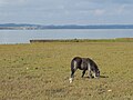 Lone horse on Higham Saltings - geograph.org.uk - 5558767.jpg 4,000 × 3,000; 4.64 MB
-
 Lone horse on Higham Saltings - geograph.org.uk - 5558776.jpg 4,000 × 3,000; 4.91 MB
-
 Looking across Shorne Marshes - geograph.org.uk - 2375840.jpg 1,280 × 960; 625 KB
-
 Looking across Shorne Marshes - geograph.org.uk - 2375929.jpg 1,280 × 960; 606 KB
-
 Looking across Shornmead Fort - geograph.org.uk - 4526987.jpg 4,000 × 3,000; 4.03 MB
-

-
 Looking towards Brewers Wood from Park Pale - geograph.org.uk - 3323531.jpg 4,000 × 3,000; 4.17 MB
-
-
 Looking towards Hoo Junction - geograph.org.uk - 5462427.jpg 4,000 × 3,000; 4.95 MB
-
 Looking towards Hoo Junction - geograph.org.uk - 6215309.jpg 4,000 × 3,000; 4.59 MB
-
 Looking towards the Thames from near Upper Ifield - geograph.org.uk - 1728728.jpg 3,430 × 2,572; 2.25 MB
-
 Lower Road looking towards Higham - geograph.org.uk - 3320470.jpg 4,000 × 3,000; 3.73 MB
-
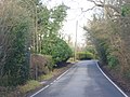
 Lower Road, Shorne - geograph.org.uk - 1402755.jpg 640 × 480; 80 KB
-
 M2 motorway - geograph.org.uk - 2871182.jpg 640 × 426; 72 KB
-
 Malthouse Lane, Shorne - geograph.org.uk - 3899368.jpg 3,488 × 2,616; 1.4 MB
-
 Marling Way, Gravesend - geograph.org.uk - 4146800.jpg 3,488 × 2,616; 2.63 MB
-
 Metal railings leading down to the Thames - geograph.org.uk - 4188809.jpg 3,488 × 2,616; 2.27 MB
-
 Military road from Shornmead Fort - geograph.org.uk - 6520203.jpg 1,024 × 768; 504 KB
-
 Mill Hill Lane, Shorne - geograph.org.uk - 3899324.jpg 3,488 × 2,616; 2.14 MB
-
 Monument in St Peter and St Paul Churchyard, Shorne - geograph.org.uk - 5461343.jpg 4,000 × 3,000; 4.78 MB
-
 Mud and shingle in a bay next to Higham Saltings - geograph.org.uk - 5560629.jpg 3,799 × 2,849; 1.81 MB
-
 Mud and shingle in a bay next to Higham Saltings - geograph.org.uk - 5560650.jpg 3,895 × 2,922; 2.41 MB
-
 Multicat passing old Shornmead Light remains - geograph.org.uk - 6519558.jpg 1,024 × 768; 402 KB
-
 National Grid 400kV power lines - geograph.org.uk - 6520307.jpg 1,024 × 768; 541 KB
-
 National Grid 400kV pylon - geograph.org.uk - 6520299.jpg 768 × 1,024; 385 KB
-
 Neat garden on Peartree Lane, Higham - geograph.org.uk - 4651127.jpg 2,304 × 1,728; 842 KB
-
 Old barn on Thong Lane - geograph.org.uk - 1110652.jpg 640 × 481; 67 KB
-
 Old Kissing Gate on footpath - geograph.org.uk - 1109632.jpg 640 × 481; 133 KB
-
 Old lighthouse seen from the Saxon Shore Way - geograph.org.uk - 5560861.jpg 4,000 × 3,000; 4.51 MB
-
 Old military road to Shornmead Fort - geograph.org.uk - 6520902.jpg 1,024 × 768; 514 KB
-
 Old relic of Milton Ranges - geograph.org.uk - 5462384.jpg 4,000 × 3,000; 4.97 MB
-
 Old sea wall remains, Eastcourt-Shorne Marshes - geograph.org.uk - 6518761.jpg 1,024 × 768; 554 KB
-
 On Shorne Marshes - geograph.org.uk - 2118676.jpg 1,280 × 960; 656 KB
-
 On Shorne Marshes - geograph.org.uk - 5552063.jpg 4,000 × 3,000; 5.03 MB
-
 On the Saxon Shore Way alongside Higham Saltings - geograph.org.uk - 5558788.jpg 4,000 × 3,000; 4.54 MB
-
 On the Saxon Shore Way near Shornmead Fort - geograph.org.uk - 5543177.jpg 3,759 × 2,819; 1.82 MB
-
 Park Pale - geograph.org.uk - 2871093.jpg 640 × 427; 88 KB
-
 Part of Upper Shorne, Kent.jpg 1,574 × 282; 100 KB
-
 Path in Shorne Woods Country Park - geograph.org.uk - 2502550.jpg 640 × 480; 148 KB
-
 Path junction in Shorne Wood Country Park - geograph.org.uk - 2003603.jpg 3,072 × 2,304; 2.82 MB
-
 Path Markers in Shorne Wood - geograph.org.uk - 4598288.jpg 424 × 640; 105 KB
-
 Path off Butchers Hill, Shorne - geograph.org.uk - 5176636.jpg 2,304 × 1,728; 784 KB
-
 Pear Tree Lane, near Shorne - geograph.org.uk - 1398701.jpg 640 × 480; 100 KB
-
 Pear Tree Lane, near Shorne - geograph.org.uk - 5079035.jpg 3,264 × 2,448; 2.12 MB
-
 Pear Tree Lane, Shorne - geograph.org.uk - 5079040.jpg 3,264 × 2,448; 2.03 MB
-
 Pear Tree Lane, Shorne - geograph.org.uk - 5079045.jpg 3,264 × 2,448; 1.68 MB
-
 Peartree Lane - geograph.org.uk - 3323582.jpg 4,000 × 3,000; 4.17 MB
-
 Peartree Lane at the junction of Gravesend Road - geograph.org.uk - 4648900.jpg 2,304 × 1,728; 858 KB
-
 Peartree Lane at the junction of Villa Road - geograph.org.uk - 4648836.jpg 2,304 × 1,728; 876 KB
-
 Peartree Lane entering Higham - geograph.org.uk - 4651131.jpg 2,304 × 1,728; 815 KB
-
 Peartree Lane, Higham - geograph.org.uk - 3323546.jpg 4,000 × 3,000; 4.25 MB
-
 Peartree Lane, Higham - geograph.org.uk - 3323593.jpg 4,000 × 3,000; 4.3 MB
-
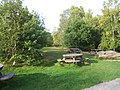 Picnic area, Shorne Wood Country Park - geograph.org.uk - 3592533.jpg 2,592 × 1,944; 1.34 MB
-
 Pillbox near Shornmead Fort - geograph.org.uk - 4188817.jpg 3,488 × 2,616; 2.28 MB
-
 Pillbox on the banks of the Thames - geograph.org.uk - 4188833.jpg 3,128 × 2,346; 1.84 MB
-
 Power lines, Shorne Marshes - geograph.org.uk - 6520620.jpg 1,024 × 768; 434 KB
-
 Prospectshorne.jpg 600 × 337; 90 KB
-
 Pylons across the marshes seen from Lower Road - geograph.org.uk - 4827742.jpg 4,608 × 3,456; 3.29 MB
-
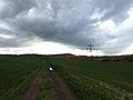 Pylons and farm track near Shorne - geograph.org.uk - 3899273.jpg 3,488 × 2,616; 2.18 MB


_(14597502970).jpg)


