Category:Agricultural maps of India
Jump to navigation
Jump to search
Media in category "Agricultural maps of India"
The following 16 files are in this category, out of 16 total.
-
Image taken from page 78 of 'Longmans' Junior School Geography, etc' (11196209185).jpg 2,107 × 2,753; 1.26 MB
-
Image taken from page 78 of 'Longmans' Junior School Geography, etc' (15968066584).jpg 1,789 × 2,399; 678 KB
-
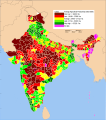
India districts productivity.pdf 2,737 × 3,091; 775 KB
-
India districts productivity.svg 1,752 × 1,979; 1.51 MB
-
India Natural vegetation.svg 1,486 × 1,734; 582 KB
-
India-farm-power-brighter-farming.jpg 556 × 479; 30 KB
-
Major crop areas India.png 1,486 × 1,734; 366 KB
-
Minor crops of India.png 1,486 × 1,734; 348 KB
-
Rice Production by States India.png 824 × 907; 209 KB
-
Share of agriculture in GSDP in India (2001-02).png 624 × 704; 66 KB
-
SOS-UP-2-13-Jun2020-1 770x433 0-x433.webp 770 × 433; 43 KB
-
Wheat cultivation in India.jpg 1,024 × 1,284; 225 KB
-
Zones de théiculture de l'Assam, 1873.jpg 6,055 × 4,137; 3.46 MB


