Category:Biogeographical maps of India
Jump to navigation
Jump to search
Subcategories
This category has the following 3 subcategories, out of 3 total.
Media in category "Biogeographical maps of India"
The following 19 files are in this category, out of 19 total.
-
Areale Boswellia ovalifoliolata.jpg 712 × 633; 100 KB
-
Asanada agharkari range.png 2,074 × 2,437; 458 KB
-
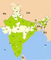
Azolla pinnata india distribution.jpg 1,486 × 1,734; 171 KB
-
Azolla pinnata india distribution.svg 1,486 × 1,734; 230 KB
-
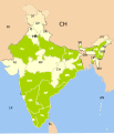
Equisetum ramosissimum india distribution.png 1,486 × 1,734; 346 KB
-
India and South Asia Köppen climate map with legend.jpg 545 × 537; 60 KB
-
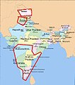
India wine regions.JPG 530 × 599; 47 KB
-
India's forest cover- by state (percentage of land area).png 3,818 × 4,600; 1,002 KB
-
Indian Banyan India distribution.png 1,510 × 1,753; 460 KB
-
Isoetes india distribution.png 1,486 × 1,734; 431 KB
-
K-M Road Vegetation Map.jpg 936 × 657; 879 KB
-
Kerala Bird Species (2021) vs Silver Line.png 2,365 × 3,421; 532 KB
-
Kerala forest divisions.pdf 1,754 × 2,481; 475 KB
-
Kerala forest types.pdf 2,481 × 3,508; 549 KB
-
Kerala Threatened Bird Species (2021) vs Silver Line.png 2,365 × 3,421; 520 KB
-
Map showing the type locality of Eurindicus bhugarbha.png 804 × 622; 728 KB
-
Minervarya pentali map.svg 389 × 327; 3.57 MB
-
Nasikabatrachus bhupathi map.svg 420 × 340; 3.57 MB
-
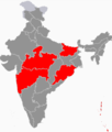
Tobacco ban India.svg 722 × 885; 261 KB


