Category:2015 maps of Europe
Jump to navigation
Jump to search
Temperate regions: North America · South America · Africa · Europe · Asia · Oceania – Polar regions: – Other regions:
English: 2015 maps of Europe
Español: Mapas de Europa en 2015
Suomi: Euroopan kartat vuodelta 2015
Română: Hărți ale Europei din 2015
Subcategories
This category has the following 24 subcategories, out of 24 total.
A
- 2015 maps of Austria (1 F)
B
- 2015 maps of Bulgaria (6 F)
C
- 2015 maps of Croatia (6 F)
D
- 2015 maps of Denmark (5 F)
E
F
G
- 2015 maps of Greece (15 F)
H
- 2015 maps of Hungary (10 F)
L
- 2015 maps of Lithuania (1 F)
- 2015 maps of Luxembourg (3 F)
N
P
- 2015 maps of Poland (3 F)
R
- 2015 maps of Romania (3 F)
- 2015 maps of Russia (5 F)
S
- 2015 maps of Slovakia (2 F)
- 2015 maps of Slovenia (3 F)
- 2015 maps of Switzerland (12 F)
T
- Tour de France maps 2015 (8 F)
U
Media in category "2015 maps of Europe"
The following 75 files are in this category, out of 75 total.
-
2015 Critérium du Dauphiné, Stage 3 map.png 1,200 × 622; 666 KB
-
2015 UEFA European Under-17 Championship map.svg 610 × 457; 377 KB
-
2015 UEFA U-19 European Championship map.svg 610 × 457; 367 KB
-
2015 UEFA Women's Under-17 Championship map.svg 610 × 457; 383 KB
-
20151026 WesternBalkans.pdf 1,754 × 1,239; 1.12 MB
-
20151125 DailyMap WBroute 2.pdf 1,754 × 1,239; 907 KB
-
20151208 Syria to EU daily map.pdf 1,754 × 1,239; 1.11 MB
-
Balearic shearwater movements.jpg 1,197 × 1,198; 234 KB
-
De grønne i Europa.svg 512 × 272; 1.55 MB
-
Death-rate-from-opioid-use-who,Europe,2015.svg 850 × 600; 152 KB
-
Death-rate-smoking,Europe,2015.svg 850 × 699; 153 KB
-
ECDM 20150206 Europe SevereWeather.pdf 1,625 × 1,125; 696 KB
-
ECDM 20150305 SevereWeather Europe.pdf 1,625 × 1,125; 796 KB
-
ECDM 20150707 Fires.pdf 1,625 × 1,125; 550 KB
-
ECDM 20151130 NEurope SW 2.pdf 1,625 × 1,125; 859 KB
-
Ejlinge map.jpg 1,365 × 546; 45 KB
-
EU map BG-v-.png 450 × 391; 152 KB
-
Euro map 2015 hu.png 960 × 1,000; 174 KB
-
Europe28eci2015.png 866 × 894; 192 KB
-
High Speed Railroad Map of Europe 2015.svg 800 × 600; 688 KB
-
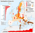
Karte Flüchtlingskrise in Europa 2015.png 2,192 × 2,040; 809 KB
-
KNMI Analyse 2015071412.gif 622 × 400; 64 KB
-
KNMI Analyse 2015080812.gif 622 × 400; 68 KB
-
KNMI Analyse 2015082412.gif 1,083 × 696; 49 KB
-
Konsumverbot.svg 680 × 520; 500 KB
-
LGTB en Europa.png 1,456 × 1,168; 65 KB
-
Map of the European Migrant Crisis 2015.png 2,192 × 2,040; 803 KB
-
NRL MRY 500hpa+SLP 20150729.jpg 1,000 × 700; 225 KB
-
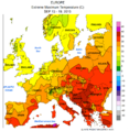
NWS-NOAA Europe Extreme maximum temperature 2015 Sum.png 2,439 × 2,490; 405 KB
-
NWS-NOAA Europe Extreme maximum temperature AUG 02- 08, 2015.png 2,431 × 2,479; 233 KB
-
NWS-NOAA Europe Extreme maximum temperature AUG 09 - 15, 2015.png 2,437 × 2,488; 320 KB
-
NWS-NOAA Europe Extreme maximum temperature AUG 16 - 22, 2015.png 2,437 × 2,489; 315 KB
-
NWS-NOAA Europe Extreme maximum temperature AUG 23 - 29, 2015.png 2,437 × 2,488; 310 KB
-
NWS-NOAA Europe Extreme maximum temperature AUG 30 - SEP 05, 2015.png 2,438 × 2,489; 320 KB
-
NWS-NOAA Europe Extreme maximum temperature JUL 12 - 18, 2015.png 2,436 × 2,484; 310 KB
-
NWS-NOAA Europe Extreme maximum temperature JUL 19 - 25, 2015.png 2,427 × 2,487; 313 KB
-
NWS-NOAA Europe Extreme maximum temperature JUL 26 - AUG 01, 2015.png 2,436 × 2,488; 315 KB
-
NWS-NOAA Europe Extreme maximum temperature JUL 5 - 11, 2015.png 2,422 × 2,483; 292 KB
-
NWS-NOAA Europe Extreme maximum temperature JUN 28 - JUL 04, 2015.png 2,444 × 2,492; 315 KB
-
NWS-NOAA Europe Extreme maximum temperature SEP 06 - 12, 2015.png 2,439 × 2,490; 306 KB
-
NWS-NOAA Europe Extreme maximum temperature SEP 13 - 19, 2015.png 2,439 × 2,491; 313 KB
-
NWS-NOAA Europe Extreme maximum temperature SEP 20 - 26, 2015.png 2,439 × 2,490; 301 KB
-
NWS-NOAA Europe Temperature anomaly AUG 02- 08, 2015.png 2,431 × 2,479; 218 KB
-
NWS-NOAA Europe Temperature anomaly AUG 09 - 15, 2015.png 2,437 × 2,488; 310 KB
-
NWS-NOAA Europe Temperature anomaly AUG 16 - 22, 2015.png 2,437 × 2,489; 304 KB
-
NWS-NOAA Europe Temperature anomaly AUG 23 - 29, 2015.png 2,437 × 2,488; 295 KB
-
NWS-NOAA Europe Temperature anomaly AUG 30 - SEP 05, 2015.png 2,438 × 2,489; 301 KB
-
NWS-NOAA Europe Temperature anomaly JUL 12 - 18, 2015.png 2,436 × 2,484; 299 KB
-
NWS-NOAA Europe Temperature anomaly JUL 19 - 25, 2015.png 2,427 × 2,487; 297 KB
-
NWS-NOAA Europe Temperature anomaly JUL 26 - AUG 01, 2015.png 2,436 × 2,488; 300 KB
-
NWS-NOAA Europe Temperature anomaly JUL 5 - 11, 2015.png 2,433 × 2,479; 268 KB
-
NWS-NOAA Europe Temperature anomaly JUN 28 - JUL 04, 2015.png 2,448 × 2,484; 307 KB
-
NWS-NOAA Europe Temperature anomaly SEP 06 - 12, 2015.png 2,439 × 2,490; 285 KB
-
NWS-NOAA Europe Temperature anomaly SEP 13 - 19, 2015.png 2,439 × 2,491; 314 KB
-
NWS-NOAA Europe Temperature anomaly SEP 20 - 26, 2015.png 2,439 × 2,490; 296 KB
-
NWS-NOAA Omega wind heatwave June 28-July 4, 2015.jpg 610 × 490; 286 KB
-
NWS-NOAA Western FSU Temperature anomaly SEP 20 - 26, 2015.png 2,763 × 2,284; 181 KB
-
OMV Downstream Portfolio 2015 EN.png 1,150 × 764; 310 KB
-
OMV Downstream Portfolio 2015.jpg 1,346 × 904; 531 KB
-
OMV Downstream Portfolio 2015.png 1,346 × 904; 251 KB
-
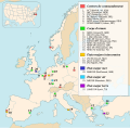
OTAN headquarters map.svg 1,099 × 1,079; 931 KB
-
PAT - Europe.gif 2,274 × 2,400; 1.18 MB
-
Polish language in Europe.png 1,236 × 1,245; 65 KB
-
Refugee crisis in Europe Q1 and Q2 2015.svg 983 × 897; 291 KB
-
Refugee crisis in Europe Q1-Q4 2015.svg 983 × 897; 287 KB
-
Regional GDP PPP per capita in former GDL.png 720 × 728; 189 KB
-
Sentinel-1A mosaic of Europe ESA348533.jpg 1,772 × 1,056; 1.7 MB
-
Share that disagrees that vaccines are safe in Europe, OWID.svg 850 × 600; 166 KB
-
The 10 most expensive streets in Paris, 2015 - Meilleurs Agents.svg 512 × 293; 129 KB
-
Triturus range 2015.png 1,200 × 864; 689 KB
-
Türkvizyon 2015 map.svg 1,000 × 665; 623 KB
-
Western Capercaillie Tetrao urogallus distribution in Europe map.png 800 × 770; 131 KB
-
WesternBalkans DailyMap 23 09.pdf 1,754 × 1,239; 1.03 MB
-
Տարածքային վեճերը Եվրոպայում (2015).png 1,984 × 1,736; 194 KB


