
Category:2015 maps of the United Kingdom
Media in category "2015 maps of the United Kingdom"
The following 10 files are in this category, out of 10 total.
-
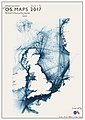 Britains Favourite Sea Routes.jpg 701 × 992; 114 KB
-
 Canterbury UK local election 2015 map.svg 1,076 × 1,266; 505 KB
-
 Canterbury UK ward map 2015 (blank).svg 1,076 × 1,266; 503 KB
-
 Canterbury unparished area UK locator map.svg 1,076 × 1,266; 453 KB
-
 City of York Council election 2015 map.svg 1,516 × 1,483; 468 KB
-
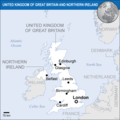 Great Britain UNOCHA.png 987 × 987; 187 KB
-
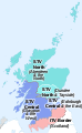 ITV network microregions in Scotland map 2015.svg 486 × 791; 255 KB
-
 Sheffield unparished area UK locator map.svg 1,425 × 996; 415 KB
-
 STV microregions map 2015 (long captions).svg 486 × 791; 245 KB
-
 Whitstable and Herne Bay unparished area UK locator map.svg 1,076 × 1,266; 453 KB


.svg)

.svg)