Category:2010s maps of France
Jump to navigation
Jump to search
Subcategories
This category has the following 7 subcategories, out of 7 total.
- 2014 maps of France (17 F)
- 2018 maps of France (8 F)
- 2019 maps of France (11 F)
'
- 2010s maps of Paris (47 F)
T
Media in category "2010s maps of France"
The following 3 files are in this category, out of 3 total.
-
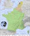
PAT - France and Benelux.gif 2,000 × 2,400; 1.99 MB
-
Pie densité.jpg 938 × 768; 117 KB
-
Travel times in train from Paris map - 2015.svg 588 × 550; 375 KB


