Category:2010s maps of Paris
Jump to navigation
Jump to search
Media in category "2010s maps of Paris"
The following 47 files are in this category, out of 47 total.
-
2014 collegiale Saint-Marcel emplacement.jpg 533 × 446; 235 KB
-
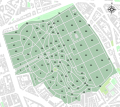
Blank map of the Père-Lachaise Cemetery - OSM 2016.svg 2,118 × 1,851; 342 KB
-
Bois de Boulogne - Open Street Map 2015.svg 512 × 475; 2.24 MB
-
Densidad de poblacion 2011 por arrondissements.png 1,389 × 1,195; 201 KB
-
Divisions of the Père-Lachaise Cemetery - OSM 2016.svg 1,900 × 1,700; 284 KB
-
Green spaces in Paris, 2012.svg 1,371 × 893; 2.02 MB
-
Historical map of Paris Metro - 1899-2012 reduced.gif 977 × 897; 9.36 MB
-
Historical map of Paris Metro - 1899-2012.gif 4,282 × 3,933; 50.5 MB
-
Jardin d'acclimatation (Paris) location map.svg 888 × 258; 1.05 MB
-
Jardins d'immeubles de la Porte de Vincennes - OSM 2017.svg 512 × 431; 5 KB
-
Jardins des Champs-Élysées - OpenStreetMap 2015.svg 512 × 380; 247 KB
-
Jms paris elevation 2014.svg 1,887 × 1,575; 2.37 MB
-
La Samaritaine 2015 plan.svg 1,373 × 1,131; 7 KB
-
Le stationnement dans Paris 2016.svg 1,020 × 567; 7 KB
-
Le top 10 des rues les plus chères de Paris, 2014 - Le Parisien.svg 512 × 293; 130 KB
-
Les 10 rues les moins chères de Paris, 2012 - Huffington Post.svg 512 × 293; 131 KB
-
Les 10 rues les moins chères de Paris, 2017 - Challenges.svg 512 × 299; 65 KB
-
Les 10 rues les plus chères de Paris, 2012 - Huffington Post.svg 512 × 293; 130 KB
-
Map of green spaces in Paris, 2012.svg 1,371 × 893; 3.56 MB
-
Map of the Père-Lachaise Cemetery - OSM 2016.svg 2,100 × 1,800; 523 KB
-
Map of Île de la Cité - OpenStreetMap 2015.svg 2,000 × 1,050; 678 KB
-
Map of Île de la Cité with monuments - OpenStreetMap 2015.svg 2,401 × 1,637; 564 KB
-
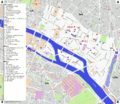
Map of Île Saint-Louis - OpenStreetMap 2015.svg 2,154 × 1,793; 252 KB
-
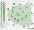
PA INSEE 2012 jms.png 4,538 × 4,048; 5.2 MB
-
Paris 4th arrondissement map with listings 2.png 3,460 × 3,008; 1.24 MB
-
Paris department land cover map, January 2012.svg 1,371 × 893; 14.95 MB
-
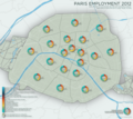
Paris INSEE employment 2012 jms.png 4,538 × 4,048; 3.94 MB
-
Paris IV porte du Chaume emplacement sur carte actuelle.jpg 387 × 318; 113 KB
-
Place Charles-de-Gaulle - OSM 2016 Tunnel de l'Etoile.svg 512 × 401; 486 KB
-
Place Charles-de-Gaulle - OSM 2016.svg 512 × 401; 440 KB
-
Place Charles-de-Gaulle and Arc de Triomphe - OSM 2016.svg 1,110 × 700; 91 KB
-
Place de la Concorde - OSM 2016.svg 512 × 508; 140 KB
-
Place du Panthéon - OpenStreetMap 2015.svg 512 × 366; 99 KB
-
Place Vendôme 2015.svg 2,100 × 1,880; 33 KB
-
Plan of the Galeries Lafayette Haussmann 2015.svg 512 × 334; 74 KB
-
Plan of the Parc de la Villette - OSM 2016.svg 1,682 × 1,913; 346 KB
-
Plan of the Parc de la Villette with follies - OSM 2016.svg 1,680 × 1,910; 240 KB
-
Plan of the Parc de la Villette with gardens - OSM 2016.svg 1,682 × 1,913; 205 KB
-
PneumaticParis1868.svg 1,678 × 1,344; 806 KB
-
Population density map of Paris in 2012.svg 512 × 293; 109 KB
-
Revenu fiscal médian par unité de consommation en 2001 - Paris.svg 1,320 × 730; 61 KB
-
Résultats des élections municipales à Paris en 2014.svg 4,280 × 3,396; 36 KB
-
Social housing in Paris DRIHL 2012.svg 1,320 × 730; 63 KB
-
Streets in the Père-Lachaise Cemetery - OSM 2016.svg 2,000 × 1,800; 1.18 MB
-
The 10 most expensive streets in Paris, 2015 - Meilleurs Agents.svg 512 × 293; 129 KB
-
Île aux Cygnes - OSM 2016.svg 1,986 × 804; 166 KB


