Category:2018 maps of France
Jump to navigation
Jump to search
Media in category "2018 maps of France"
The following 8 files are in this category, out of 8 total.
-
ECDM 20180126 France Floods.pdf 1,625 × 1,125; 877 KB
-
ECDM 20181018 France Flood.pdf 1,625 × 1,125; 589 KB
-
Gemeindeverband Astarac Arros en Gascogne 2018.png 3,500 × 2,853; 2.67 MB
-
Locator map of Departement Loir-et-Cher 2018.png 2,500 × 2,585; 1.37 MB
-
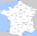
Réseau autoroutier français - 2018.svg 1,195 × 1,179; 369 KB
-
Toulois chatellenie 69186 MT (Commercy).jpg 901 × 617; 550 KB
-
Toulois chatellenie 69186 MT.jpg 2,921 × 2,002; 4.37 MB


