Category:19th-century maps of Western Sahara
Jump to navigation
Jump to search
Countries of Africa: Algeria · Angola · Benin · Botswana · Cameroon · Cape Verde · Chad · Democratic Republic of the Congo · Republic of the Congo · Djibouti · Egypt‡ · Equatorial Guinea · Eritrea · Eswatini · Ethiopia · Gabon · The Gambia · Ghana · Guinea · Guinea-Bissau · Ivory Coast · Kenya · Lesotho · Liberia · Libya · Madagascar · Mali · Mauritania · Morocco · Mozambique · Namibia · Niger · Nigeria · Senegal · Seychelles · Sierra Leone · Somalia · South Africa · South Sudan · Sudan · Tanzania · Togo · Tunisia · Uganda · Zambia · Zimbabwe
Other areas: Canary Islands · Madeira · Western Sahara
‡: partly located in Africa
Other areas: Canary Islands · Madeira · Western Sahara
‡: partly located in Africa
Media in category "19th-century maps of Western Sahara"
The following 18 files are in this category, out of 18 total.
-
Admiralty Chart No 1229 Sta. Cruz to Cape Bojador, Published 1844.jpg 8,098 × 6,090; 7.96 MB
-
Admiralty Chart No 1230 Africa west coast Garnet Head to Cape Verde, Published 1898.jpg 8,684 × 13,877; 13.88 MB
-
Admiralty Chart No 1230 Cape Bojador to Cape Blanco, Published 1844.jpg 6,106 × 8,054; 8.09 MB
-
CostaAOE1896g.jpg 5,185 × 7,751; 5.32 MB
-
ERbahiaVillaCisneros-1885.jpg 3,673 × 4,840; 2.62 MB
-
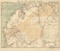
Map of the western Sahara LOC 2005625340.jpg 4,930 × 4,233; 2.59 MB
-
Map of the western Sahara LOC 2005625340.tif 4,930 × 4,233; 59.71 MB
-
Nordwest-Afrika.jpg 8,530 × 7,065; 23.17 MB
-
North Western Africa - DPLA - 91854319e40a2ebbbf603a4caeeaad45.jpg 1,000 × 886; 216 KB
-
Sahara western 1876 map by Ravenstein.jpg 4,930 × 4,233; 5.67 MB
-
Western Sahara 1876.png 746 × 641; 882 KB


