Category:19th-century maps of Seychelles
Jump to navigation
Jump to search
Media in category "19th-century maps of Seychelles"
The following 9 files are in this category, out of 9 total.
-
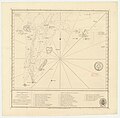
Admiralty Chart No 714 Archipelago to the Northward of Mauritius, Published 1811.jpg 4,214 × 4,134; 3.29 MB
-
Admiralty Chart No 721 Seychelles group, Published 1875.jpg 16,317 × 11,180; 37.41 MB
-
Admiralty Chart No 1072 Mahé Island and approaches, Seychelles Group, Published 1892.jpg 16,369 × 11,141; 42.84 MB
-
Admiralty Chart No 722 Approaches to Port Victoria Seychelles, Published 1892.jpg 16,257 × 11,119; 69.68 MB


