
Category:19th-century maps of Estonia
Subcategories
This category has the following 8 subcategories, out of 8 total.
- 1800s maps of Estonia (1 F)
- 1820s maps of Estonia (6 F)
- 1830s maps of Estonia (empty)
- 1850s maps of Estonia (3 F)
- 1860s maps of Estonia (3 F)
- 1880s maps of Estonia (7 F)
- 1890s maps of Estonia (5 F)
T
- 19th-century maps of Tallinn (17 F)
Media in category "19th-century maps of Estonia"
The following 11 files are in this category, out of 11 total.
-
 Подробная карта Российской империи и близлежащих заграничных владений — лист 017.jpg 4,872 × 4,482; 11.46 MB
-
 KRUSE(1846) p655.2.jpg 1,570 × 1,733; 1.1 MB
-
 KRUSE(1846) p655.3.jpg 1,117 × 1,174; 562 KB
-

-
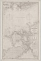
 Admiralty Chart No 2191 Gulf of Finland, Published 1875.jpg 13,540 × 8,139; 12.9 MB
-

-

-
 Admiralty Chart No 2241 Gulf of Finland, Published 1862.jpg 8,386 × 12,279; 11.81 MB
-
 Admiralty Chart No 2246 Gulf of Finland Port Baltic to Hogland, Published 1854.jpg 12,079 × 8,299; 11.66 MB
-
 Beryozovye Islands. A new chart of the Gulf of Finland &c.tiff 561 × 463; 761 KB
-
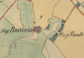 Prandikaart.png 654 × 454; 469 KB

_p655.2.jpg)
_p655.3.jpg)


.jpg)


