
Category:19th-century maps of Armenia
Subcategories
This category has the following 10 subcategories, out of 10 total.
- 1800s maps of Armenia (2 F)
- 1810s maps of Armenia (12 F)
- 1820s maps of Armenia (10 F)
- 1830s maps of Armenia (2 F)
- 1840s maps of Armenia (1 F)
- 1860s maps of Armenia (19 F)
- 1880s maps of Armenia (3 F)
Media in category "19th-century maps of Armenia"
The following 5 files are in this category, out of 5 total.
-

-
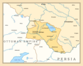 Armenian Oblast, 1828-1840.png 2,088 × 1,651; 446 KB
-
 Carte du Caucase en turc (19th century).jpg 5,181 × 4,221; 3.3 MB
-
 Circassiaa.jpg 500 × 400; 49 KB
-
 Карта Кавказа времён Ермолова (выкупировка).jpg 2,202 × 1,621; 1.88 MB
._Arm%C3%A9nie_Russe._Rossijskaja_Armenija._Venice,_(Imprimerie_des_M%C3%A9chitaristes_de)_St._Lazare,_1828.jpg)

.jpg)

.jpg)