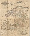
Category:1890s maps of Estonia
Jump to navigation
Jump to search
Media in category "1890s maps of Estonia"
The following 5 files are in this category, out of 5 total.
-
Image taken from page 332 of 'Histoire d'un siècle' (11203766703).jpg 1,532 × 2,649; 966 KB
-
Baltikum nach Rücker 1890.jpg 8,234 × 9,907; 33.6 MB
-
Meyers leiner Hand-atlas 1893 (73137050).jpg 4,847 × 6,453; 6.59 MB
-
Meyerbaltikum.jpg 1,513 × 2,000; 1.26 MB


