Category:1930s maps of Asia
Jump to navigation
Jump to search
Temperate regions: North America · South America · Africa · Europe · Asia · Oceania – Polar regions: – Other regions:
Subcategories
This category has the following 38 subcategories, out of 38 total.
- 1939 maps of Palestine (1 F)
1
A
- 1930s maps of Arabia (3 F)
C
- 1930s maps of Cambodia (empty)
- 1930s maps of the Caucasus (7 F)
E
G
I
- 1930s maps of Iran (1 F)
- 1930s maps of Iraq (3 F)
J
- 1930s maps of Jordan (6 F)
K
- 1930s maps of Korea (13 F)
L
P
R
- 1930s maps of Russia (12 F)
S
- 1930s maps of Syria (7 F)
T
- 1930s maps of Thailand (9 F)
Media in category "1930s maps of Asia"
The following 10 files are in this category, out of 10 total.
-

-
 Map Asia 1937 - Touring Club Italiano CART-TRC-13.jpg 8,495 × 7,103; 29.48 MB
-

-
 Map Geological Map of Asia 1928-1940 - Touring Club Italiano CART-TRC-25.jpg 6,103 × 6,825; 5.15 MB
-
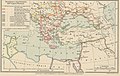 Map The decadence of the Ottoman Empire- Touring Club Italiano CART-TRC-45 02.jpg 4,874 × 3,102; 1.82 MB
-

-
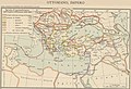 Map The Ottoman Empire- Touring Club Italiano CART-TRC-45 01.jpg 4,877 × 3,317; 1.94 MB
-
 БСЭ1. Азия - карта 1.jpg 1,840 × 1,484; 1.36 MB
-
 БСЭ1. Азия - карта 3.jpg 1,484 × 920; 737 KB
-
 БСЭ1. Азия - карта 4.jpg 1,484 × 920; 711 KB


.jpg)