
Category:1930s maps of Indonesia
Media in category "1930s maps of Indonesia"
The following 9 files are in this category, out of 9 total.
-
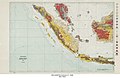 Indonesia Geology - DPLA - 00a0751adefef1953955df989f62fc34.jpg 9,274 × 5,996; 5.97 MB
-
 Banten java.jpg 1,549 × 1,140; 1.18 MB
-

-
 1938 Index to Admiralty charts of the Eastern Archipelago and China Sea nla.obj-574968374.jpg 8,195 × 11,192; 22.63 MB
-
 Ijen-Umgebung.JPG 1,511 × 1,508; 668 KB
-
 Ijen.JPG 1,800 × 1,418; 1.13 MB
-

-
 Landbouwstatistiekkaart - sheet 1, KK 045-02-01045-03-13.tiff 4,101 × 2,849; 33.44 MB
-
 Map telok niboeng.jpg 1,080 × 608; 69 KB


.jpg)