Category:18th-century maps of Nicaragua
Jump to navigation
Jump to search
Subcategories
This category has the following 2 subcategories, out of 2 total.
- 1700s maps of Nicaragua (empty)
- 1740s maps of Nicaragua (2 F)
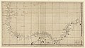
Media in category "18th-century maps of Nicaragua"
The following 12 files are in this category, out of 12 total.
-

-

-
 Carte des Provinces de Nicaragua et Costa Rica 1764.png 2,169 × 2,621; 11.26 MB
-
 Carte des provinces de Nicaragua et Costa Rica LOC 2004629009.jpg 4,214 × 3,779; 1.86 MB
-
 Carte des provinces de Nicaragua et Costa Rica LOC 2004629009.tif 4,214 × 3,779; 45.56 MB
-
-
 Fitzwilliam Museum, Cambridge 15.jpg 4,128 × 3,096; 4.58 MB
-
 Map of the Provinces of Nicaragua and Costa Rica WDL57.png 1,141 × 1,024; 1.96 MB
-

-
 Plano de Costa Rica LOC 90683976.jpg 5,974 × 4,536; 2.73 MB
-
 Plano de Costa Rica LOC 90683976.tif 5,974 × 4,536; 77.53 MB
-
 Rigobert-Bonne-Atlas-de-toutes-les-parties-connues-du-globe-terrestre MG 0009.tif 5,220 × 3,564; 53.26 MB

_it_and_Iamaica_LOC_2004627358.jpg)


