Category:1863 Mitchell's new general atlas (NYPL collection)
Jump to navigation
Jump to search
Media in category "1863 Mitchell's new general atlas (NYPL collection)"
The following 39 files are in this category, out of 39 total.
-
List of maps (NYPL b13663520-1510789).tiff 5,246 × 6,298; 94.54 MB
-
New Hampshire and Vermont (NYPL b13663520-1510798).tiff 4,160 × 5,220; 62.79 MB
-
Plan of New Orleans (NYPL b13663520-1510812).jpg 4,129 × 3,477; 4.45 MB
-
Plan of New York, &c (NYPL b13663520-1510801).tiff 3,996 × 4,851; 74.61 MB
-
Plan of Boston (NYPL b13663520-1510802).tiff 3,514 × 4,155; 42.43 MB
-
Plan of Philadelphia (NYPL b13663520-1510804).tiff 4,830 × 4,043; 75.15 MB
-
Plan of Baltimore (NYPL b13663520-1510805).tiff 4,147 × 3,524; 41.83 MB
-
County map of Kentucky and Tennessee (NYPL b13663520-1510808).tiff 5,044 × 3,951; 57.68 MB
-
County map of Georgia and Alabama (NYPL b13663520-1510809).jpg 4,995 × 3,962; 6.67 MB
-
Map of Louisiana, Mississippi, and Arkansas (NYPL b13663520-1510811).jpg 3,955 × 5,070; 6.56 MB
-
County map of Texas; Galveston Bay and vicinity (inset) (NYPL b13663520-1510813).jpg 5,067 × 4,084; 6.45 MB
-
Prussia, and the German States (NYPL b13663520-1510832).jpg 5,012 × 3,985; 6.01 MB
-
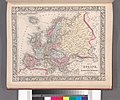
Map of Europe, showing its gt. political divisions (NYPL b13663520-1510827).jpg 5,002 × 4,020; 6.26 MB
-
Map of Denmark (NYPL b13663520-1510828).jpg 1,105 × 1,777; 768 KB
-
Map of Switzerland in cantons (inset) (NYPL b13663520-1510829).jpg 1,424 × 1,016; 541 KB
-
County map of England and Wales (NYPL b13663520-1510830) (cropped).jpg 4,007 × 5,053; 6.83 MB
-
County map of England and Wales (NYPL b13663520-1510830).jpg 5,248 × 6,299; 8.99 MB
-
Prussia, and the German States (NYPL b13663520-1510832).tiff 6,299 × 5,248; 95.24 MB
-
List of Post Offices in the United States. (A, B) (NYPL b13663520-1510839).tiff 5,248 × 6,299; 95.23 MB
-
List of Post Offices in the United States. (B, C) (NYPL b13663520-1510841).tiff 5,248 × 6,299; 95.23 MB


