
Category:1850s maps of Australia
States of Australia:
Internal territories of Australia:
External territories of Australia:
Internal territories of Australia:
External territories of Australia:
Media in category "1850s maps of Australia"
The following 16 files are in this category, out of 16 total.
-

-

-
-
 1853 Mitchell Map of Asia - Geographicus - Asia-mitchell-1850.jpg 3,500 × 2,837; 3.95 MB
-
 1855 Colton Map of Australia - Geographicus - Australia-colton-1855.jpg 3,500 × 2,908; 2.51 MB
-

-

-

-
 Australien und Polynesien in Mercators Projection.jpg 5,662 × 4,571; 5.44 MB
-
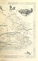
 The Quarterly journal of the Geological Society of London (12826322685).jpg 2,064 × 1,296; 501 KB
-

-

-

-

-

-
 Tasman's track.jpg 800 × 535; 40 KB
%27_(11037777286).jpg)
%27_(11037977265).jpg)
%27_(11038025404).jpg)


.jpg)


.jpg)
.jpg)
.jpg)
.jpg)
.jpg)
_;_Grav%C3%A9_chez_Erhard_Schi%C3%A8ble_-_btv1b53081425m.jpg)
