
Category:1840s maps of Australia
States of Australia:
Internal territories of Australia:
External territories of Australia:
Internal territories of Australia:
External territories of Australia:
Subcategories
This category has only the following subcategory.
Media in category "1840s maps of Australia"
The following 17 files are in this category, out of 17 total.
-
 Part of Western Australia (Discoveries in Australia).jpg 986 × 953; 388 KB
-

-

-
 Admiralty Chart No 1042 General chart of Terra Australis or Australia, Published 1843.jpg 11,596 × 7,884; 40.36 MB
-
 Arafura Sea (Discoveries in Australia).jpg 742 × 579; 97 KB
-
 Bass Strait (Discoveries in Australia).jpg 1,258 × 1,012; 267 KB
-
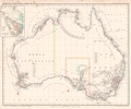
 General Chart of Australia (Discoveries in Australia).jpg 1,500 × 1,298; 406 KB
-
 Gulf of Carpentaria (Discoveries in Australia).jpg 2,475 × 1,703; 1.42 MB
-
 Port Adelaide and Holdfast Bay (Discoveries in Australia).jpg 2,009 × 2,248; 1.43 MB
-
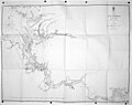 The Victoria River (Discoveries in Australia).jpg 3,586 × 2,828; 2.62 MB
-
 Karte vom Festland Australien Platt 1848.pdf 2,866 × 2,377; 483 KB
-
 Asiatischer Archipel und Neu Holland.jpg 3,926 × 3,420; 3.23 MB
-
 Admiralty Chart No 1670 Australia East Coast Moreton Bay, Published 1848.jpg 5,853 × 7,873; 8.57 MB
-
 Brisbane County.jpg 540 × 788; 96 KB
-
 Karte - von Australia nach Arrowsmith entw. u. gez. von Albrecht Platt - btv1b53098661z.jpg 10,687 × 8,748; 13.19 MB
-

-
 Map of Brisbane Town by Robert Dixon 24 March 1840 (7173003438).jpg 3,000 × 2,267; 887 KB
.jpg)
.jpg)


.jpg)
.jpg)
.jpg)
.jpg)
.jpg)
.jpg)


.jpg)